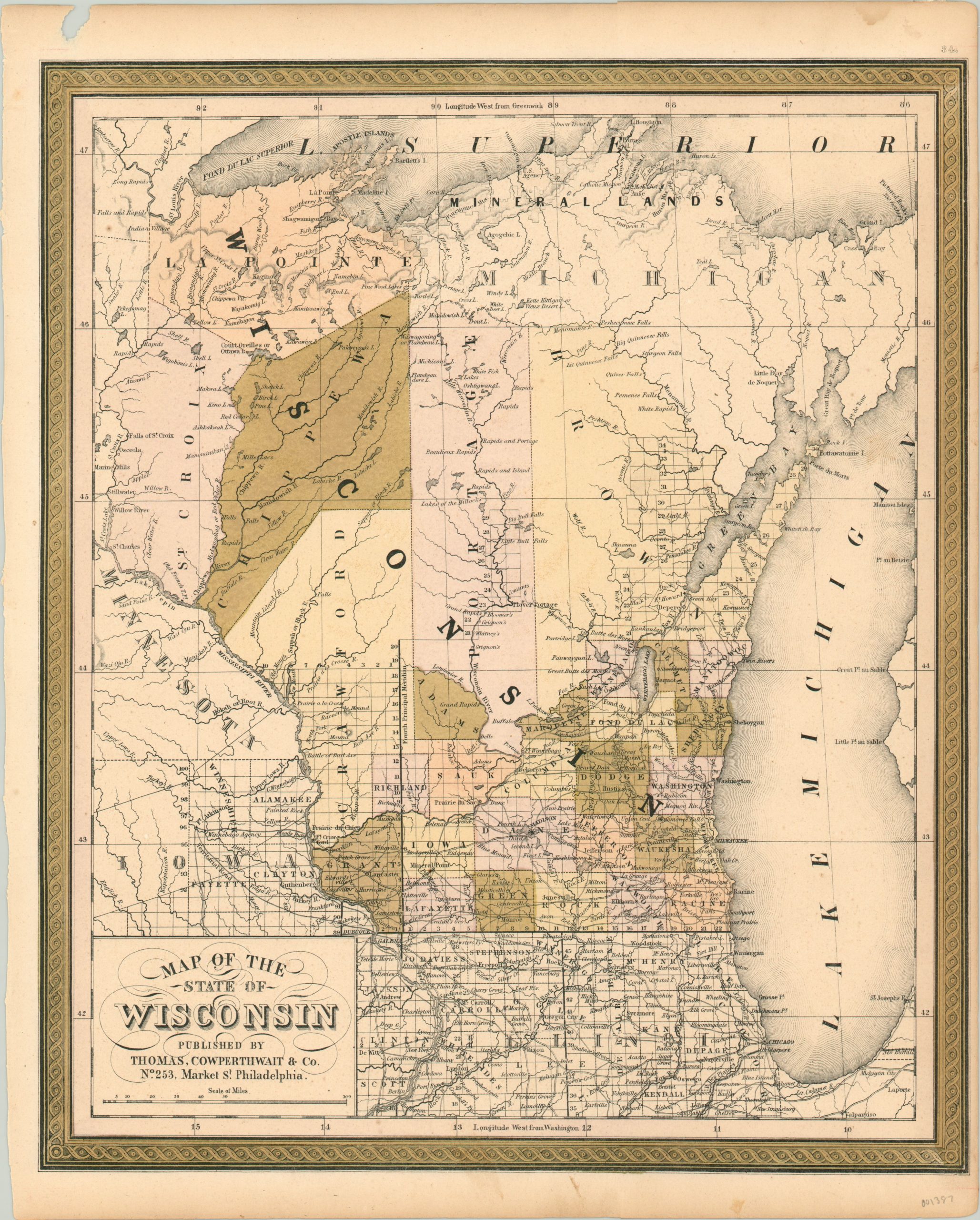
Map of the State of Wisconsin
$179.00
Cowperthwait’s first issue of Mitchell’s map of Wisconsin.
1 in stock
Description
This finely engraved map provides a detailed overview of Wisconsin just two years after incorporation as the thirtieth state. Surveyed townships and settlement can be seen gradually proceeding from the southeast corner to the northwest, often along the numerous navigable rivers and coastlines in the region.
Geographic features such as rapids, falls, lakes, and portages are all individually labeled, and a broad area of Michigan’s Upper Peninsula is identified as Mineral Lands for its valuable ore deposits. The map was originally included as part of Samuel August Mitchell’s New Universal Atlas. Thomas Cowperthwait acquired the rights to the publication in 1850, and would continue to make updates until 1855.
Map Details
Publication Date: 1850
Author: Thomas Cowperthwait & Co.
Sheet Width (in): 13.75
Sheet Height (in): 17.00
Condition: B+
Condition Description: The sheet has a small half inch hole in the upper margin and narrow, soiled right edge. The bottom margin is toned and the image has faded slightly. Remains in very good condition, with lovely original color.
$179.00
1 in stock