Map of the State of New York
$200.00
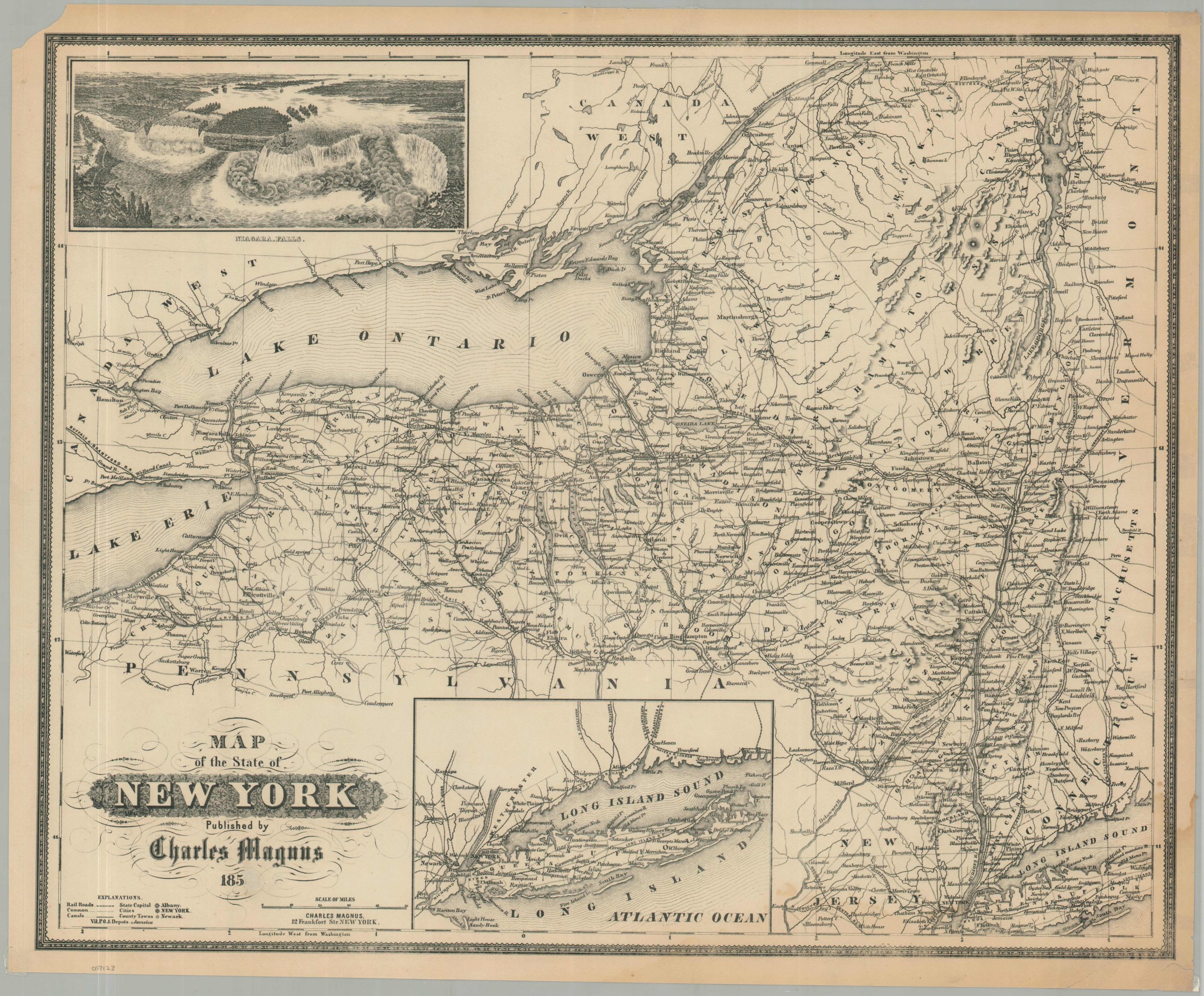
A detailed map that highlights the statewide growth of New York, facilitated by the Erie Canal and railroads.
1 in stock
Description
This interesting mid-19th-century map of New York State was designed and published by Charles Magnus in New York City in 1854. Unusually, this example has the last digit of the date scratched out, so this might have been re-issued somewhat later.
The image highlights an impressive network of canals, railroads, and wagon trails that stretch across the state. An inset in the lower center shows the entirety of Long Island, while an engraved view in the upper left shows an aerial perspective of Niagara Falls.
New York was developing, economically and politically, at an impressive rate during the 19th century. The opening of the Erie Canal in 1825 led to a manufacturing and agricultural boom due to cheaper freight rates, propelling New York City to the nation’s principal seaport. Abolitionism and equal rights were also hot-button topics of the day, with the 1848 Seneca Falls Convention considered the first women’s rights convention held in America.
Map Details
Publication Date: 1854
Author: Charles Magnus
Sheet Width (in): 23.5
Sheet Height (in): 19.25
Condition: B-
Condition Description: Printed on a flat, thin sheet (normally issued as a pocket map) that is moderately damp stained along the lower edge. Numerous closed tears along the edges (repaired on verso) and a chip in the upper left corner. The last digit of the date has been scratched out. Between fair and good condition overall.
$200.00
1 in stock