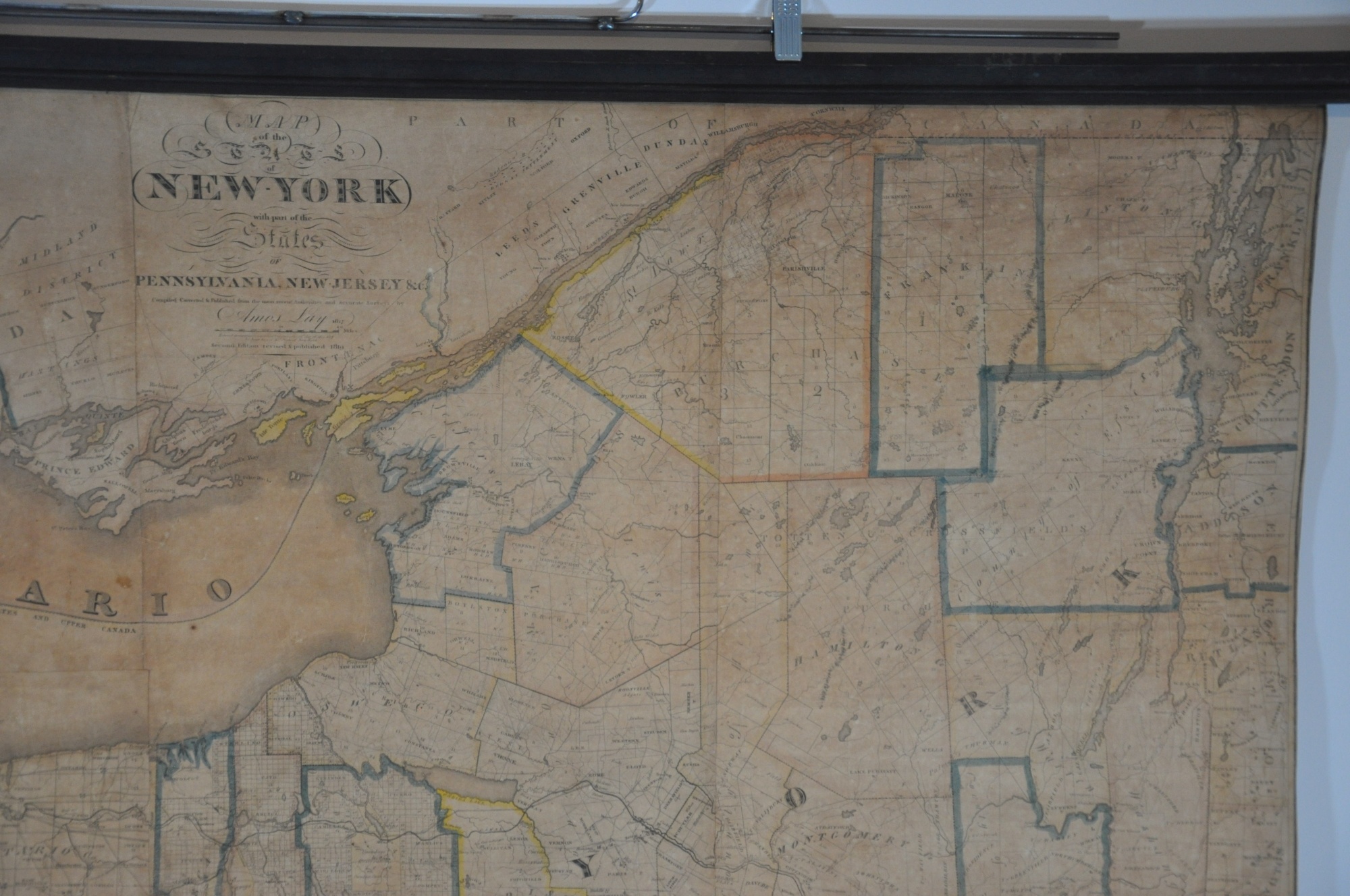
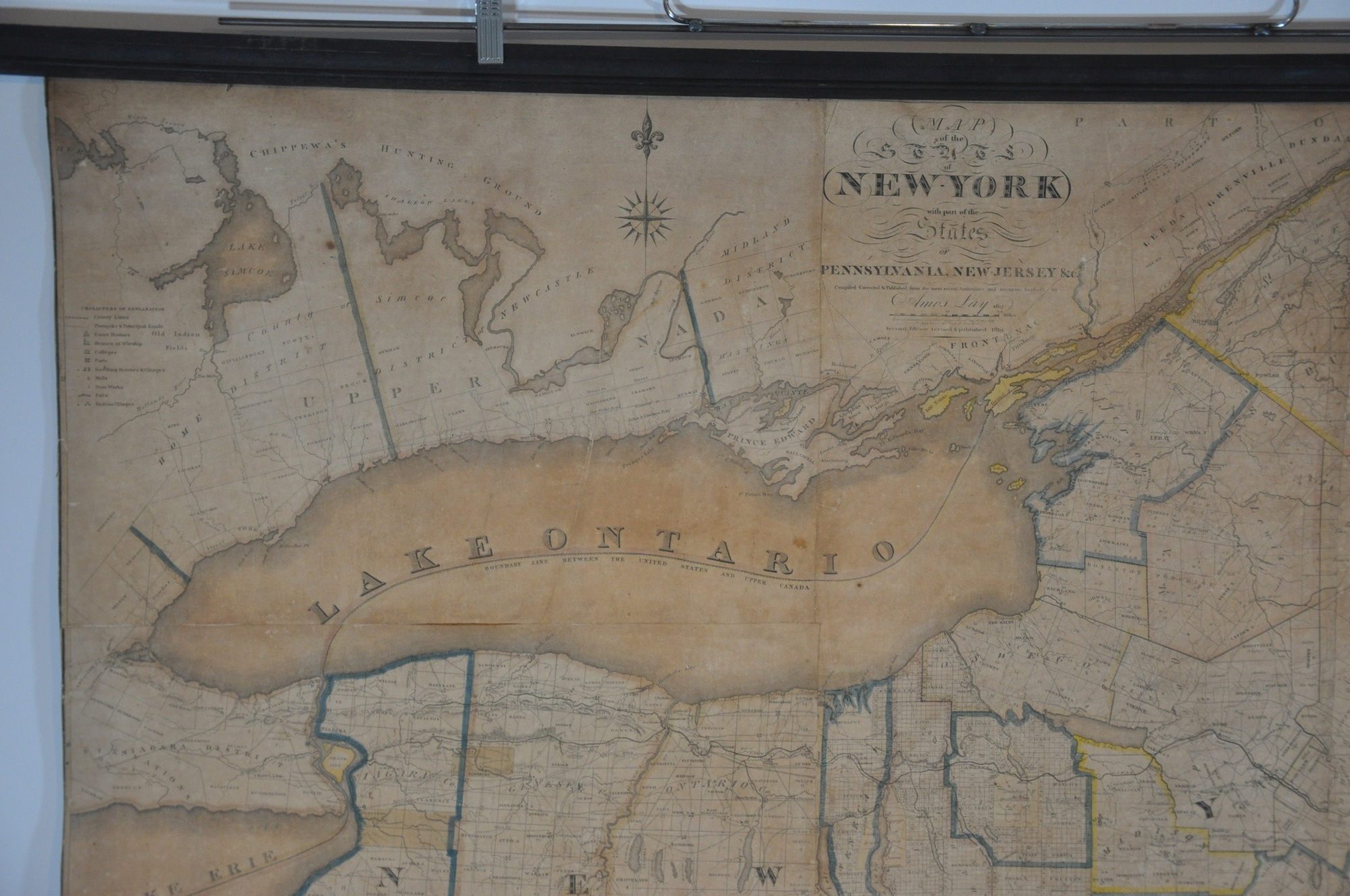
Map of the State of New York with parts of the States of Pennsylvania, New Jersey, etc.
Original price was: $4,500.00.$3,800.00Current price is: $3,800.00.
An unrecorded edition of Amos Lay’s spectacular wall map of New York.
1 in stock


Description
Amos Lay published his first map covering the entirety of New York state in 1817, the same year that construction began on the ‘Great Canal’ connecting the Hudson River to Lake Erie. According to the David Rumsey Map Collection, the 1817 map “adds a southern sheet to the 1812 map which only extended to the Pennsylvania border. Compared to [John] Eddy’s map of the state-issued in 1818, Lay’s map is on a larger scale and, although not as graphically elegant, it has more information regarding township lines and lots and improvements (especially the surveyed Erie Canal).”
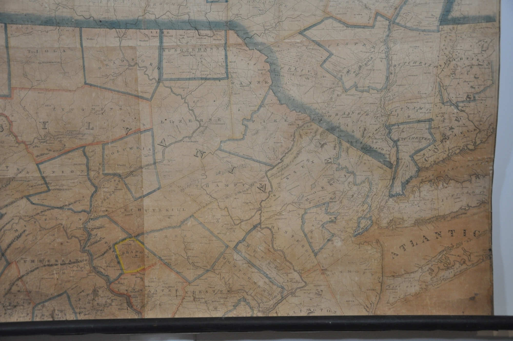
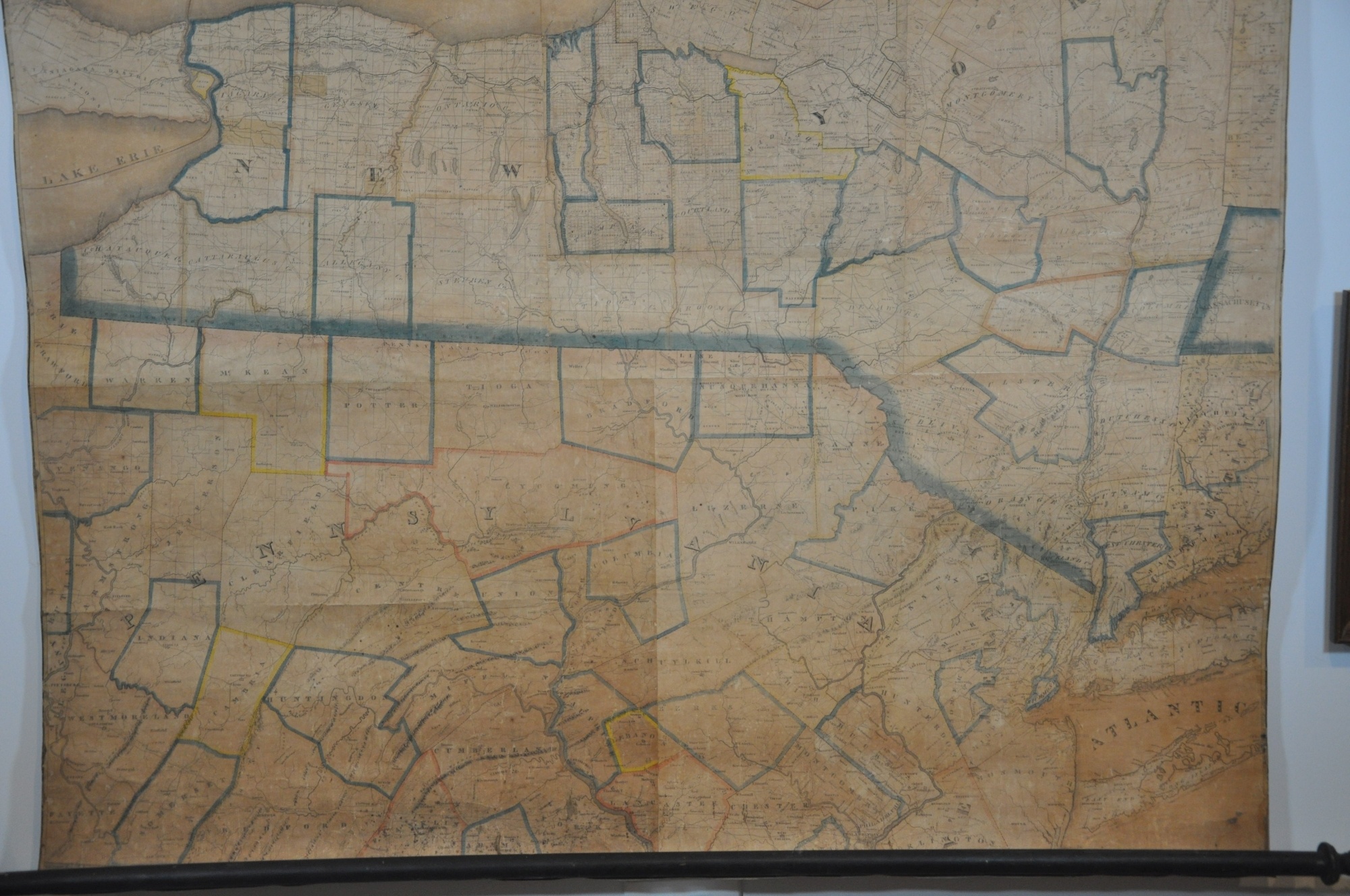
The map includes large portions of the states of Pennsylvania and New Jersey, as well as the British province of Upper Canada. This particular example is noted as the second edition and dated 1819 immediately below the title block, an unrecorded date not referenced in Philips, Ristow, WorldCat, or the AMPR (normally the second edition refers to the 1820 issue).
As indicated by Rumsey, the image presents a wealth of fascinating contemporary details from the early 19th century. At the time, New York was at the forefront of the nation’s growing transportation grid, with a robust network of roads and turnpikes connecting the various settlements across the state. Robert Fulton was operating the nation’s first successful steamship line between New York City and Albany and construction proceeded apace on the Erie Canal. A portion from Rome to Utica was open for traffic in 1819, but the canal’s completion in 1825 would create the first viable waterway between the Atlantic Ocean and the Great Lakes, forever changing America’s economic outlook by allowing the easy transportation of commodities and people to and from the interior.
The Erie Canal also cemented a period of prosperity across the state from New York City to Buffalo, as thousands of canal workers, real estate speculators, and entrepreneurs flocked to profit from the new opportunities available. Local industries also benefited, as shown by the mines, mills, and springs that dot the image. Colleges, houses of worship, and courthouses – all indications of civilization and progress – are also labeled according to the legend in the upper left.
However, the map’s content is not entirely idyllic and forward-thinking. It includes a number of important battle sites from the Revolutionary War and War of 1812, including the Battles of Long Island and Queenstown Heights. Numerous forts are noted throughout, though the hostile Natives against whom they once stood guard have been confined to several outlined reservations.
Sources:
Levanthal Collection G3800 1820 .L39 (1820 Edition)
New York Cartography in the 19th Century (NYPL)
Phillips, Philip Lee. A List of Maps of America in the Library of Congress: Preceded by a List of Works Relating to Cartography. B. Franklin, 1967.
Rumsey 4455.000 (1817 Edition)
Ristow, Walter William. American Maps and Mapmakers: Commercial Cartography in the Nineteenth Century. 1986.
Map Details
Publication Date: 1819
Author: Amos Lay
Sheet Width (in): 49.00
Sheet Height (in): 49
Condition: B+
Condition Description: An odd configuration of five separate sheets, professionally cleaned, restored, and mounted on a single piece of linen. Affixed with copper tacks to black painted wooden rollers, which appear to be old. The lower left sheet is moderately toned, with the one immediately above also showing some discoloration. The seams are clearly visible and show some light wear and there are a few spots where the image has lightened from old cracks or abrasions. The lower right sheet is beginning to curl along its upper border and has a bit of minor paper loss and accompanying fill in the bottom right. Overall this rare example is in good condition and well preserved thanks to the careful restoration.
Original price was: $4,500.00.$3,800.00Current price is: $3,800.00.
1 in stock