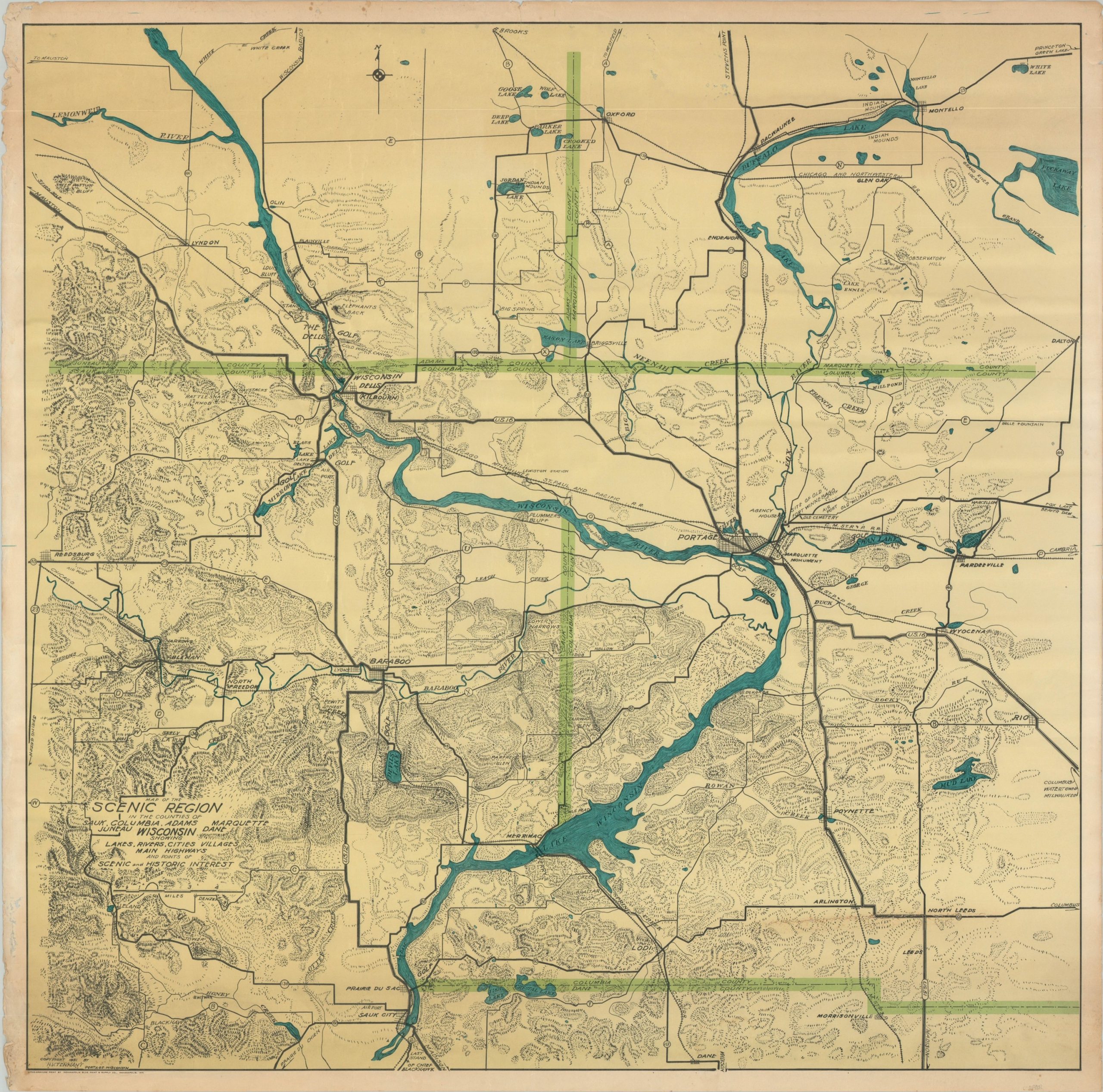
Map of the Scenic Region in the Counties of Sauk, Columbia, Adams, Marquette, Juneau, Dane Wisconsin…
Uncommon wall map of a scenic region in central Wisconsin.
Out of stock
Description
This large map covers portions of Sauk, Columbia, Adams, Marquette, Juneau, and Dane counties in central Wisconsin. The Wisconsin River is shown bisecting the image from top to bottom, cutting the Wisconsin Dells and flowing through Lake Wisconsin while at the same time highlighting a lack of originality in naming conventions. Roads, towns, ‘Indian mounds’, cemeteries, geographic features, and important buildings are individually labeled across the image. County borders are distinguished in green and topography is depicted in simple hachure.
The region around the Fox and Wisconsin Rivers has been a popular tourist destination since the railroad’s arrival in the final quarter of the 19th century. Known for excellent fishing, hunting, hiking, and other outdoor recreation, the area was a welcome retreat from the summer heat of Chicago, Milwaukee, and other Midwestern cities.
The map was drawn by H.V. Tennant and published in Portage, Wisconsin in 1931. Printing done by the Indianapolis Blue Print & Supply Company. The map is rare, with only two separate examples identified in WorldCat at the Wisconsin Historical Society and Robinson Map Library at the University of Wisconsin-Madison.
Map Details
Publication Date: 1931
Author: H.V. Tennant
Sheet Width (in): 35.5
Sheet Height (in): 35
Condition: B
Condition Description: Moderate to heavy wear visible around the outer margins, including a few chips in the paper and some scattered soiling. One large tear in the lower right, just above the Dane County line, has been repaired with archival tape on the verso. The paper has thinned in a few small spots near the top of the page, resulting in some light see through.
Out of stock