
Map of the Russian & Chinese Frontier…
$110.00
One of the first English maps to show the Tian Shan mountains.
1 in stock
Description
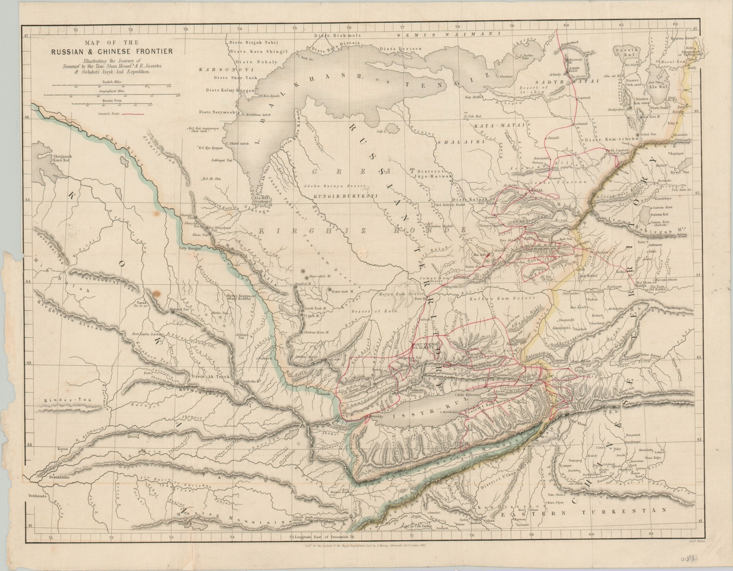
This skillfully engraved map covers a large region in Central Asia near the modern-day borders of Kyrgyzstan, Kazakhstan, and China; though at the time of publication the area was in dispute between the Mongolian, Russian, and Chinese Empires. The route of Pyotr Semenov, one of the earliest Europeans to explore and describe in detail portions of the Tian Shan, or Mountains of Heaven, is highlighted in red.
Semenov was a notable Russian explorer, geographer, and statistician who led the Russian Royal Geographic Society for over 40 years (1873-1914) and helped to organize the first (and only) official census of the Russian Empire. The map was engraved by Edward Weller and published by John Murray in London in 1861 as part of the Journal of the Royal Geographic Society. A relevant excerpt from the accompanying text reads;
“In the last published volume of our Transactions we have a further accession to Asiatic geography – a translation of the narrative and account of a Journey to the Tian-Shan, or Celestial Mountains, in Russian Tartary, by P.P. Semenoff, which was undertaken under the auspices of the Imperial Russian Geographical Society. M. Semenoff was the first European who visited (in 1857) this gigantic range – one of the four which traverse Asia in a parallel direction, only two of which have been explored, the Himalayas from the south, and the Altai from the north. Another translated Memoir on the same country is also given, by M.A. Golubef, who has travelled on the Chinese frontier.”
Source: Journal of the Royal Geographic Society (Google Books)
Map Details
Publication Date: 1861
Author: Edward Weller
Sheet Width (in): 18.1
Sheet Height (in): 14.5
Condition: B+
Condition Description: Two small circular stains in the image, center left, and a trimmed left margin. Light offsetting visible near the bottom of the sheet.
$110.00
1 in stock