Map of the Rock Island Lines and Connections
$95.00
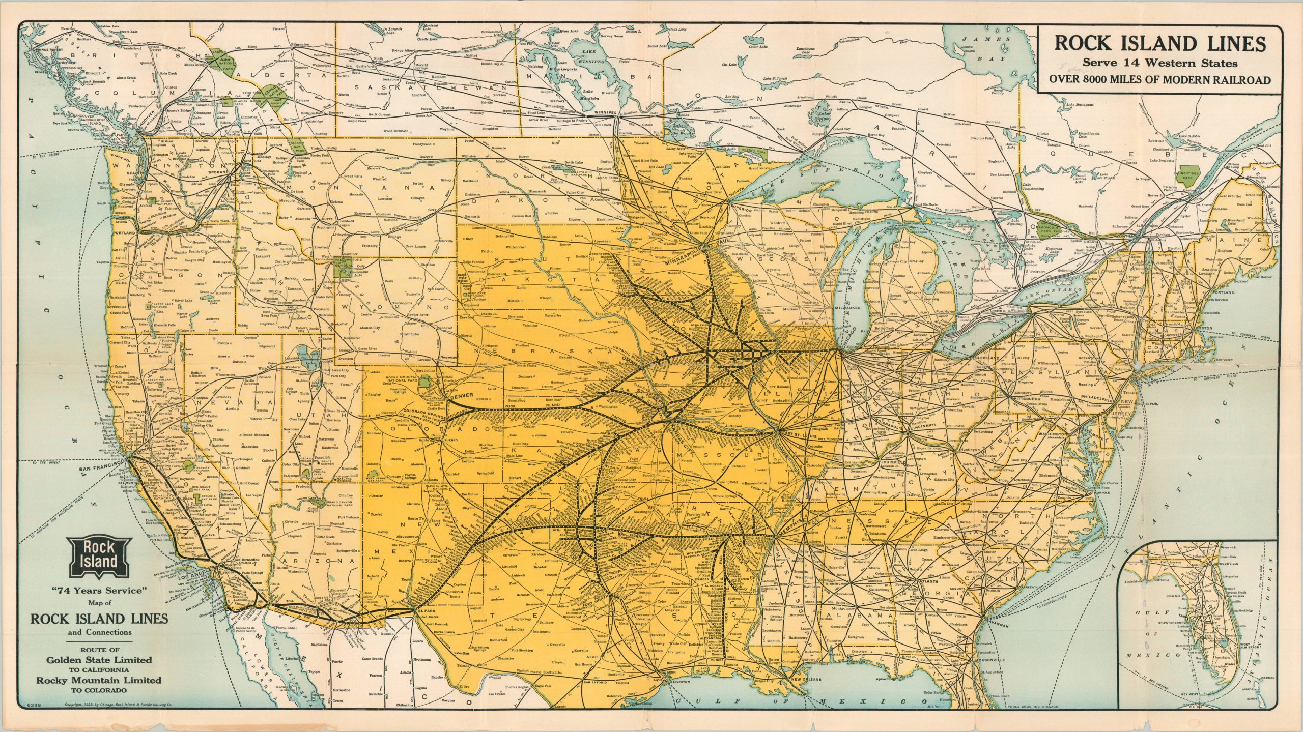
“ROCK ISLAND LINES Serve 14 Western States OVER 8000 MILES OF MODERN RAILROAD “Over 74 years of Service””
1 in stock
Description
This vibrant railroad map of the United States was published in Chicago by the Poole Brothers in 1926 on behalf of the Chicago, Rock Island, and Pacific Railroad Company. Bright yellow highlights the fourteen western states served by the company’s routes between Chicago and Denver/El Paso. Lines and connections are shown in thick black, with tiny text identifying the various stations along each in operation.
National Parks, a major destination for passenger services across the western United States, are shaded in green. Text and photographs describing the company’s routes in operation and its luxurious accommodations are provided on the verso.
Map Details
Publication Date: 1926
Author: Chicago, Rock Island, & Pacific Railway Company
Sheet Width (in): 31.5
Sheet Height (in): 17.5
Condition: B-
Condition Description: Heavy wear along former fold lines, including numerous areas of separation along the horizontal fold that have been repaired on the verso with archival materials. Minor to moderate image loss and abrasion to the sheet as a result. Several chips also present along the margins. Fair to good condition overall.
$95.00
1 in stock