Map of the Republic of Poland
Promoting a short-lived version of Poland’s future.
Out of stock

Description
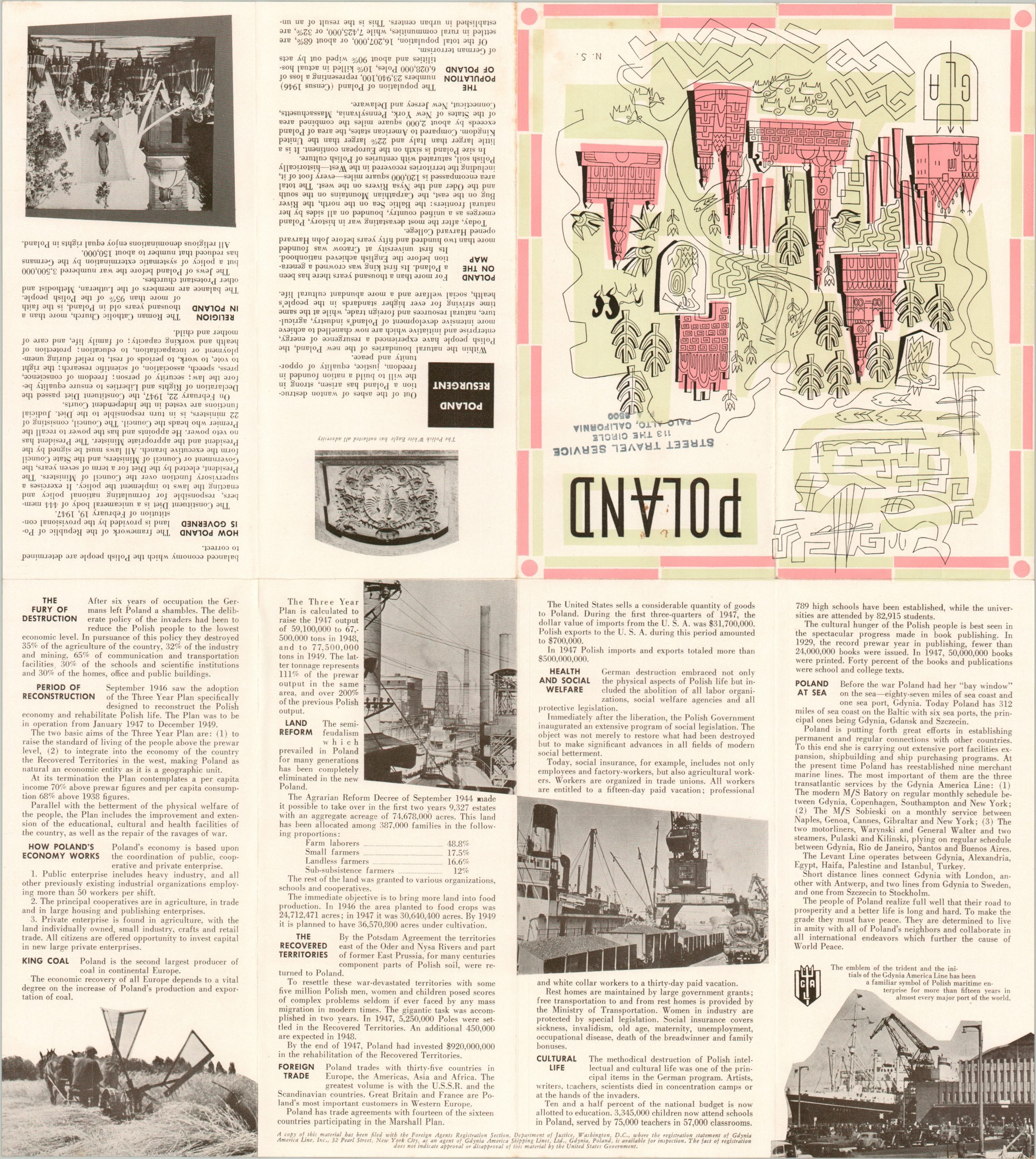
This apparently straightforward political map belies the upheavals experienced by Poland in the years following the end of World War II. International boundaries (pre and post-war) are firmly set amid a network of highways and railroads that would rival any European nation in the mid-20th century. Many cities are shown as having inflated populations, considering the overwhelming losses in the previous decade.
Somewhat disingenuously, the Republic of Poland is presented as a land of opportunity amid a rebuilding Europe. This notion is reinforced by text, photographs, and statistics on the verso. Poland’s reconstruction, massive population redistribution, important industries (notably King Coal), and robust cultural life are described in glowing terms. Social programs are another focal point. These reflect Communist influences that are otherwise largely omitted from the production, issued in 1948. The publisher, Gdynia America Line, Inc., indicates that ‘a copy of this material has been filed with the Foreign Agents Registration Section.’
The map is scarce, noted in only two examples in WorldCat as of June 2024 – at the University of Illinois Urbana-Champaign and Stanford University.
Sources: OCLC# 81342971; Warsaw Institute
Map Details
Publication Date: 1948
Author: Gdynia America Line, Inc.
Sheet Width (in): 18.1
Sheet Height (in): 16.2
Condition: A
Condition Description: Eight panel folding brochure with light wear along fold lines. Light soiling on the front panels does not affect the map's image. Near fine condition overall.
Out of stock