Map of the Railroads of the State of New York
Original price was: $375.00.$250.00Current price is: $250.00.
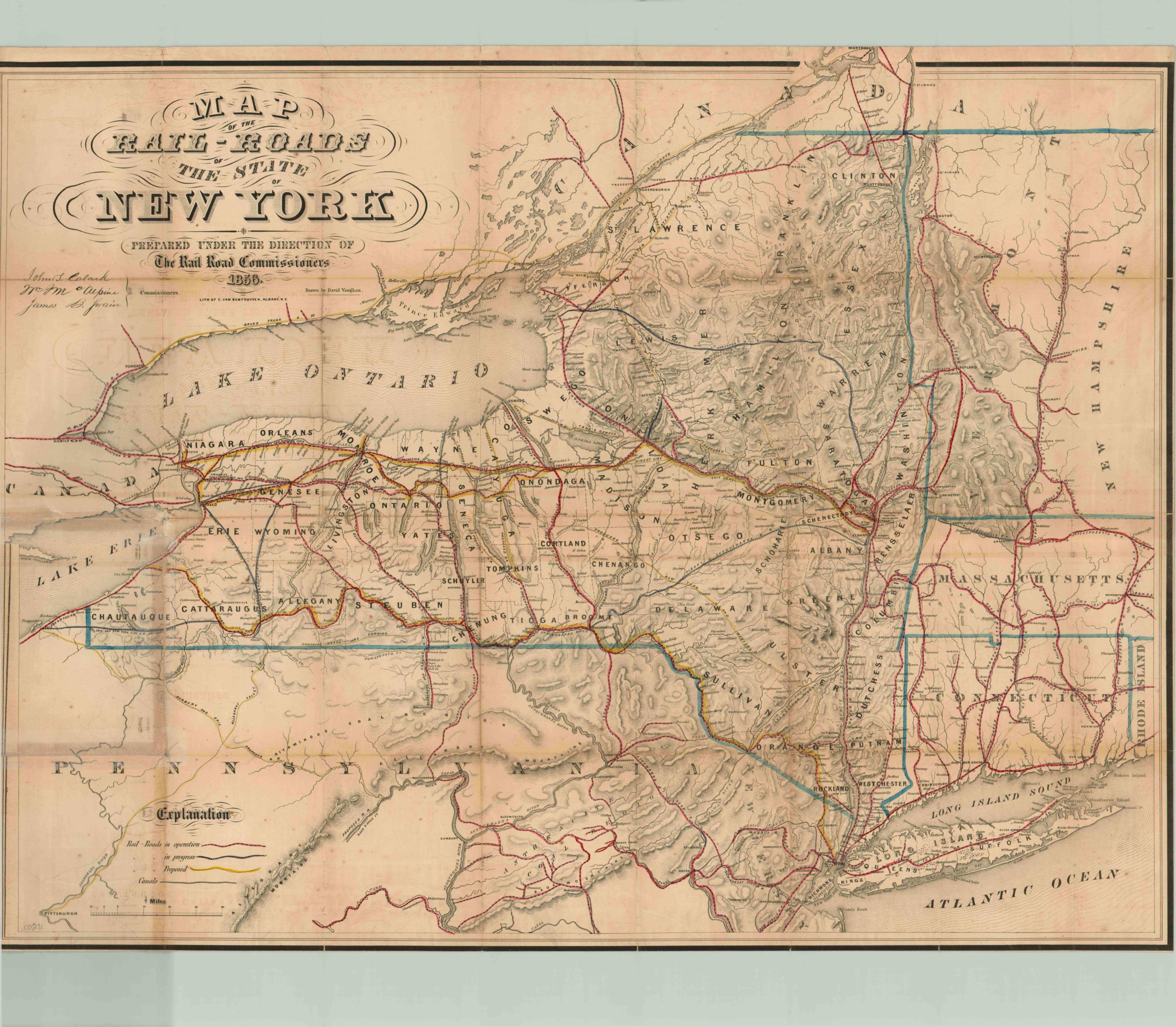
Pre-Civil War rail map of New York showing the explosive growth experienced in the western regions of the state in the first half of the 19th century.
Description
The opening of the Erie Canal in 1825 likely did more to guide the fortunes of New York than anything else, making New York City the nation’s most accessible port and opening the western half of the state to an explosion of settlement. Rail lines quickly popped up around the canal, at first to offer cheaper alternative routes for shipping, but eventually to branch across upstate and western New York to rapidly growing towns focused heavily on agriculture, livestock and coal mining. By 1850, New York had 8 of the nation’s largest 30 cities.
This map is a reflection of that rapidly growing state, showing various rail routes snaking across an underlaying image that shows topographical relief, water features, and county boundaries. Operational lines are highlighted in red, such as the famous New York Central, which had incorporated only three years prior to publication and was quickly ascendant. Routes under construction are shown in blue with a hatched pattern, some of which were never completed; like the Sackets Harbor and Saratoga Railroad Company. Lastly, proposed routes are yellow and include a second track along the Erie Canal and the Grand Trunk Route – a railway system that, upon completion, would economically unite the British colonies and push them towards confederation in Canada.
Map Details
Publication Date: 1856
Author: David Vaughan
Sheet Width (in): 28.5
Sheet Height (in): 22.5
Condition: B+
Condition Description: The map is in very good condition, laid on cloth and with original covers. Some discoloration and wear along fold lines.
Original price was: $375.00.$250.00Current price is: $250.00.