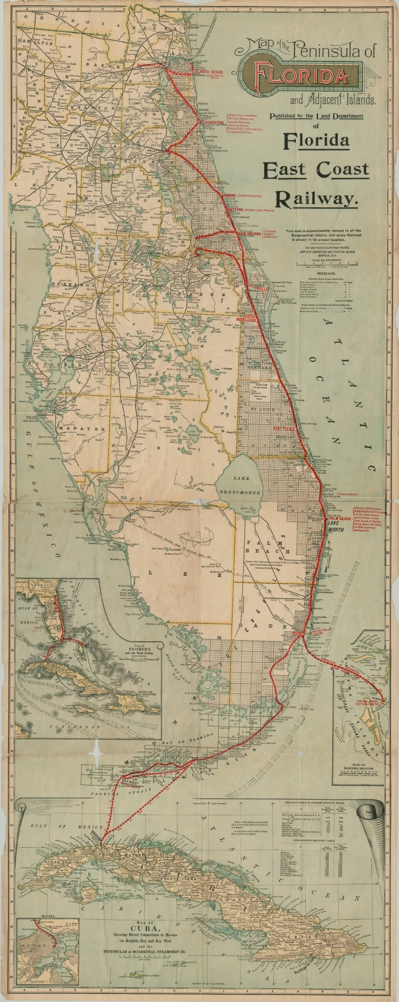
Map of the Peninsula of Florida and Adjacent Islands
The growing empire of the Florida East Coast Railway.
Out of stock
Description
This marvelously detailed map of southern Florida was created around 1914 by the Matthews-Northrup Company of Buffalo, New York, and issued to promote the lines of the Florida East Coast Railway by the company’s land department. The routes in operation are highlighted in red and reflect the recent extension to Key West, completed in 1912.
Several of the most popular resort towns are labeled with bold print and include the names of various hotels and beachside resorts. Surveyed townships are confined to the eastern portion of the peninsula and competing railroads are minimized, giving the rest of the state a decidedly more rural composition (as intended). Inset maps show the nearby destinations of Bahama, Cuba, and the West Indies; each with their respective connections to the FEC.
Map Details
Publication Date: c. 1914
Author: Matthews-Northrup Company
Sheet Width (in): 15.6
Sheet Height (in): 39.8
Condition: B-
Condition Description: Heavy wear along former fold lines, including several areas of worming and image loss at fold intersections (see below inset of West Indies, east Citrus County for examples). Other areas of separation, edge tears, and minor image loss have been repaired on the verso with archival tape. Additional significant wear visible in the margins. Despite the issues, the map remains largely intact and retains its bright lithographed color.
Out of stock