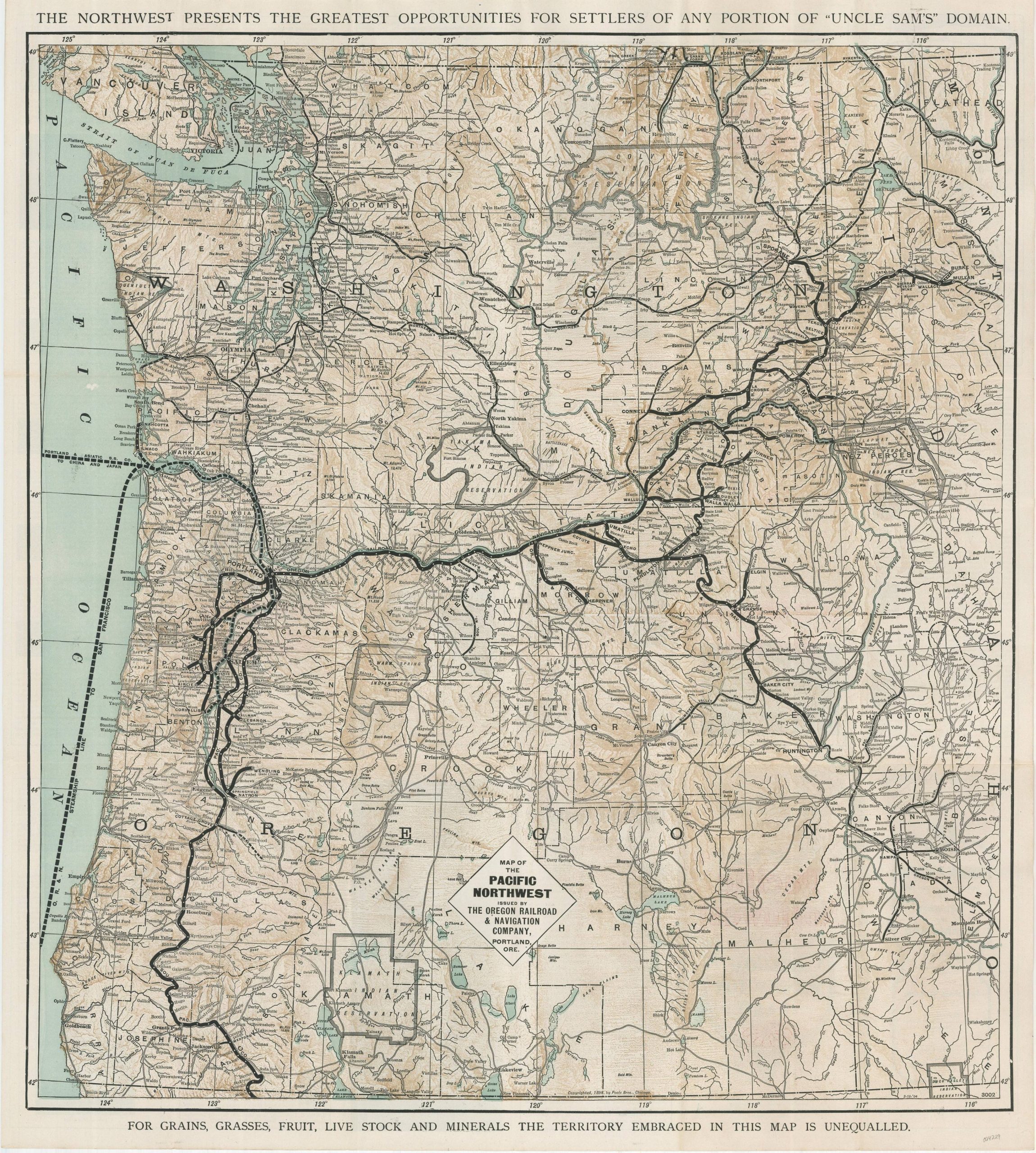
Map of the Pacific Northwest Issued by The Oregon Railroad & Navigation Company
$275.00
“THE NORTHWEST PRESENTS THE GREATEST OPPORTUNITIES FOR SETTLERS OF ANY PORTION OF “UNCLE SAM’S” DOMAIN.”
1 in stock
Description
This persuasive railroad map was published in 1904 and issued by the Passenger Department of The Oregon Railroad and Navigation Company. Thick black lines emphasize the network of railroads in operation from the border with California to Canada. Coastal and Pacific steamship routes are also noted. Text at the top and bottom reflects the map’s motivation – to promote settlement along the railroad and develop its freight and passenger business.
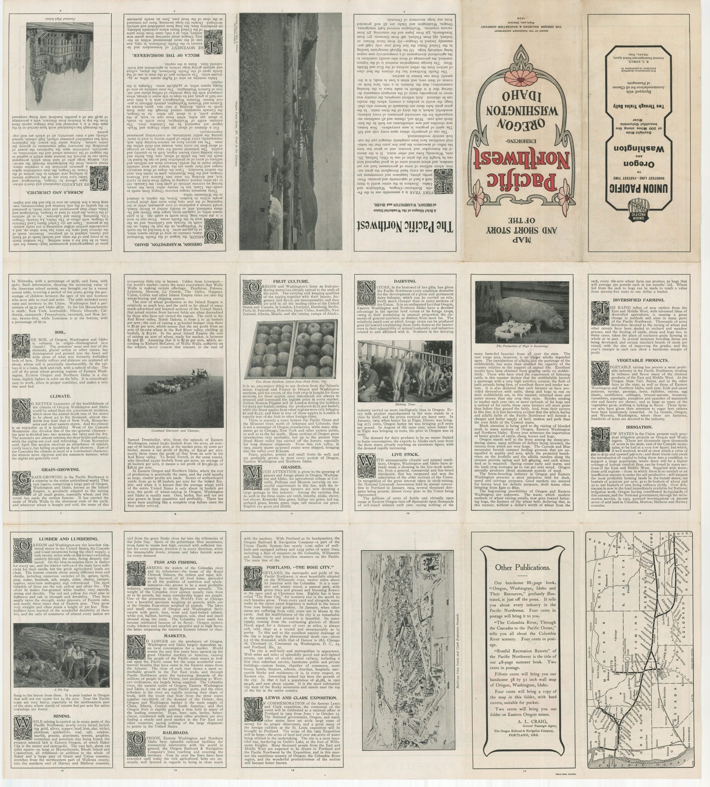
The timing is notable. Between June and the middle of October 1905, Portland, Oregon held its first (and only) World’s Fair, organized to celebrate the centennial of the Lewis & Clark Expedition and encourage investment and emigration to the city. Over 1.5 million visitors would ultimately attend the event, visiting the Palace of Agriculture, a log cathedral, a fish hatchery, and a million-dollar pavilion hosted by Japan. According to the Oregon Encyclopedia,
“The Lewis and Clark Exposition was conceived so Portland could demonstrate that it could mount a major civic enterprise. The city had had a solid record of economic growth since its founding in 1845, but at the turn of the twentieth century it was competing for investment and immigration with dozens of other cities throughout the American West—nearby Seattle, Spokane, Tacoma, Bellingham, and Everett and with more distant places such as Denver, Oakland, and San Diego. A successful world’s fair would enhance the city’s reputation as a safe and sound place to do business.”
A view of the Exposition Grounds can be seen on the verso, along with a simple black and white map showing primary railroad connections with the East. Further panels of flowery text provide biased information on a variety of subjects including Diversified Farming, Railroads, Mining, the Exposition, and Portland “The Rose City”.
Map Details
Publication Date: 1904
Author: The Oregon Railroad & Navigation Company
Sheet Width (in): 22.25
Sheet Height (in): 25
Condition: A-
Condition Description: Shows creasing and faint wear along originally issued fold lines, with a 2" tear in the upper right repaired on the verso with archival tape. Faint wear present along the outer edges of the sheet, consistent with age and use. Very good overall.
$275.00
1 in stock