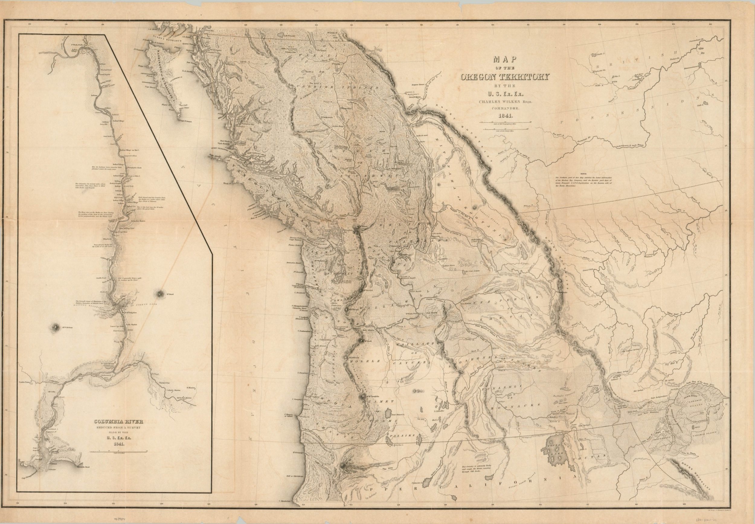
Map of the Oregon Territory by the U.S. Ex. Ex.
Original price was: $2,750.00.$2,100.00Current price is: $2,100.00.
First official U.S. map of the Pacific Northwest.
1 in stock
Description
The United States Exploring Expedition, under the command of Lieutenant Charles Wilkes, was a massive four-year undertaking whose six ships and nearly 500 men traveled around the globe. Their goals were economic as well as scientific and looked to cement America’s presence on the world stage. Important discoveries and official surveys were made across the Pacific Ocean, Antarctica, the South Atlantic, and the Pacific Northwest.
The last was of particular interest to U.S. commercial interests and an ongoing border dispute with Britain threatened to destabilize the regional economy of fur trading, fishing, and whaling. Wilkes arrived at the Columbia River in April of 1841, over 2.5 years after departing, and ordered surveys and overland reconnaissance of the Oregon Territory – the first ever to be performed on behalf of the U.S. Government. The results, seen here, appeared in Wilkes’ narrative of the expedition that was published in New York in 1845 by J.H. Young & Sherman & Smith.
The image captures the entirety of the Oregon Territory from the boundary with Britain at 54-40 latitude to Spanish Upper California and inland as far as the Black Hills of South Dakota. The scope of the map is notable as it represents the greatest extent of American territorial claims in the boundary dispute, a conflict that would not be finalized until international arbitration in 1872. In addition to the performed surveys, Wilkes incorporated geographic information and toponyms from indigenous tribes, other explorers like Fremont, and English employees of the Hudson’s Bay Company.
Topography is depicted with delicately engraved hachure and numerous small trees reflect the heavily forested region. Missions, fortifications, farms, and Native American settlements are labeled throughout, providing a fascinating snapshot of the sparse European presence and heavy indigenous presence until the second half of the 19th century. The left side of the sheet contains a detailed map of the course of the Columbia River between Ft. Walla Walla, the Willamette Mission, and Astoria. Individual buildings are outlined and labeled within and numerous annotations provide details on geographic features. Mt. St. Helens and Mt. Hood are also prominently featured.
A fine map from one of the most impressive exploring expeditions ever undertaken and an influential piece in the decades-long territorial debate over the Oregon Question.
Sources: Wheat 457; Oregon Encyclopedia
Map Details
Publication Date: 1845
Author: Charles Wilkes
Sheet Width (in): 35
Sheet Height (in): 24
Condition: B
Condition Description: Light to moderate offsetting visible on a sheet that has become somewhat brittle with age. Numerous tears around the outer edges have been repaired on the verso with archival materials and the upper left corner has been re-attached with the same method. Several chips remain along the outer margins, but the image remains intact and in good condition, with faint toning along previous fold lines.
Original price was: $2,750.00.$2,100.00Current price is: $2,100.00.
1 in stock

