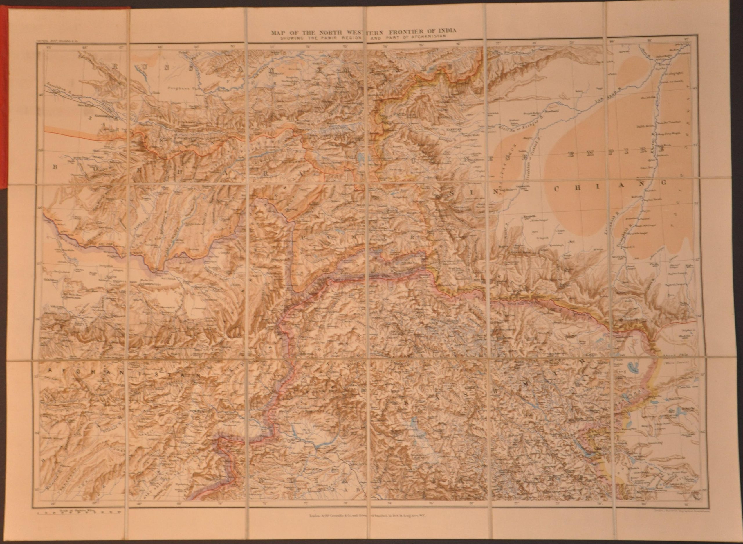
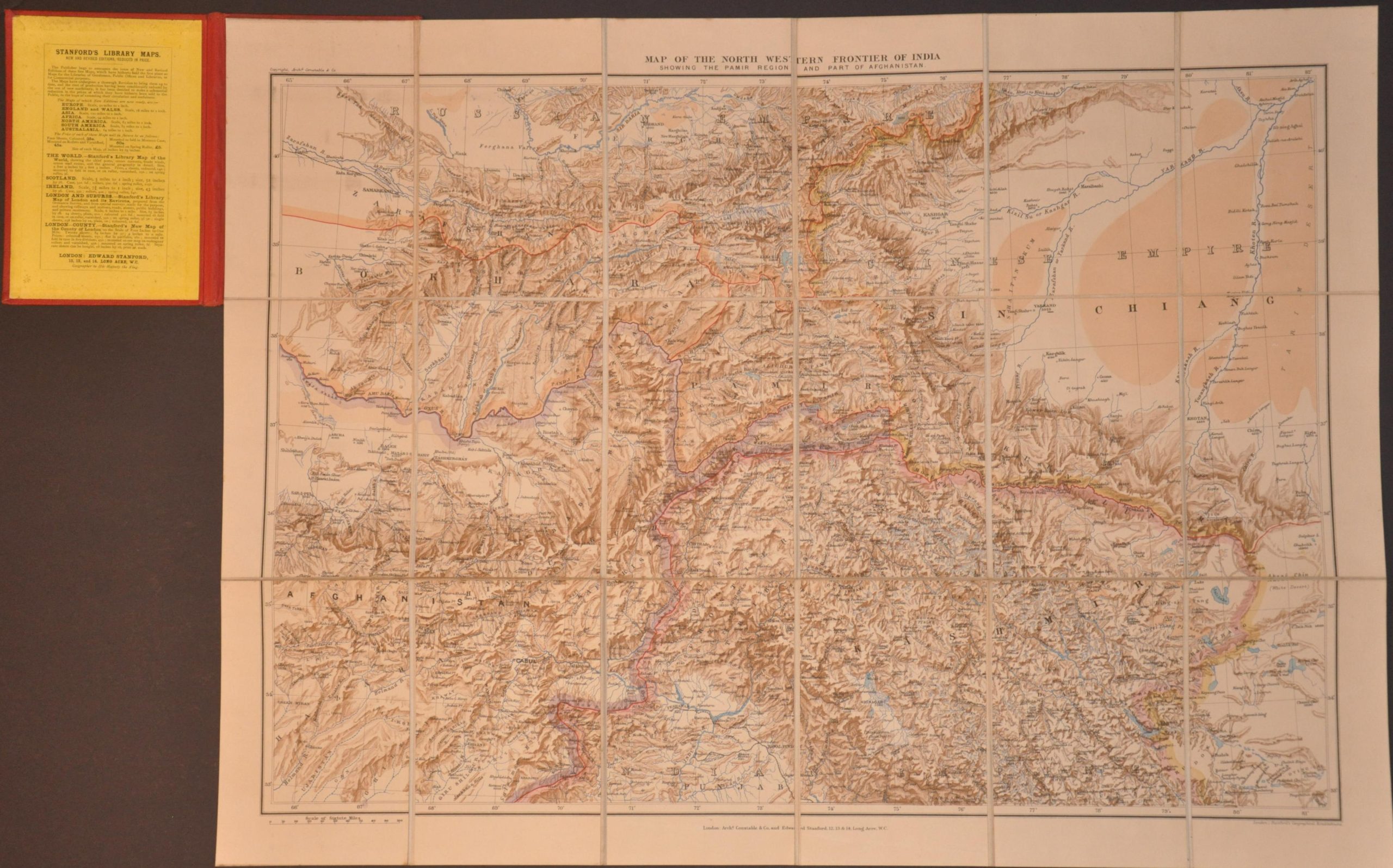
Map of the North Western Frontier of Indian Showing the Pamir Region and Part of Afghanistan
$625.00
The ‘chessboard’ of the Great Game at the turn of the century.
1 in stock
Description
This immaculately detailed map of Central Asia captures the region’s volatile geographical and political landscape near the end of the ‘Great Game’ – the diplomatic and military standoff between the British and Russian Empires for supremacy over India. In order to protect the ‘Crown Jewel’ of its empire, Britain heavily subsidized the Emirs of Afghanistan (after fighting them in two Anglo-Afghan wars). In 1893, they established the Wakhan Corridor, connecting Afghanistan to China as a physical barrier between the rival nations.
Elsewhere, the Oxus and an important branch, the Pandj, rivers function as the border, as established by the signing of the Pamir Boundary Commission protocols in 1895. Some historians consider this the end of the Great Game – Russia realized an invasion through Pamir was all but impossible – but economic and social anxiety over the region likely persisted until the Anglo-Russian Convention of 1907, at which point the two nations set aside their rivalry to focus on curtailing Germany.
In addition to offering an overview of the region’s politics, the map also provides an incredible depiction of the physical landscape, which includes some of the most mountainous terrain in the world. Shaded relief gives a good impression, but examination of the numerous height data offers the best insight into the dramatic heights mapped by 19th-century explorers. Of particular note is K2, labeled as Mt. Godwin Austen and listed at 28,218 feet. Modern satellite imagery and GPS put the mountain’s true height at just 33 feet more – a mind-boggling calculation made by surveyors using brass theodolites from miles away through distorted mountain air. The dramatic topography of the Himalayas is a striking contrast to the remarkably flat expanse of China’s Taklamakan Desert.
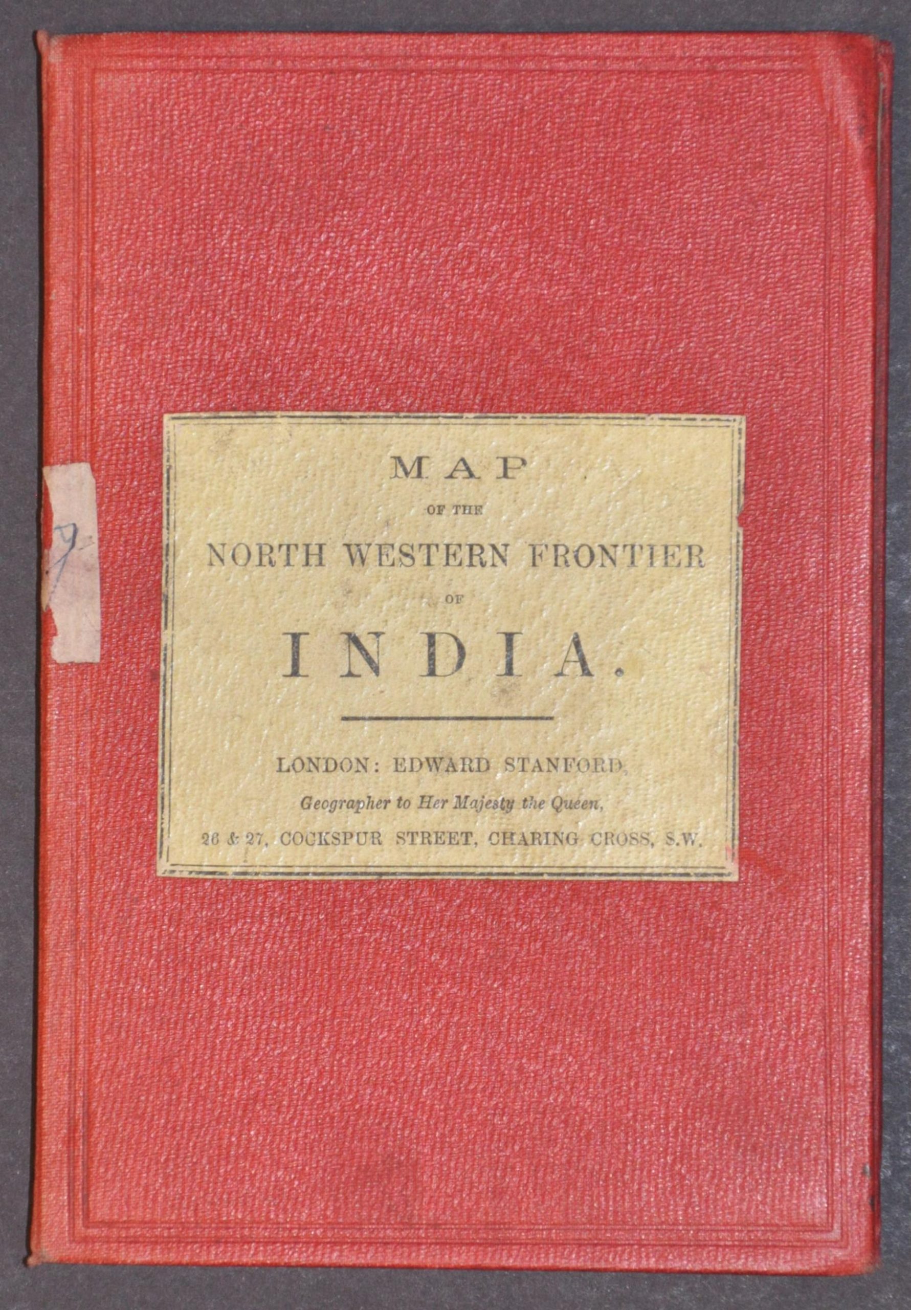
The map was issued in London by Archibald Constable and Company and Edward Stanford. The latter was a prolific British publisher and several of his works are listed across two pastedowns. Though this map is undated, there is a discrepancy in Stanford’s addresses, with the front cover listing 26 & 27 Cockspur Street in Charing Cross and the bottom of the sheet showing 12, 13, & 14 Long Acre, W.C. It’s possible he used old stock, but this detail offers a probable range of c. 1897 – 1900.
Map Details
Publication Date: c. 1900
Author: Archibald Constable & Company and Edward Stanford
Sheet Width (in): 28.00
Sheet Height (in): 20.75
Condition: A
Condition Description: Chromolithograph map dissected into 18 segments and affixed to original linen, bound to full red leather boards. Some light marginal soiling and wear on the covers, but overall in very good to near fine condition.
$625.00
1 in stock