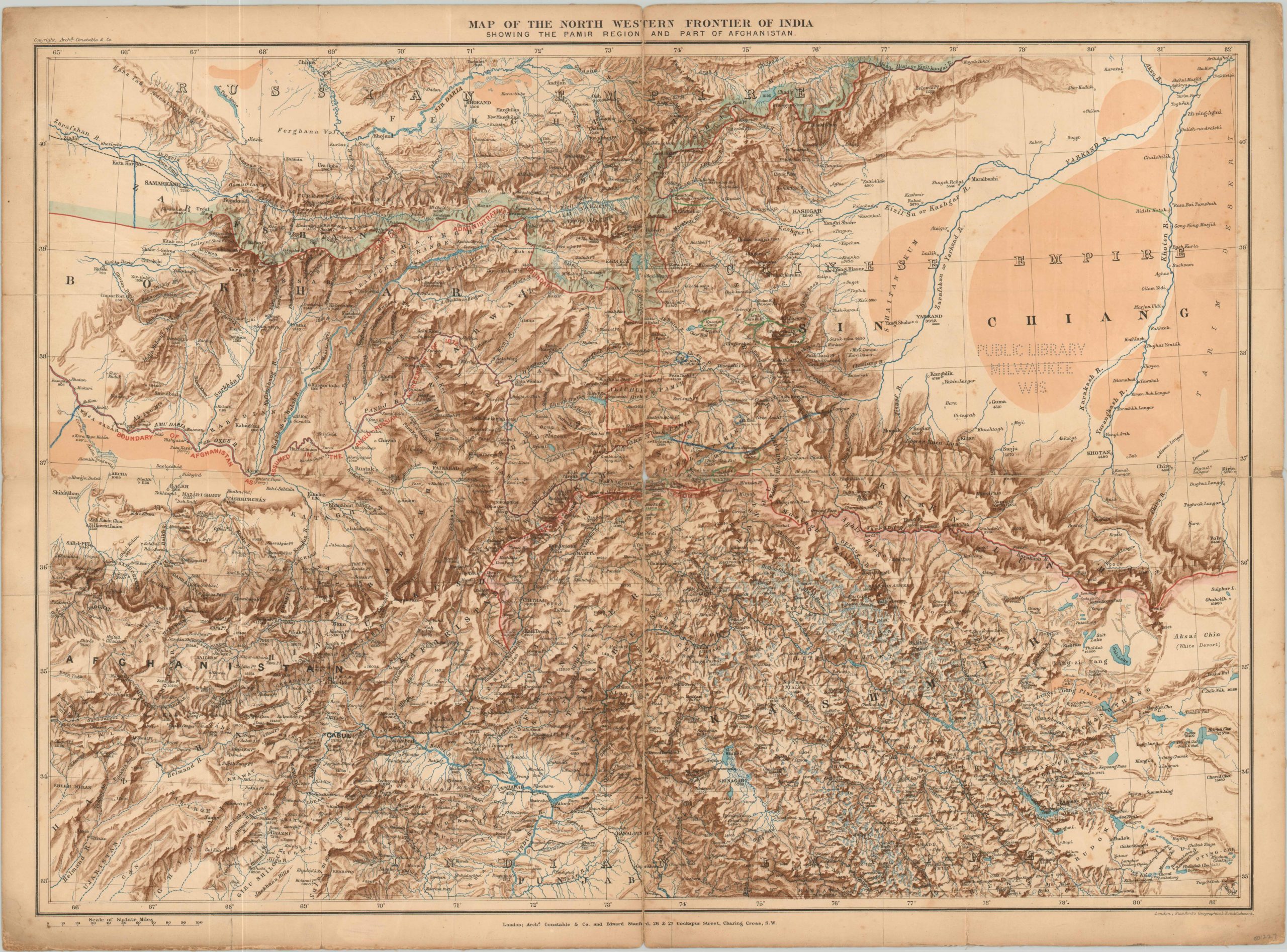
Map of the North Western Frontier of India
Topographical map of the theater of the Second Afghan War.
Out of stock
Description
This detailed map of the area ranging from Samarkand to the Punjab highlights a disputed territory along the border of the British Raj in India. Throughout much of the 19th century, Britain and Russia had dueled in “the Great Game” – a serious of political, military and diplomatic events that aimed to determine a clear European influence across a large portion of central Asia.
The English wanted to protect India, the gem of the Empire, and desired a series of buffer states against the expanding Russian Empire. As a result, they invaded in Afghanistan in 1878 and installed a new friendly emir by 1880 (dynastic rivalries were exploited by both European powers).
This map was issued shortly thereafter, showing the resulting buffer state within red borders. Extensive topographical detail is provided, highlighting the rugged terrain, and the elevations of numerous mountain peaks are given. Manuscript additions in green and blue pencil highlight Russian outposts and certain passes, but I’ve been unable to conclusively link them with any pattern of fighting or campaign.
Color lithograph published in London by Archibald Constable & Co. & Edward Stanford.
Map Details
Publication Date: c. 1882
Author: Archibald Constable & Co. and Edward Stanford
Sheet Width (in): 25.00
Sheet Height (in): 17.75
Condition: B+
Condition Description: Dissected and mounted on linen, with a few separations at the folds and minor soiling the margins. A perforated Milwaukee Public Library stamp in the blank area. Remains very good overall.
Out of stock