Map of the Niagara Frontier
$110.00
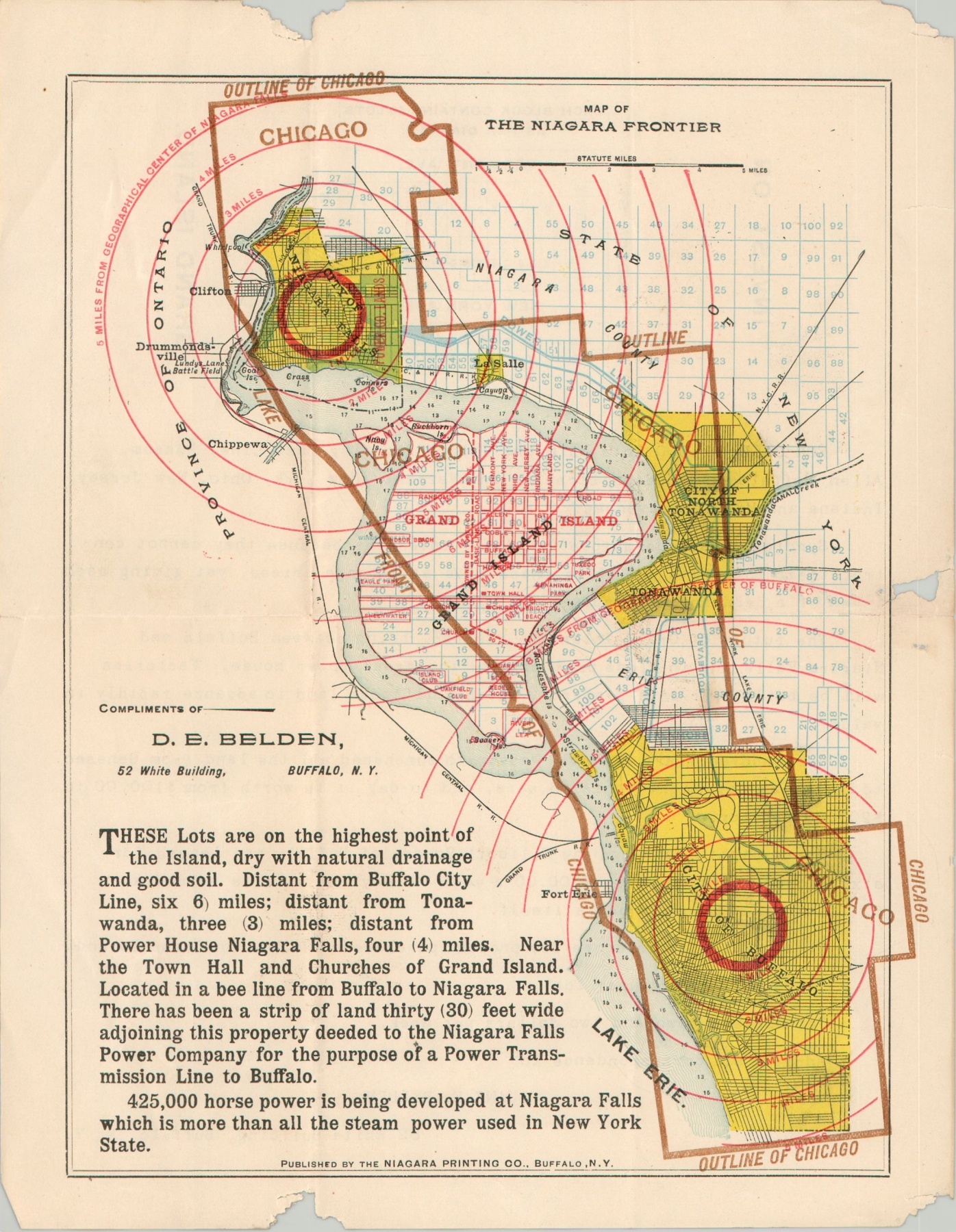
An interesting use of persuasive cartography to sell real estate on Grand Island, New York.
1 in stock
Description
This clever marketing map uses the geographic outline of the city of Chicago to highlight the proximity of Grand Island to nearby Niagara Falls and Buffalo, New York. Concentric circles radiate from both urban centers and reinforce the claims made by the accompanying text in the lower left.
The map was published in the early 20th century by Duane Belden, owner and subdivider of 1,000 lots on Grand Island. The verso includes further details on the terms and conditions and assures the reader that the future of the island community is a bright one, due in part to the electricity-producing capabilities of the Niagara Falls Power Company;
“68 years ago the Ellicott Square of Buffalo was leased for 63 years for only $800 a year, to-day the site is valued at $2,000,000. History repeats itself. Great wealth is in store for present purchasers of lots on Grand Island.”
Map Details
Publication Date: c. 1908
Author: Duane Belden
Sheet Width (in): 8.4
Sheet Height (in): 10.9
Condition: B-
Condition Description: Several large chips in the margin and a large 3" tear on the right side, repaired on the verso with archival tape. Toning on the verso does not affect the image.
$110.00
1 in stock


