
Map of the Mexican Railway and Connections
$250.00
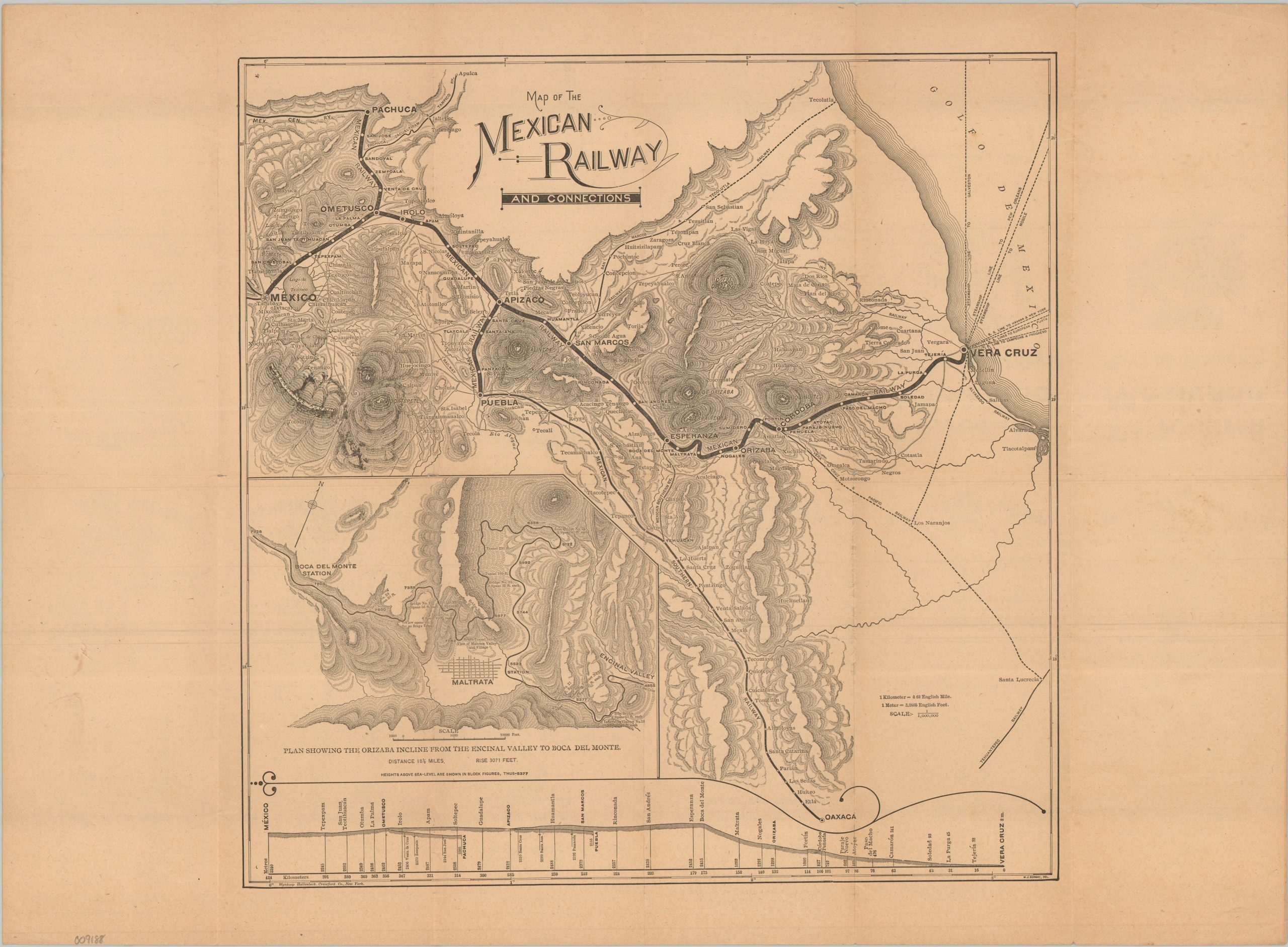
An early 20th-century map of the Veracruz Route.
1 in stock
Description
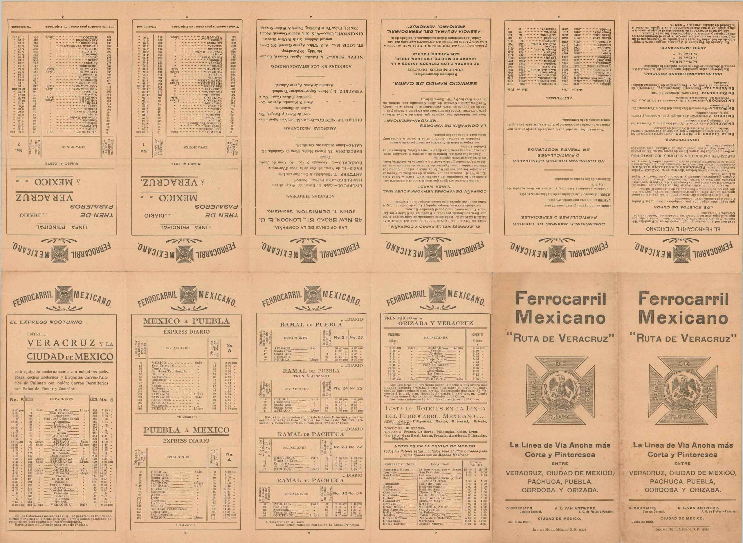
“The Shortest and Most Scenic Broad Gauge Line Between Veracruz, Mexico City, Pachuca, Puebla, Cordoba, and Orizaba.” – Text, front cover. The first official efforts to connect Mexico City to Veracruz via rail began in 1837, when the Mexican government granted Francisco Arrillaga a concession to construct a single broad-gauge track. Several decades of construction, supported variously by Mexican, American, Belgian, French, and British financiers, ultimately resulted in a completed line (with several important connections) by early 1873, under the auspices of the British-owned Mexican Railway.
This uncommon map and timetable capture the operations of the Mexican Railway in the early 20th century. A detailed topographic map outlines the primary routes and connections, with numerous steamship lines emanating from the important port of Veracruz. An elevation diagram along the lower edge notes the Orizaba Encline from the Encinal valley to Boca Del Monte. Spanish text on the verso offers additional information about the railway, timetables, and lists of altitudes.
The map was drawn by W.J. Bormay and printed by Wynkoop Hallenbeck of Crawford County, New York. Published in Mexico City by Imprenta De Hull, an important Porfirato-era publishing house, in July 1903.
Map Details
Publication Date: 1903
Author: W.J. Bormay
Sheet Width (in): 21.3
Sheet Height (in): 15.9
Condition: A-
Condition Description: Map and timetable printed on toned paper that's creased along original folds. Small holes at fold joints and light wear along the outer edges. Front covers are lightly spotted, though the map is unaffected. Very good condition overall.
$250.00
1 in stock