
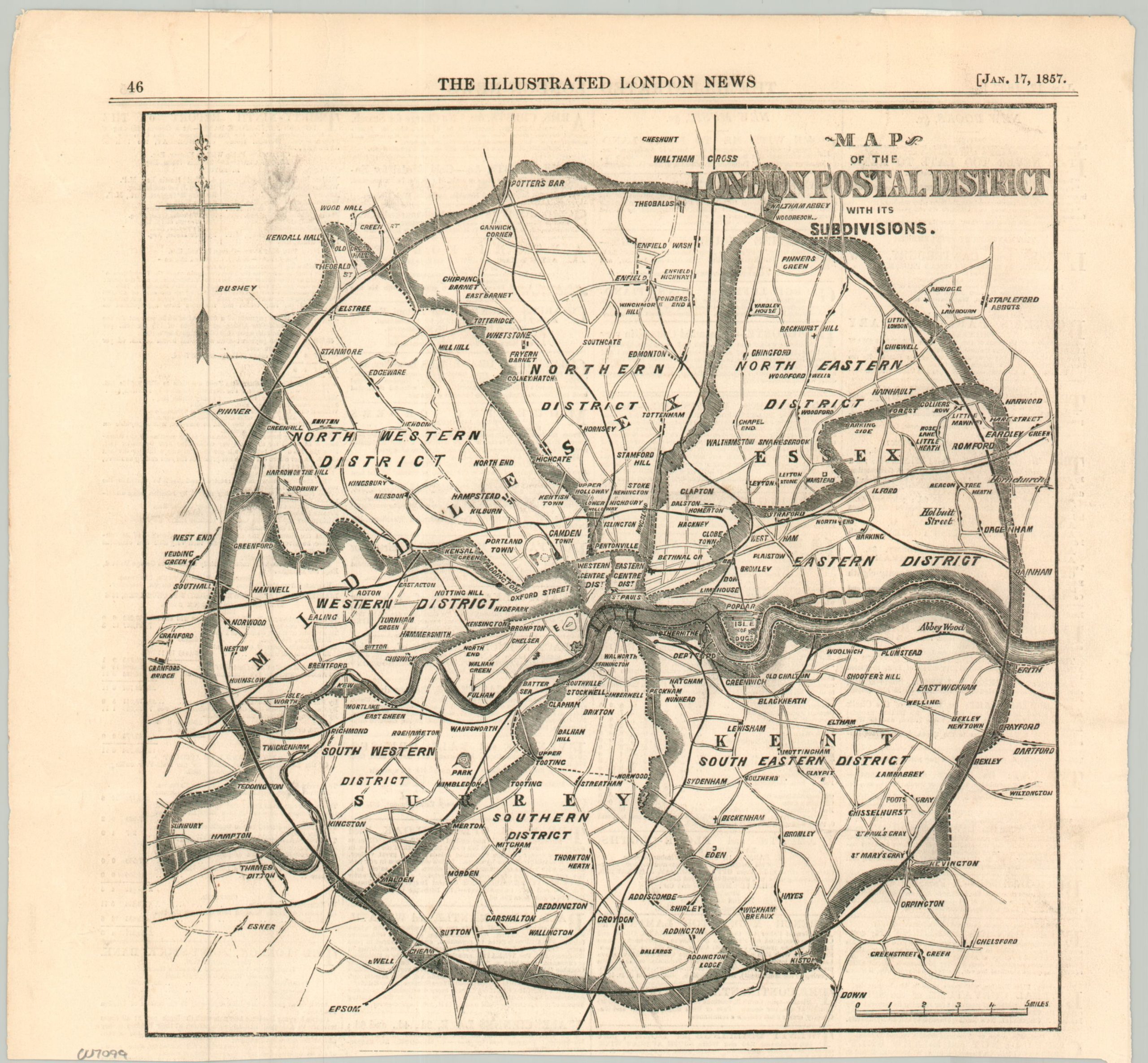
Map of the London Postal District with its Subdivisions
Introducing London’s first Postal District.
Out of stock
Description
The growth of London’s physical size, industry, and population during the mid-19th century caused a myriad of difficulties for postal delivery. This map shows the innovative solution, introduced the year after publication. The London Postal District encompassed a circular area of 12 miles radius from the central post office at St. Martin’s Le Grand. Each of the eight constituent districts, approximately matching points of the compass, has its own separate head office.
Source: London Historians;
Map Details
Publication Date: 1857
Author: The Illustrated London News
Sheet Width (in): 10.9
Sheet Height (in): 10
Condition: B
Condition Description: Fragment (map only) of a single sheet from the January 17, 1857 issue of the Illustrated London News. Light wear in the irregular trimmed margins and old archival tape on the verso, were previously matted. Good condition overall.
Out of stock