
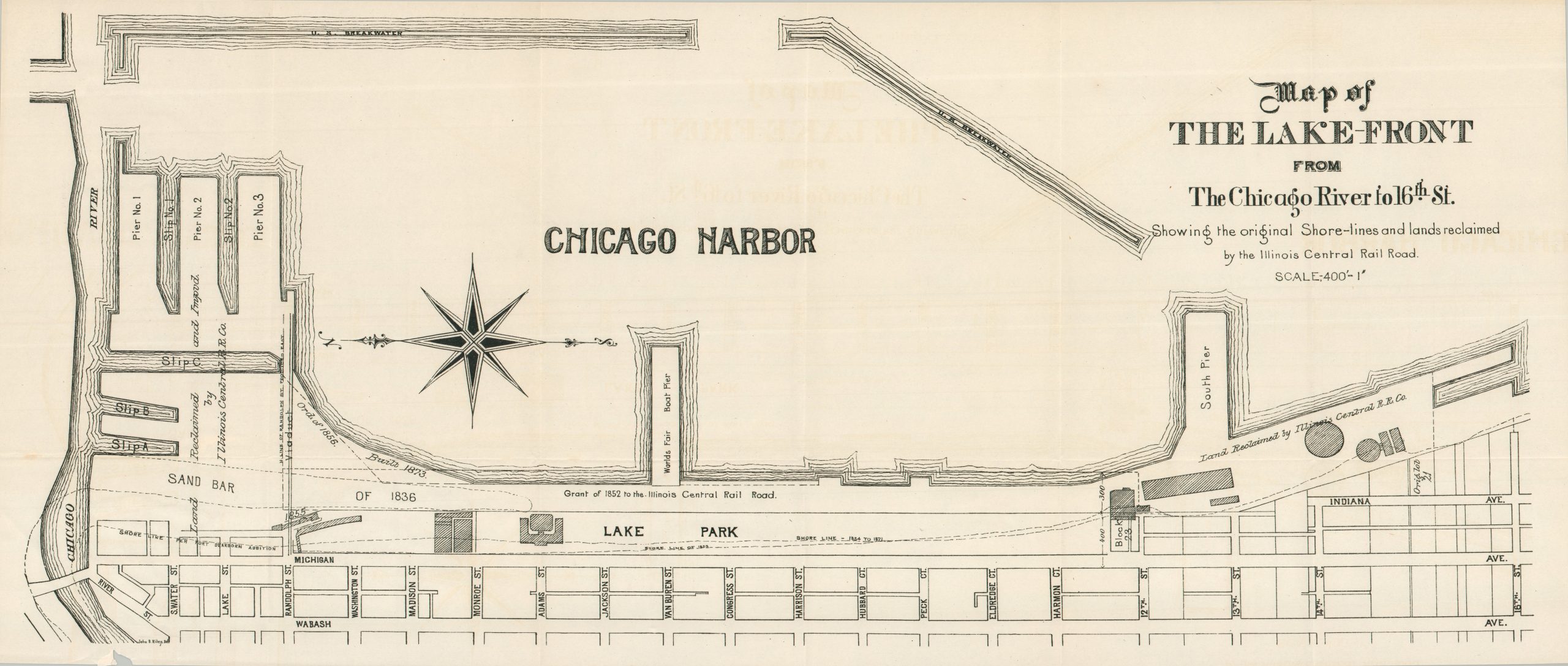
Map of the Lake-Front from the Chicago River to 16th St. Showing the Original Shore-lines and land reclaimed by the Illinois Central Railroads
A scarce map commemorating the historic legal battle for Chicago’s lakefront.
Out of stock
Description
This fascinating outline map of Chicago’s harbor was engraved by John D. Riley and published around 1894, likely as part of a broader government or legal report. The evolution of the city’s waterfront can be traced through the successive shoreline delineations, documenting its growth from the days of Fort Dearborn to the World’s Columbian Exposition. The Art Institute, Lake Park, and the World’s Fair Boat Pier are also identified along the shore. Large tracts extending into the harbor are marked as having been reclaimed by the Illinois Central Railroad.
The railroad’s lakefront operations became the subject of one of the most consequential property disputes in American legal history. In 1869, the Illinois legislature passed the Lake Front Act, granting the Illinois Central Railroad control over nearly 1,000 acres of submerged lands along Lake Michigan. Amid mounting public opposition, the grant was repealed in 1873, prompting a legal battle that culminated in the Supreme Court’s landmark decision in Illinois Central Railroad Co. v. Illinois (1892). The Court held that the State held the submerged lands in trust for the public and could not permanently relinquish control of them to a private corporation. The ruling established the modern public trust doctrine and helped preserve Chicago’s lakefront as public open space, laying the legal foundation for the later development of Grant Park, Millennium Park, and the city’s celebrated waterfront.
The map is quite rare and known in only a handful of examples. WorldCat records other Chicago-related publications engraved by Riley, primarily from the early twentieth century, but not this work. The Chicago History Museum appears to hold the only cataloged example.
Sources: Chicago History Museum; Justia
Map Details
Publication Date: c. 1894
Author: John D. Reilly
Sheet Width (in): 28.50
Sheet Height (in): 12.10
Condition: A
Condition Description: Black and white map on a somewhat thin sheet, softly creased along old folds - likely originally issued in a report that's sadly lost. Some very faint scattered spotting, but overall near fine condition.
Out of stock