
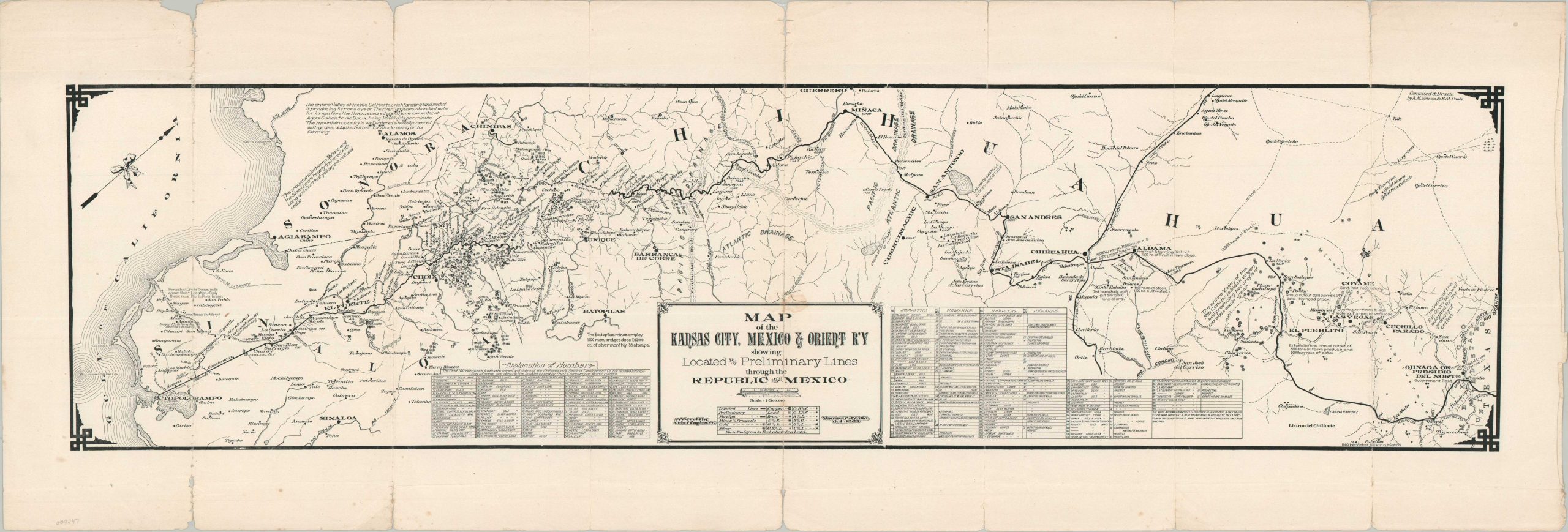
Map of the Kansas City, Mexico & Orient Ry. Showing the Located and Preliminary Lines through the Republic of Mexico
$450.00
An ambitious plan to connect the Mexican coast to the Midwestern United States by rail.
1 in stock
Description
This rare and ephemeral map documents a portion of the proposed Kansas City, Mexico and Orient Railway, an ambitious project chartered in 1900 to connect Kansas City with the Pacific port of Topolobampo, Mexico. Promoted by Arthur E. Stilwell, the railway was intended to link American markets with the agricultural and mineral wealth of the southwestern United States and northern Mexico, ultimately providing a direct route to Pacific shipping. The project depended on a complex network of subsidiary companies and Mexican government concessions secured under President Porfirio Díaz.
Dated October 1904, this map was prepared by the Office of the Chief Engineer of the Kansas City, Mexico and Orient Railway. Its unusual orientation, with northwest at the top, emphasizes the proposed southern portion of the route between Presidio, Texas, and Topolobampo. The image is a remarkable example of persuasive cartography, identifying more than 200 mining operations associated with gold, iron, copper, silver, and lead. An elaborate legend distinguishes the various mineral deposits, while supplementary notes highlight local agricultural production and livestock, presenting the region as a rich source of potential traffic and revenue.
Despite these apparent advantages, the railway struggled to realize its ambitious plans. By the early 1910s, the American line and several disconnected Mexican segments had been constructed, but the envisioned continuous route to the Pacific remained incomplete. The company entered receivership in 1912 and continued to face financial difficulties for years afterward. Oil discoveries in West Texas during the 1920s brought new traffic and improved the railway’s prospects, but in 1928 the American system was acquired by the Atchison, Topeka and Santa Fe Railway.
Map Details
Publication Date: 1904
Author: Kansas City, Mexico, and Orient Railway Office of the Chief Engineer
Sheet Width (in): 32.10
Sheet Height (in): 11.00
Condition: B
Condition Description: Single-sided black and white map, heavily worn along several old vertical folds. Numerous splits repaired on the verso with archival tape, though there is a bit of marginal loss along some of the visible seams. A small circular stain in the center of the sheet. About good condition overall.
$450.00
1 in stock