
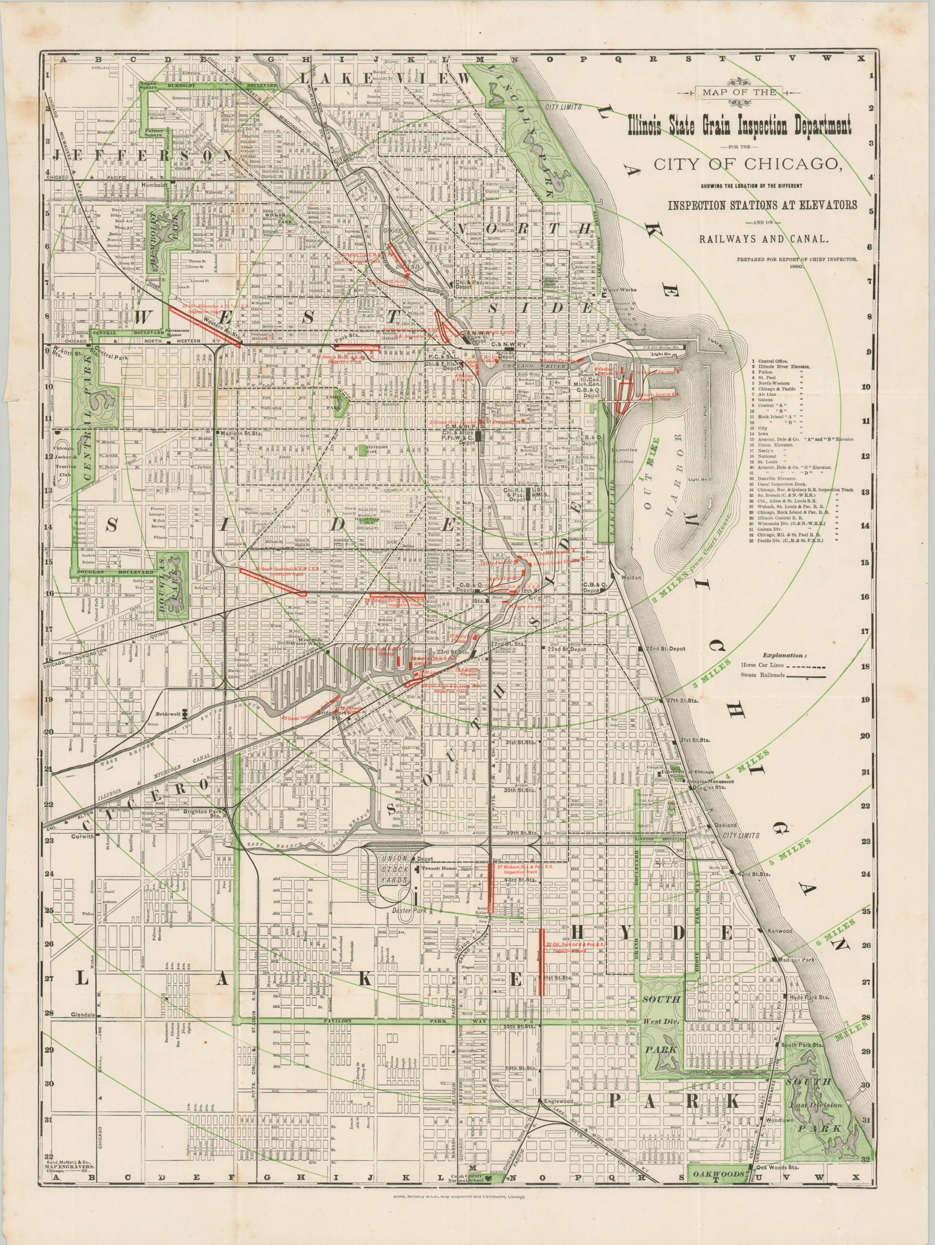
Map of the Illinois State Grain Inspection Department for the City of Chicago
$195.00
Chicago’s commercial commodity infrastructure in the early 1880s.
1 in stock
Description
This uncommon map of Chicago was designed and published by Rand McNally to accompany the 1880 report of the Chief Inspector of the Illinois State Grain Inspection Department. The city was well on its way to becoming one of the world’s premier commodity markets, conveniently situated to handle the vast agricultural output of the Great Plains and Upper Midwest. The image notes the complex system of inspection stations located near grain elevators and major railroad lines. Over thirty associated locations of interest are numbered and labeled with red overprinting. According to a 1911 article on the subject;
“The “Track” system of grain inspection, the system so long in general use in all inspection departments and so designated from the fact that the work is performed and the grades established by the tracks of the different railroads instead of at a central office, had its origin on the Chicago Board of Trade in the year 1858 and was adopted by the Illinois state grain inspection department when the state assumed the responsibility of grain inspection under legislative enactment in 1871.”
Map Details
Publication Date: 1880
Author: Rand McNally
Sheet Width (in): 18.9
Sheet Height (in): 25.25
Condition: A-
Condition Description: Creasing and light wear along fold lines. Scattered soiling visible in the upper left corner, mostly confined to the margins, and in the upper right and center left. Good to very good condition overall. Blank on verso.
$195.00
1 in stock