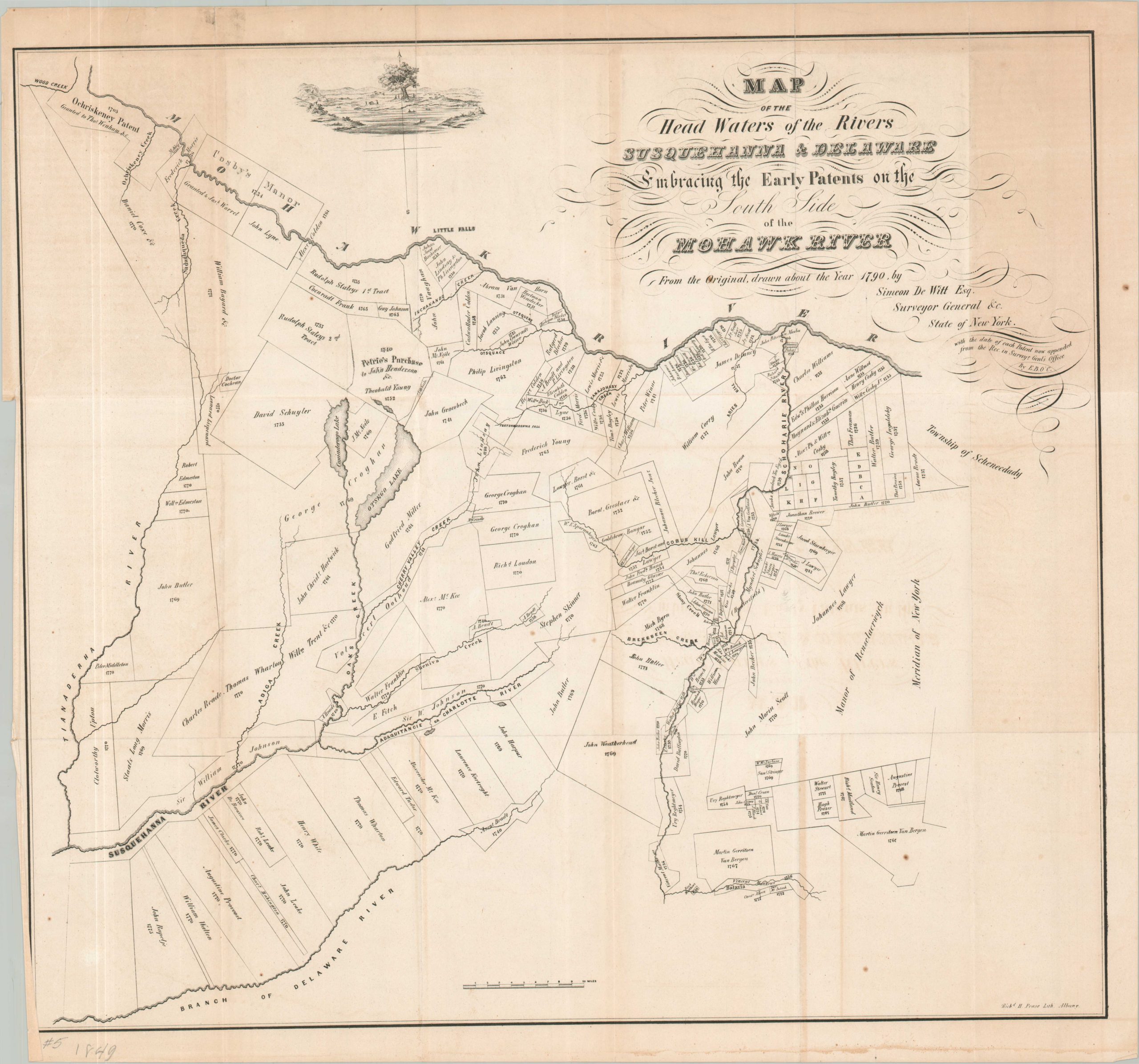
Map of the Headwaters of the Rivers Susquehanna & Delaware Embracing the Early Patents on the South Side of the Mohawk River
$75.00
Mid-19th century reprint of an early American cadastral map.
1 in stock
Description
This detailed cadastral map covers a large region along the Mohawk River in central New York. It was originally drawn by Simeon De Witt, State Surveyor General, in 1790, though this is a later (1849) reprint by R.H. Pease for O’Callaghan’s Documentary History of N.Y. State. The image names the early landowners north of the Delaware River, along with their respective dates of patent. Of particular interest is the (unbounded) Manor of Rensselaerswyck – the recently concluded ‘Anti-Rent War’ (1845) dissolved the Dutch colonial patroonship.
Source: New York Public Library;
Map Details
Publication Date: 1849
Author: Simeon De Witt/R.H. Pease
Sheet Width (in): 22.5
Sheet Height (in): 21
Condition: B
Condition Description: Soft creasing along originally issued fold lines and moderate toning visible on the left and right sides of the sheet. Irregular margins show a small spot and wear. About good condition overall.
$75.00
1 in stock