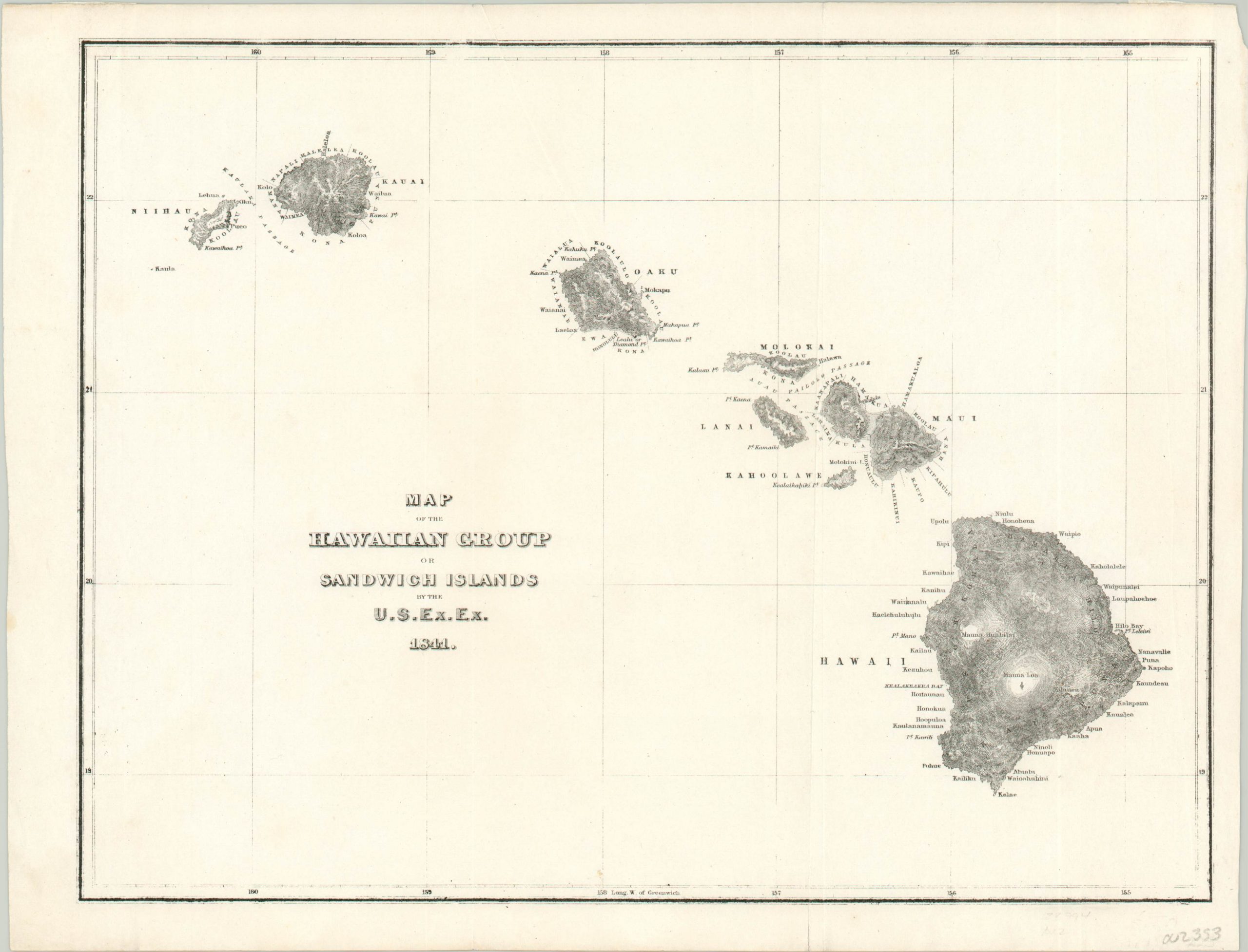
Map of the Hawaiian Group or Sandwich Islands by the U.S. Ex. Ex.
Finally, an improvement over Cooks’ maps of Hawaii.
Out of stock
Description
This small, but detailed, map of the Hawaiian Islands is based off the surveying performed by the United States Exploring Expedition during its visit in 1841. The global circumnavigation led by Charles Wilkes provided a wealth of scientific and cartographic contributions, and is seen by many as the American response to earlier voyages by prominent national explorers like Cook (England) or La Perouse (France).
Topography is shown in hachure while the islands, prominent geographic features, and numerous place names are individually labeled. Of particular interest is Kealakekua Bay on the island of Hawaii. It was here in 1779 that Captain Cook was killed onshore by a native while attempting to kidnap a local chieftain.
Map Details
Publication Date: c. 1844
Author: Charles Wilkes
Sheet Width (in): 12.00
Sheet Height (in): 9.10
Condition: A-
Condition Description: Slight wear, a chipped upper left corner, and a few small tears around the outer edges. Light creasing along a vertical fold an one extraneous wrinkle at the top center. Very good overall.
Out of stock