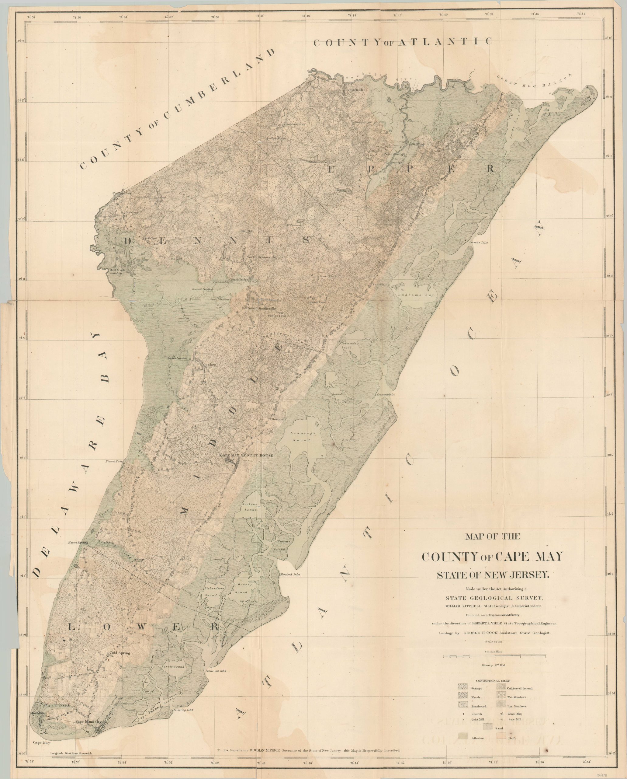
Map of the County of Cape May State of New Jersey
Original price was: $950.00.$700.00Current price is: $700.00.
Mid-19th century map and geologic report of Cape May County, New Jersey.
1 in stock

Description
“Within the last six years the quantity of its [Cape May County’s] staple agricultural products has increased fifty percent, and the price of land has doubled. When the railroads now in process of construction are opened through this county, and proper facilities for marketing are afforded, the whole area of Cape May will be desirable ground for farmers and market gardeners.” – Pg. 10.
This detailed map of Cape May County, New Jersey was published in 1857 to accompany George Cook’s geologic report, printed at the Office of the True American in Trenton (a copy of which is included).
Formations of sand, alluvium, and drift are colored by hand atop a finely engraved overview of the coastal county. Surface composition is noted according to the legend in the lower right, which also identies the symbols for churches, grist mills, wind mills, and saw mills. Neatly ordered farms hung the primary roads, sandwiched between forests and marshy coastal plains.
A fascinating overview of the mid-19th century composition of the peninsula.
Map Details
Publication Date: 1857
Author: William Kitchell
Sheet Width (in): 25
Sheet Height (in): 31.5
Condition: B
Condition Description: Printed on thin paper that has become somewhat brittle with age. Numerous separations along fold lines have been repaired on the verso with archival tape, though several small spots at the fold intersections remain. The sheet is lightly toned and shows offsetting from the hand color and printed title block in the corners. Includes a broken ex-libris copy of The Geology of the County of Cape May, State of New Jersey.
Original price was: $950.00.$700.00Current price is: $700.00.
1 in stock