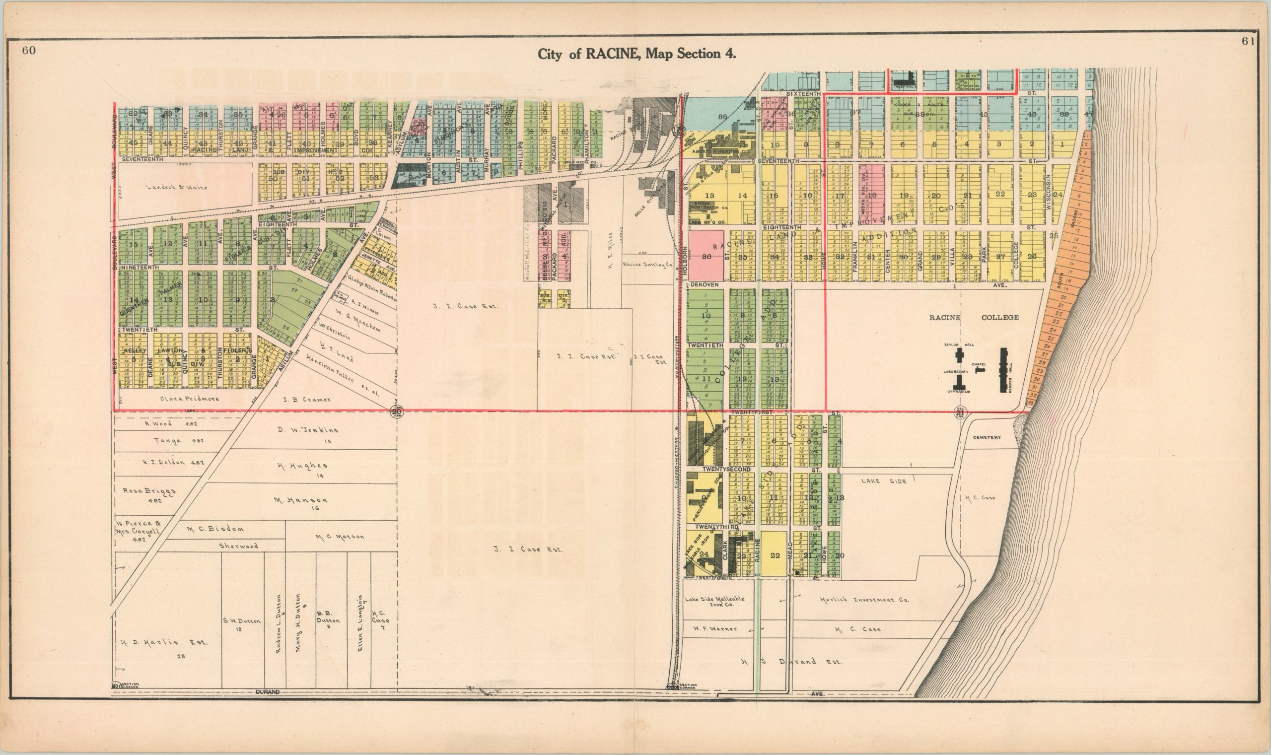
Map of the City of Racine
Original price was: $150.00.$110.00Current price is: $110.00.
Rare and colorful four sheet city plan of Racine, Wisconsin published in 1908.


Description
This large, four sheet plat map of the city of Racine was published by Hennessey & Co. as part of their atlas of Racine and Kenosha counties in 1908. Vivid colors differentiate between separate additions, while finely detailed text provides ownership information on individual plots. Important buildings, parks and railroads are also shown, while wards are separated by bold red outline. Racine at this time was a city divided between agriculture and industry; as evidenced by the dairies, stockyards and farms on the outskirts of the city and the factories, mills and warehouses along the rivers and rail lines. It was also largely a town of immigrants, as can be seen in many of the property owner’s names listed on the map.
Map Details
Publication Date: 1908
Author: P.C. Hennessey & Co.
Sheet Width (in): 29.75
Sheet Height (in): 18
Condition: A-
Condition Description: Each sheet is in excellent condition, with minimal edge wear and very slight offsetting. Sheet 4 has a 3" tear along the centerfold that has been repaired on the verso.
Original price was: $150.00.$110.00Current price is: $110.00.