Map of the City of Providence Rhode Island
Detailed city plan of Providence, Rhode Island with fascinating manuscript annotations.
Out of stock

Description
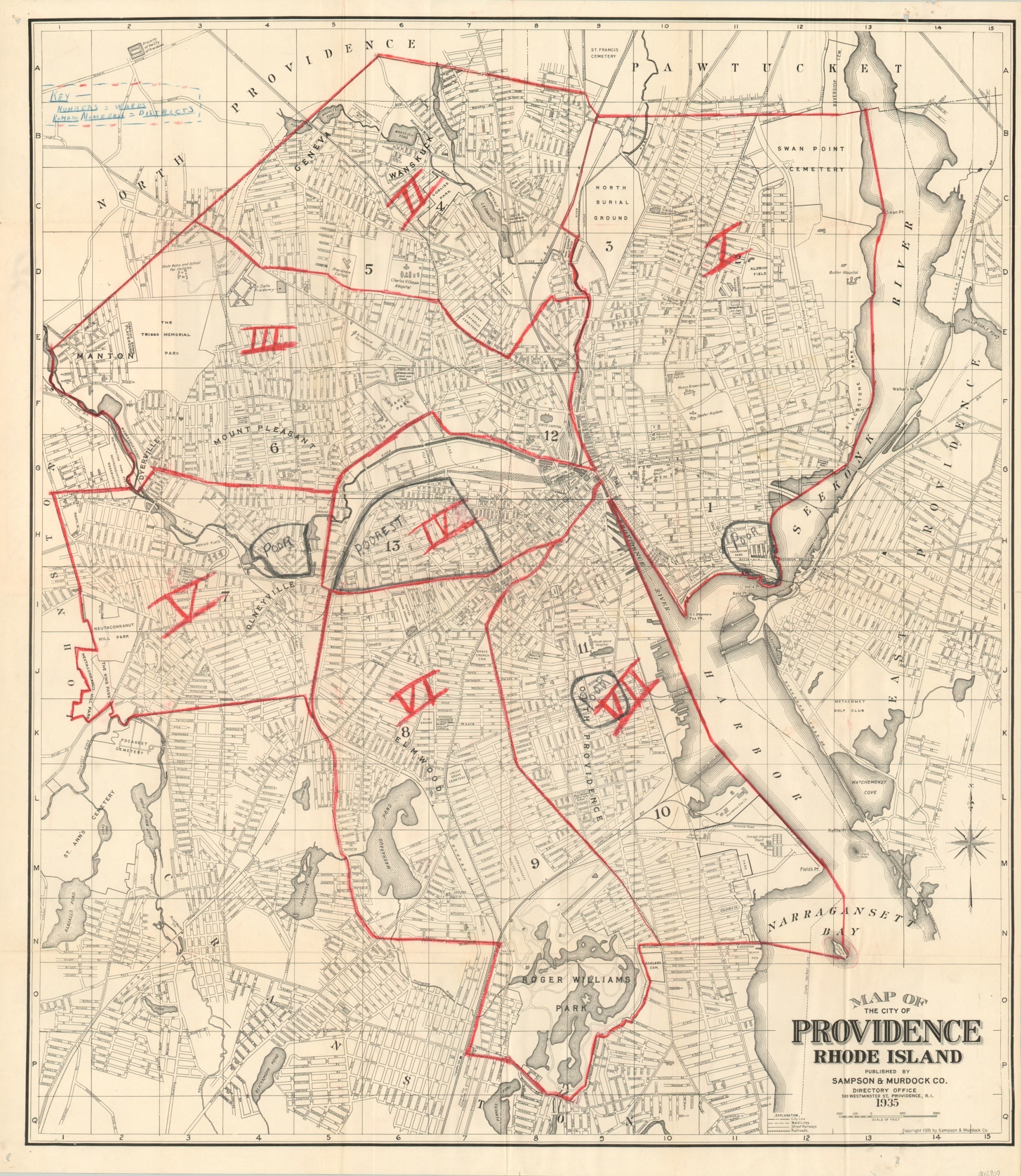
This street map of Providence, Rhode Island was published locally by Sampson & Murdock. Co. in 1935. It emphasizes the city’s transportation routes and shows street railways, steam railroads, and steamship lines. Important buildings, recreational areas, and geographic features are also labeled.
At the time of issue, Providence was still reeling from the Great Depression and was about to suffer further economic hardships during a national recession in 1937. Old manuscript writing in pencil noting some of the city’s poorest neighborhoods reflects this downturn. Their locations are concentrated along the waterfront and rail lines – undoubtedly some of the noisier and smellier areas of the city. Further red annotations divide the city into seven districts and a custom key is included in the upper left.
Map Details
Publication Date: 1935
Author: Sampson & Murdock Co.
Sheet Width (in): 25.70
Sheet Height (in): 28.25
Condition: A-
Condition Description: Folded into 24 panels and affixed to original colored paper covers. Light creasing along fold lines and faint wear on the wrappers, but overall in very good condition. Includes interesting old annotations dividing the city into districts (red oil pencil/crayon) and highlighting impoverished areas (gray graphite).
Out of stock