Map of the City of Olean New York
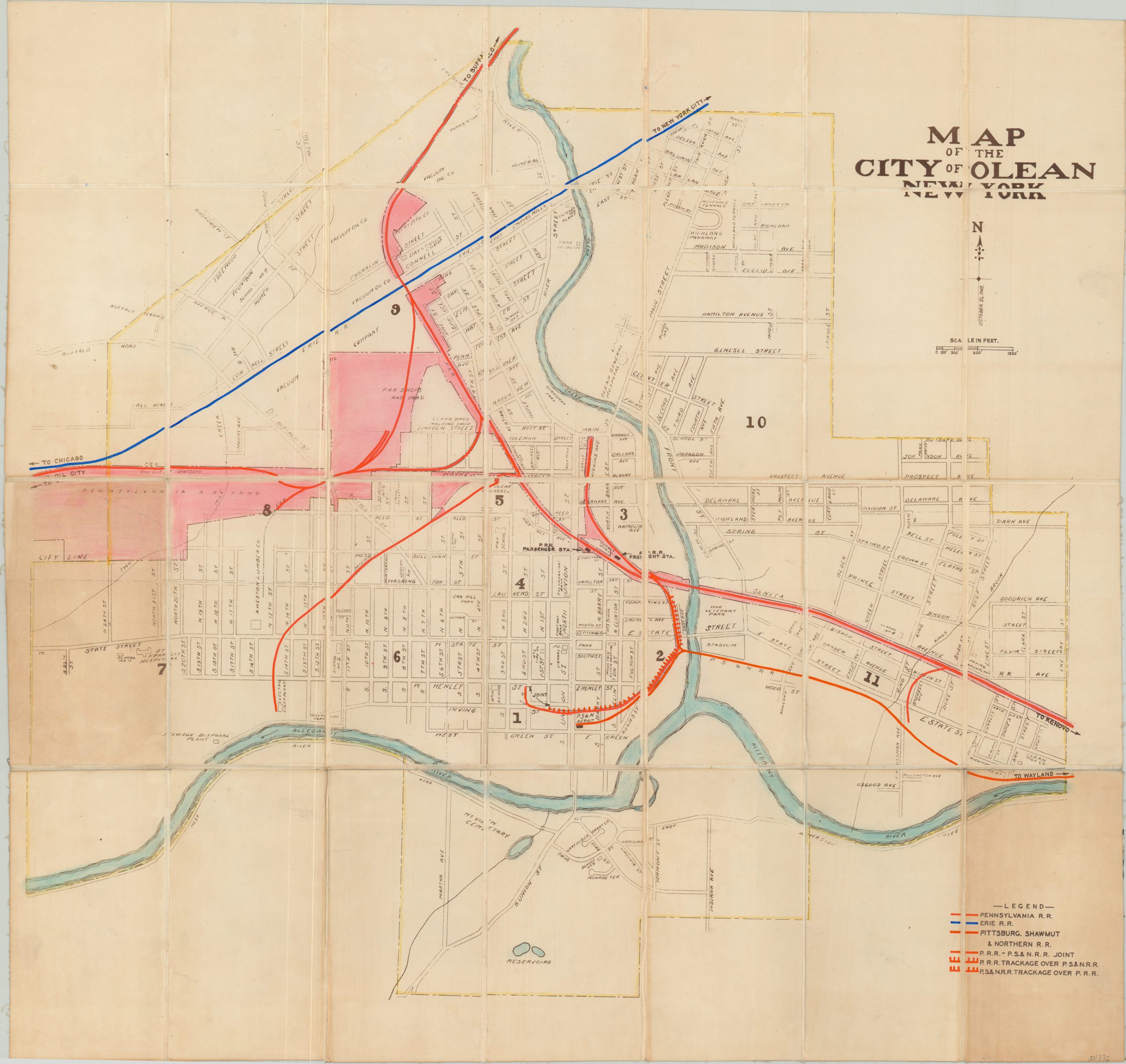
Street plan of Olean, New York customized for use by the Pennsylvania Railroad.
Out of stock
Description
Dated October 12, 1942, this detailed city plan of Olean, New York shows the city on the banks of the Allegany River shortly after the U.S. entered World War II. Streets, prominent local industries, geographic features and public buildings are all individually labeled and shown at a scale of approximately 1″ to 500′.
This particular example has been customized for use in the Central Engineering Department of the Pennsylvania Railroad and was dissected and mounted on linen for preservation and convenient storage. Bright color applied by hand denotes property and track ownership throughout the city, with a custom index added to the lower right to identify the primary operators.
Of particular interest is the Pittsburg, Shawmut & Northern R.R. This short lived line was in bankruptcy proceedings for 42 of its 48 years of operations, ending shortly after the publication of this map in 1947, when the Olean branch was acquired by the Pennsylvania Railroad.
Map Details
Publication Date: 1942
Author: Central Engineering Department of the Pennsylvania Railroad.
Sheet Width (in): 31.00
Sheet Height (in): 29.00
Condition: B+
Condition Description: Dissected into 28 panels and mounted on linen with black leather covers. Two panels show moderate discoloration as a result of the adhesive used to affix the covers to the verso. Otherwise there is minor wear and scattered soiling consistent with age and use.
Out of stock

