Map of the City of Newport
$225.00
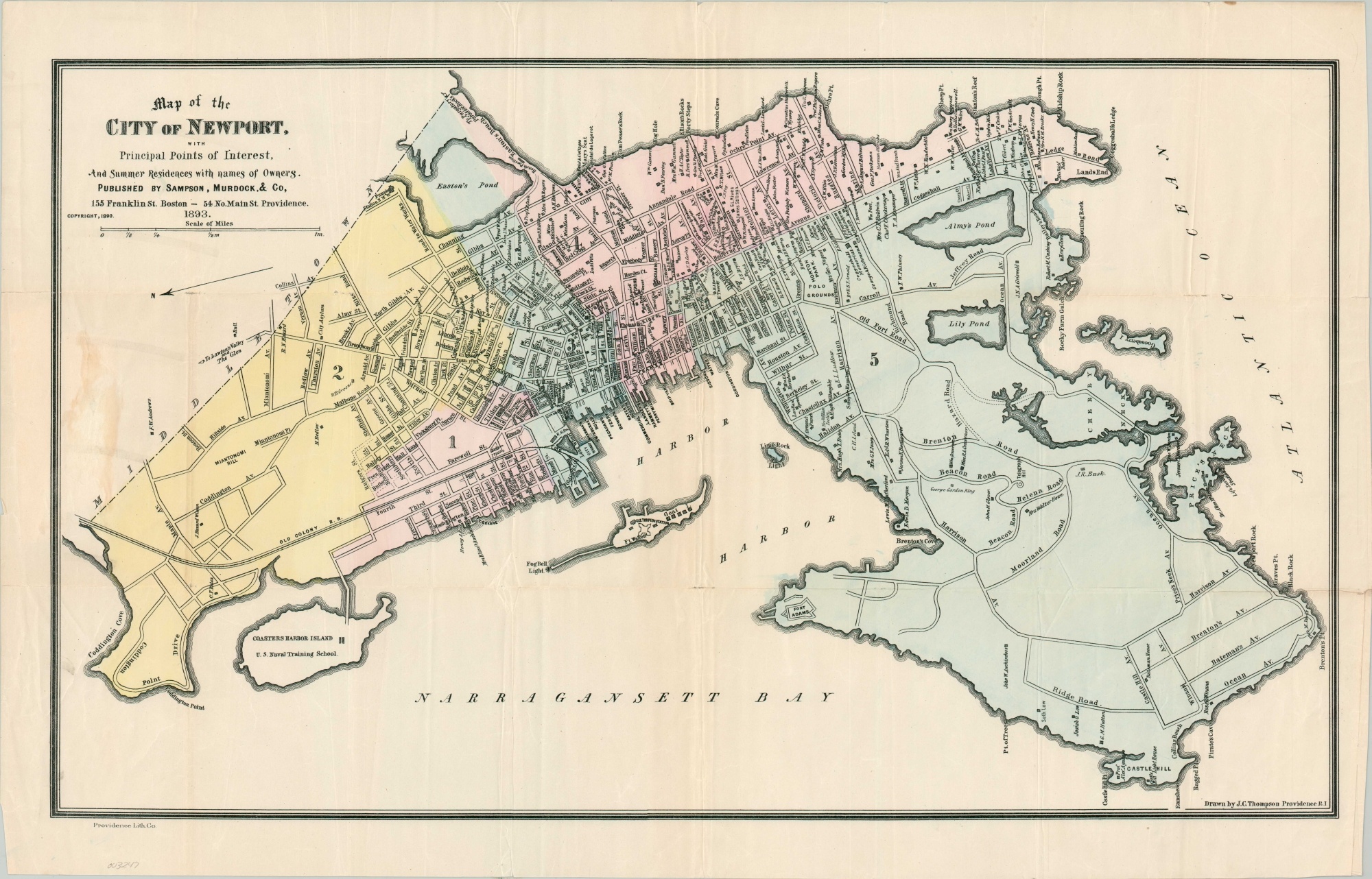
Late 19th-century map of Newport, Rhode Island.
1 in stock
Description
This former pocket map shows a detailed outline of Newport, Rhode Island during the city’s Gilded Age. Apart from rudimentary information like ward outlines, street names, and geographic features, the image lists the locations of homes owned by various industrial titans of the late 19th century. Astor and Vanderbilt are among those named, along with dozens of other wealthy magnates and local bigwigs. Other locations of interest include the U.S. Naval Training School on Coasters Harbor Island, Forts Walcott and Adams, lighthouses, and transportation depots.
The map was drawn by J.C. Thompson and published in Providence by Sampson, Murdock & Company in 1893.
Map Details
Publication Date: 1893
Author: J.C. Thompson
Sheet Width (in): 27.40
Sheet Height (in): 17.25
Condition: B+
Condition Description: Residue and wear on the left side from where the map was likely formerly adhered to covers. Creasing and light wear along fold lines, with some extraneous wrinkling throughout the sheet. Small edge tears repaired on the verso with archival tape and light wear along the outer margins, but remains in good to very good condition overall.
$225.00
1 in stock

