Map of the City of Nauvoo
$75.00
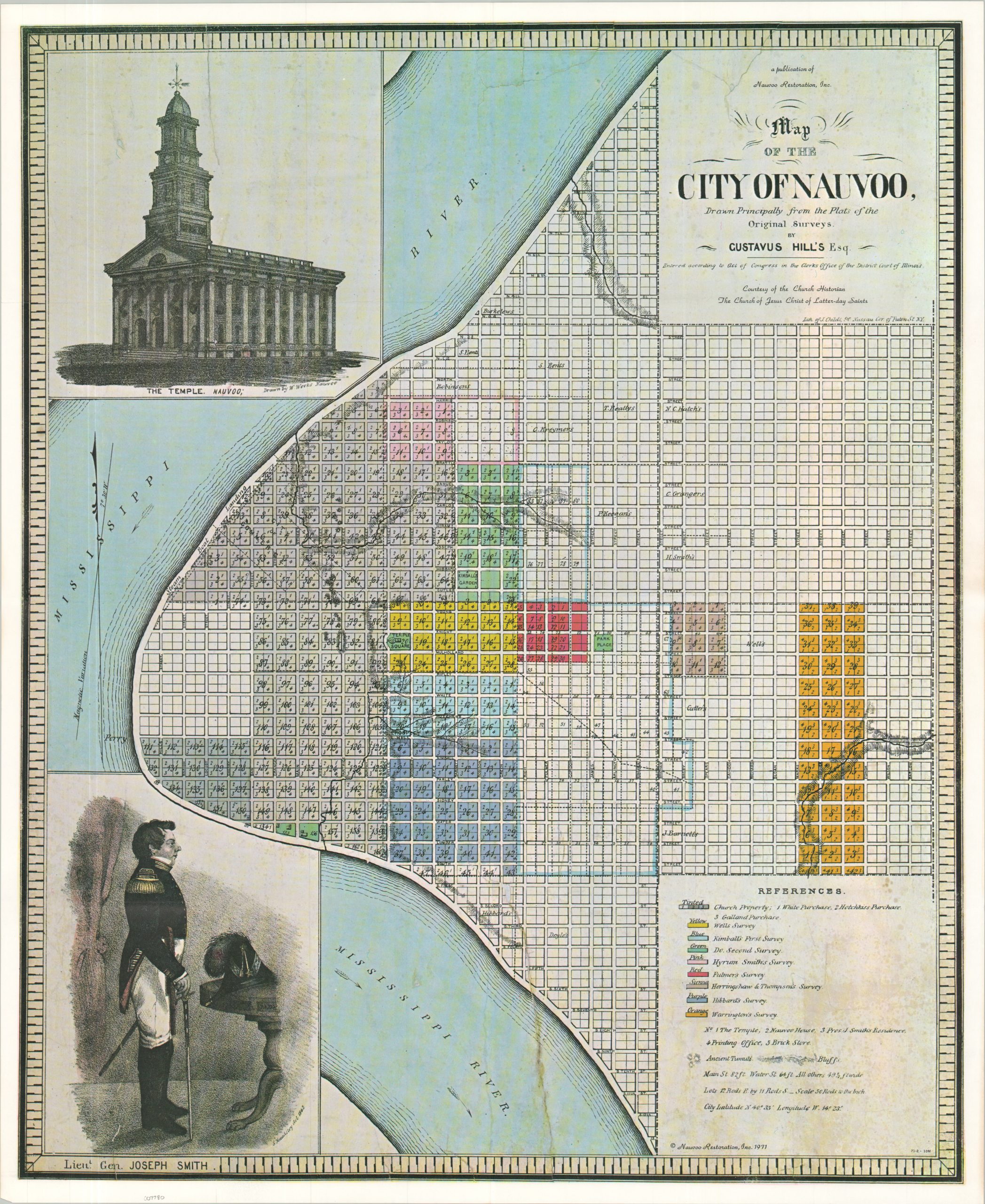
A 20th-century reprint of a rare map of great importance to the Mormon faith.
1 in stock
Description
This beautiful map of the Illinois city of Nauvoo was originally drawn by Gustavus Hill and lithographed in 1842, though this is a later reprint from the early 1970s. Various locations of interest (including Joseph Smith’s residence) and property owners are noted according to the legend in the lower right – the largest landowners by far are the Church. The upper left presents the first known drawing of the Nauvoo Temple as proposed by architect William Weeks.
Published by Nauvoo Restoration, Inc. in 1971 and distributed courtesy of the Church Historian of the Church of Jesus Christ of Latter-day Saints. Nauvoo was founded in the late 1830s by Smith (pictured, lower left) as the principal gathering place for those who practiced the Mormon faith. During the early 1840s, the city grew rapidly, rivaling Chicago in population and featuring a thriving, theocratic civic structure before violent conflict with neighboring communities forced the residents to abandon Nauvoo in 1846.
Map Details
Publication Date: 1971
Author: Gustavus Hill/Nauvoo Restoration, Inc.
Sheet Width (in): 22.75
Sheet Height (in): 27.50
Condition: A
Condition Description: Modern reprint, creased along old folds. Very good to near fine overall.
$75.00
1 in stock