Map of the City of Montreal
$175.00
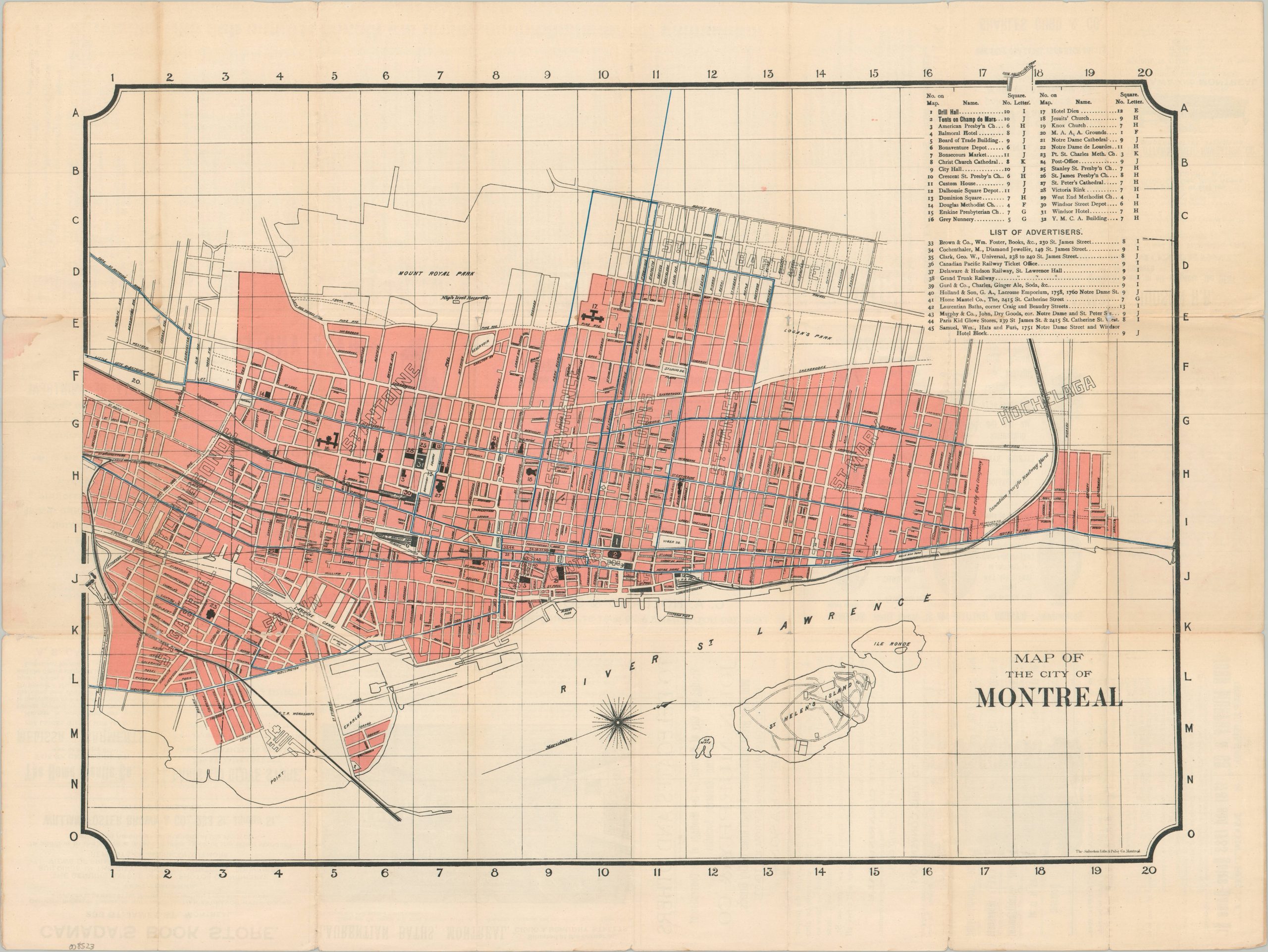
An uncommon pocket map of Montreal from the late 19th century.
1 in stock

Description
This ephemeral street plan of Montreal was published locally by the Sabiston Litho. and Publishing Company in 1893. It was issued in conjunction with the 12th International Christian Endeavor Convention, held in the city that year. A relatively straightforward overview highlights the city limits in soft pink and uses bright blue to denote the network of streetcar lines. Forty-five different locations of interest are numbered throughout the image and listed in the upper right – mostly churches, public buildings, and sponsoring advertisers. Other notable features include St. Helen’s Island, Mount Royal Park, steam railroads/depots, and the adjacent neighborhood of Hochelaga. Numerous advertisements aimed at delegation participants are provided on the verso, including souvenirs, furs, sporting goods, and more.
It is estimated that over 15,000 ultimately attended the weeklong event, held in July. The Young People’s Society of Christian Endeavor was founded just twelve years earlier, in 1881, in Portland, ME. The interdenominational Christian group encouraged participation by younger members of the church and exploded in popularity in the late 19th century.
Map Details
Publication Date: 1893
Author: Sabiston Litho. and Publishing Company
Sheet Width (in): 24.00
Sheet Height (in): 18.20
Condition: B
Condition Description: Double-sided pocket map with moderate wear and toning along original folds. Several splits and small marginal tears repaired on the verso with archival tape, with only a bit of minor loss at the fold joints. Good condition overall.
$175.00
1 in stock