Map of the City of Mansfield, Ohio
Unique city map of Mansfield, Ohio modified for use by the Pennsylvania Railroad.
Out of stock
Description
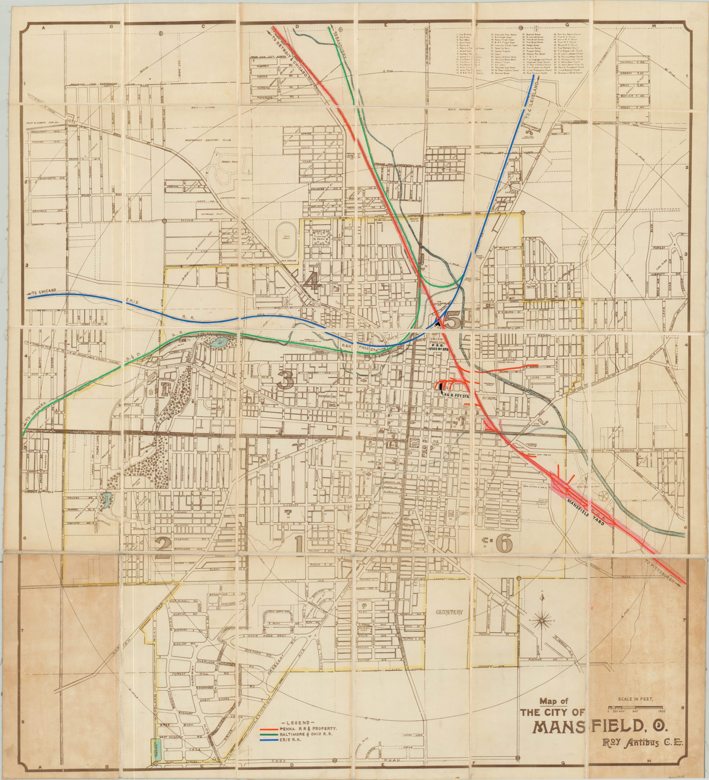
Originally drawn by civil engineer Roy Antibus and issued at a large scale of 1″ to 800′, this map of Mansfield, Ohio provides a tremendous amount of detail about the city prior to the U.S. entry into World War II. The image is organized by wards and individually labels primary transportation routes, parks, cemeteries, subdivisions and several local points of interest. An index at the top of the sheet identifies the locations of sixty important buildings; including churches, schools, public buildings, hospitals, rail depots and more.
This particular example has been customized for use in the Central Engineering Department of the Pennsylvania Railroad and has been dissected and mounted on linen for preservation and convenient storage. Vivid color was applied by hand to denote property and track ownership throughout the city, and a custom legend was added to the lower center to identify the three primary railroad operators; the Pennsylvania, Baltimore & Ohio, and Erie Railroads.
Further manuscript updates in black ink pinpoint the location of the Penn R.R. freight station, passenger station, and Mansfield Yard.
Map Details
Publication Date: c. 1940
Author: Roy Antibus
Sheet Width (in): 25.00
Sheet Height (in): 27.75
Condition: B
Condition Description: Dissected into 24 panels and mounted on linen with black leather covers. Two panels exhibit moderate discoloration due to the adhesive used to affix the covers to the verso. Otherwise the map is in very good condition, with faint wear and scattered soiling consistent with age and use.
Out of stock