Map of the City of Los Angeles
$525.00
Uncommon pocket map of Los Angeles from 1907.
1 in stock
Description
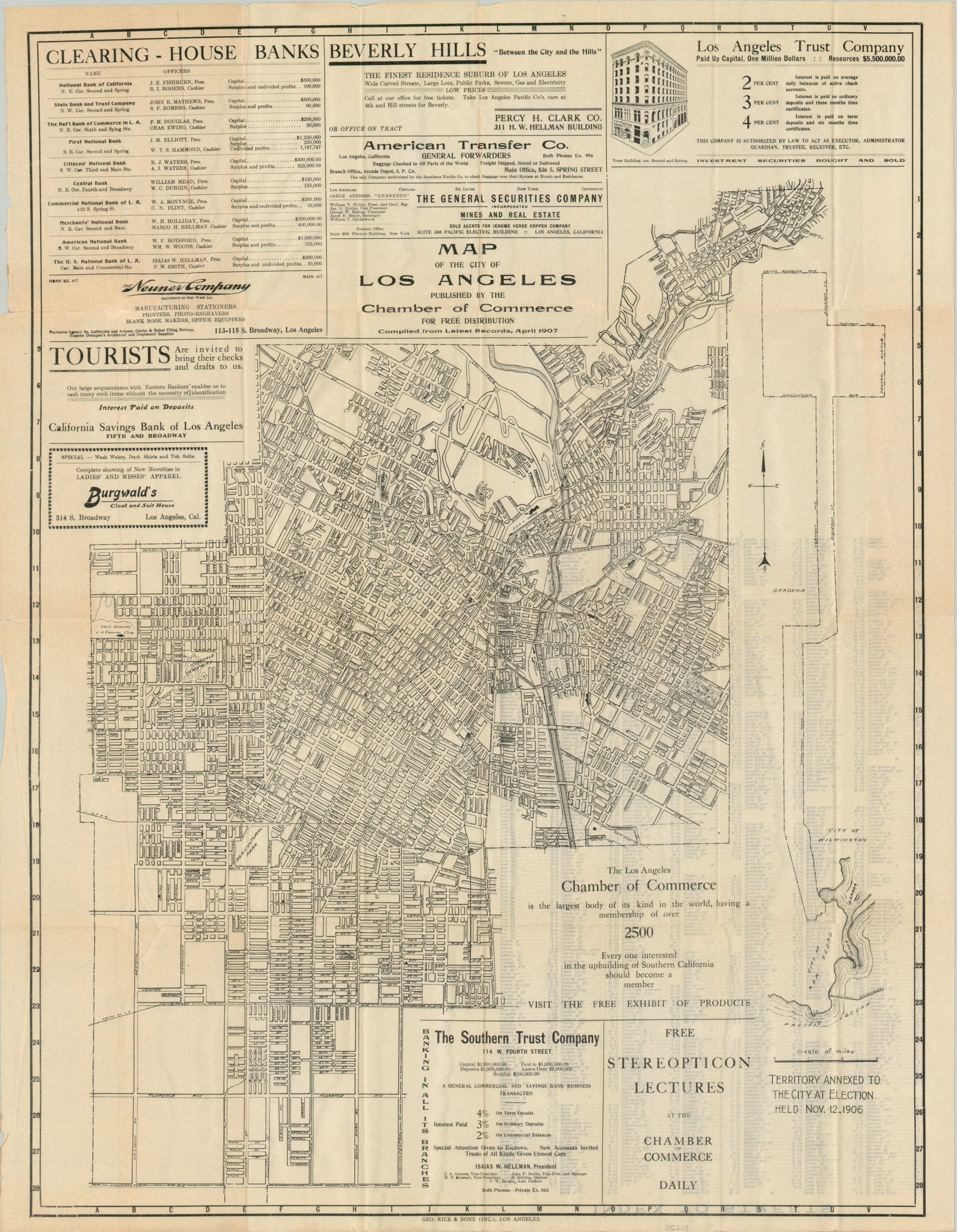
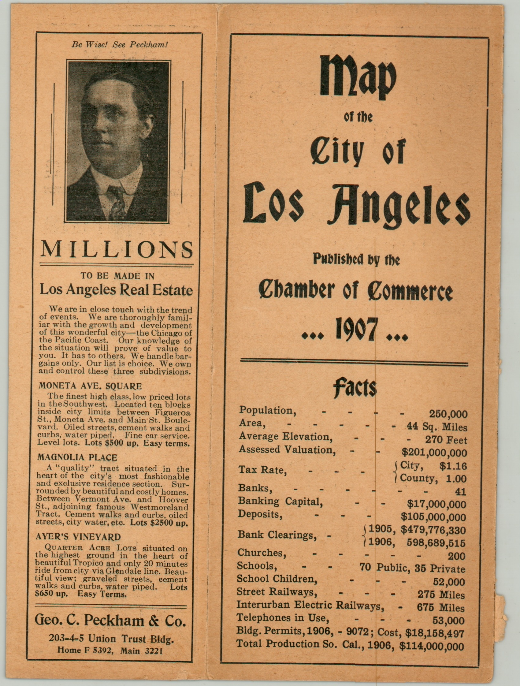
This detailed pocket map of Los Angeles was created locally by George Rice & Sons, Inc. and published ‘for free distribution’ in 1907 by the L.A. Chamber of Commerce. Numerous advertisements in the negative spaces reflect the economic incentives of the production. Further ads are present on the paper covers, including an illustration of the locally-produced Maxwell automobile (The L.A. Auto Show started the same year). The transportation overview extends to label street names, railroads, electric railways, and transportation depots. Named locations of interest include the L.A. Country Club, various parks, the County Hospital, and the Hollenbeck Home.
Also of interest is an inset map in the lower right noting the extent of the city annexations made the year prior to publication. This unusual configuration of formerly unincorporated territory was a naked attempt by L.A. officials to encourage the incorporation of San Pedro and Wilmington (and their valuable harbor facilities). Known as ‘The Shoestring’, the 16-mile corridor acquired by eminent domain was ultimately successful, and both San Pedro and Wilmington were annexed in 1909. An alphabetical street index is printed on the verso.
Map Details
Publication Date: 1907
Author: Los Angeles Chamber of Commerce
Sheet Width (in): 21.77
Sheet Height (in): 28
Condition: A-
Condition Description: Large pocket map, folded into 32 segments and affixed to the back of the original paper wraps (front cover present, but detached). Printed on thin paper that has creased and separated in a few places along the fold lines, though no image loss. A few spots of light toning and minor wear along the outer edges. Good to very good condition overall.
$525.00
1 in stock