Map of the City of Evanston Cook County Illinois
$80.00
Simple postwar plan of Evanston, Illinois.
1 in stock

Description
This straightforward street map of Evanston, Illinois was published by the local Chamber of Commerce in June of 1951. It presents the suburb, situated about 15 miles north of Chicago, during a period of tremendous growth in the years following World War II.
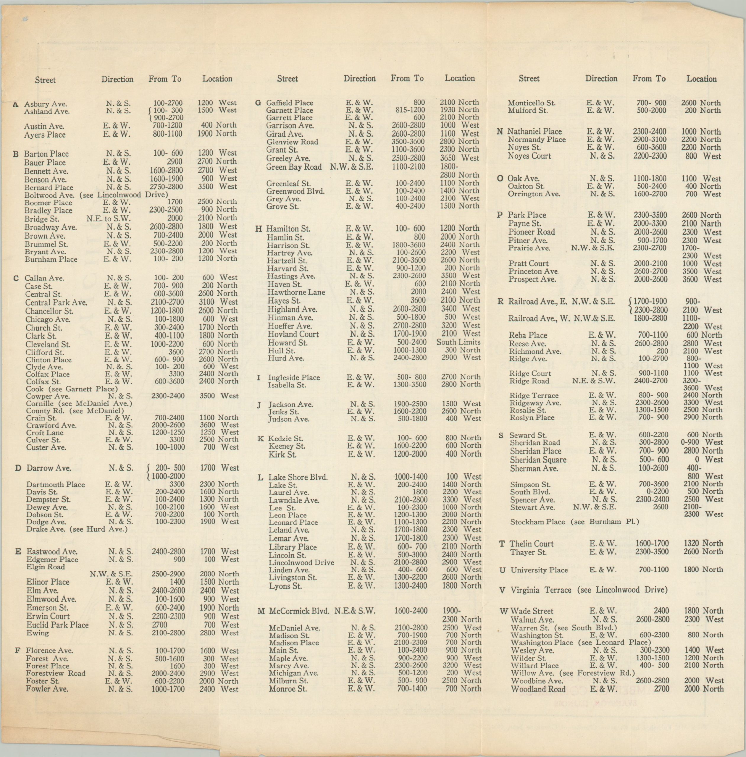
Thirty-six different locations of interest are identified; including hotels, theaters, banks, schools (public, parochial, and private), and more. Cavalry Cemetery, the campus of Northwestern University, Dyche Stadium, and the Evanston Township High School are also labeled. Railroads are noted, including the iconic interurban North Shore Line. Alphabetical street index on the verso.
Map Details
Publication Date: 1951
Author: Evanston Chamber of Commerce
Sheet Width (in): 11
Sheet Height (in): 11
Condition: B+
Condition Description: Soft creasing along one old vertical fold line. Scattered toning visible along the top and bottom of the sheet and a creased lower right corner. Good condition overall.
$80.00
1 in stock