
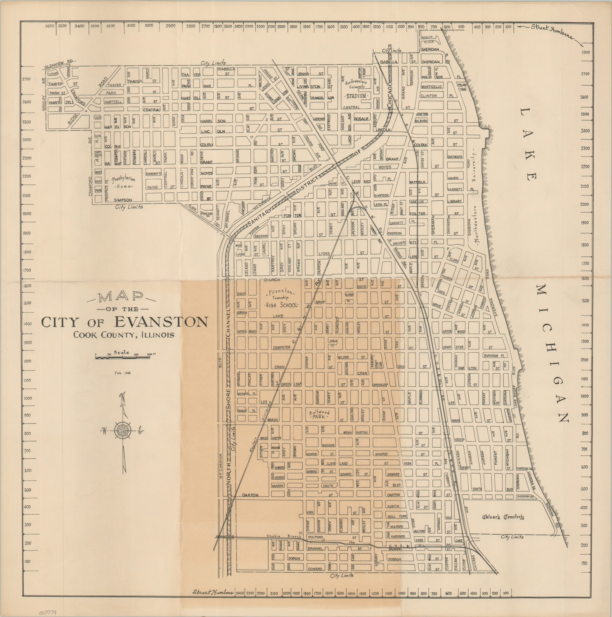
Map of the City of Evanston Cook County, Illinois
$125.00
A straightforward WWII-era street plan of Evanston, Illinois.
1 in stock
Description
This anonymously published map of Evanston, Illinois, a prominent suburb north of Chicago, is dated February, 1945. The image reflects significant growth enjoyed by the town during the first few decades of the 20th century (population increased from 19,000 in 1900 to 63,000 in 1930). Apart from street names and railway lines, labeled features include the city limits, the campus of Northwestern University (including Dyche Stadium), Calvary Cemetery, Evanston High School, and the Presbyterian Home.
Map Details
Publication Date: 1945
Author: Anonymous
Sheet Width (in): 16.75
Sheet Height (in): 16.75
Condition: B
Condition Description: Creased along old folds and heavily toned along the panel in the lower center (see scan). About good condition overall.
$125.00
1 in stock