Map of the City of Eureka, California
$135.00
Eureka!
1 in stock

Description
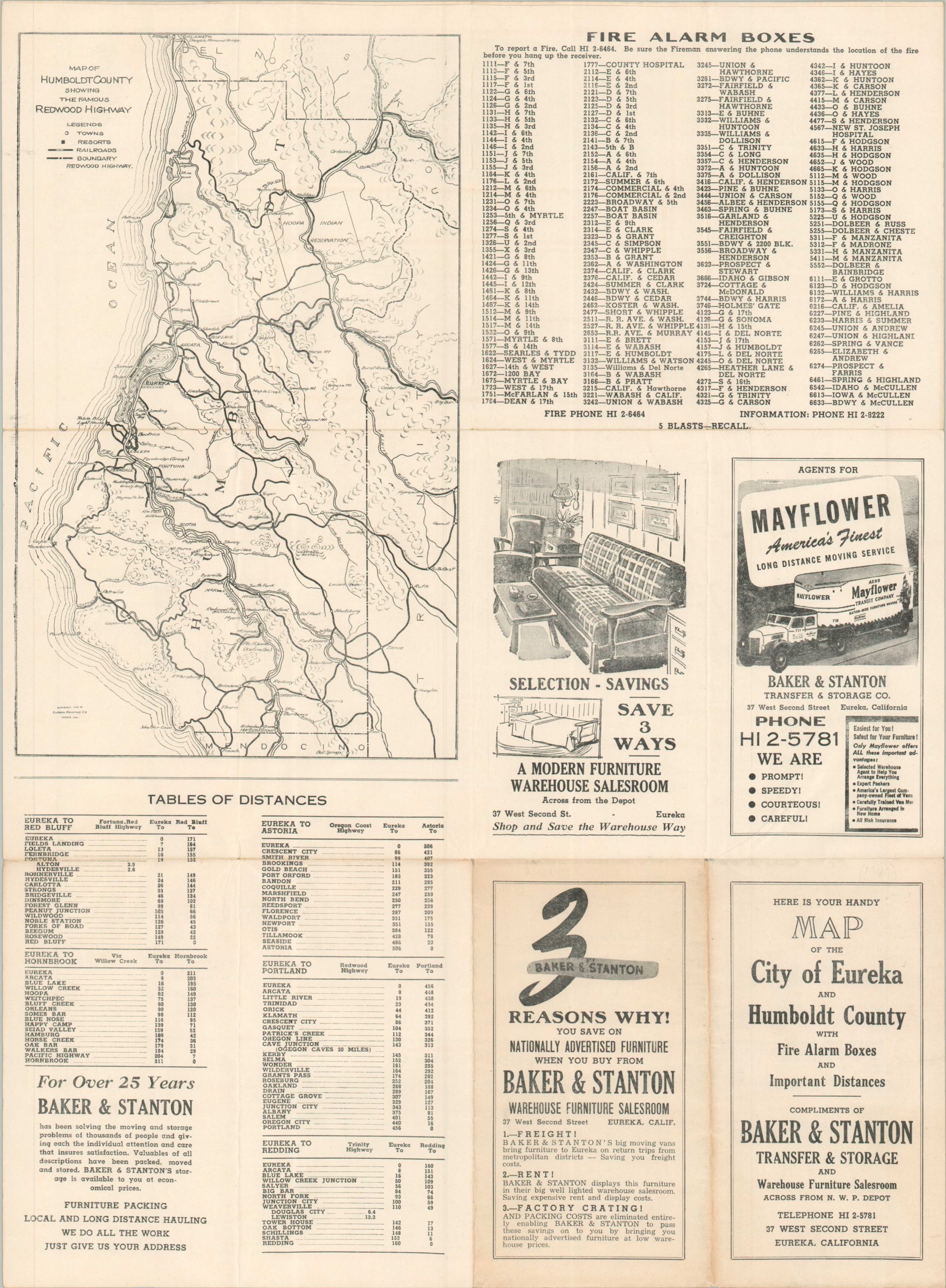
This interesting mid-1920s map of the ‘Queen City of the Ultimate West’ was published locally by the Eureka Printing Company. A relatively straightforward street plan notes various locations of interest, including the Humboldt County Airport, Sunset Memorial Park, and numerous lumber mills and finishing plants. Red overprinting highlights the route of U.S. 101, plus the location of the Baker & Stanton, Transfer & Storage Company/Warehouse Furniture Salesroom. Advertisements for this sponsoring firm on the verso, along with a list of fire alarm boxes, tables of distances, and a road map of Humboldt County.
Map Details
Publication Date: 1925
Author: Eureka Printing Company
Sheet Width (in): 15.30
Sheet Height (in): 20.90
Condition: A
Condition Description: Double-sided map with faint wear and light creasing along folds, consistent with age. Very good to near fine condition overall.
$135.00
1 in stock