Map of the City of Chicago
$125.00
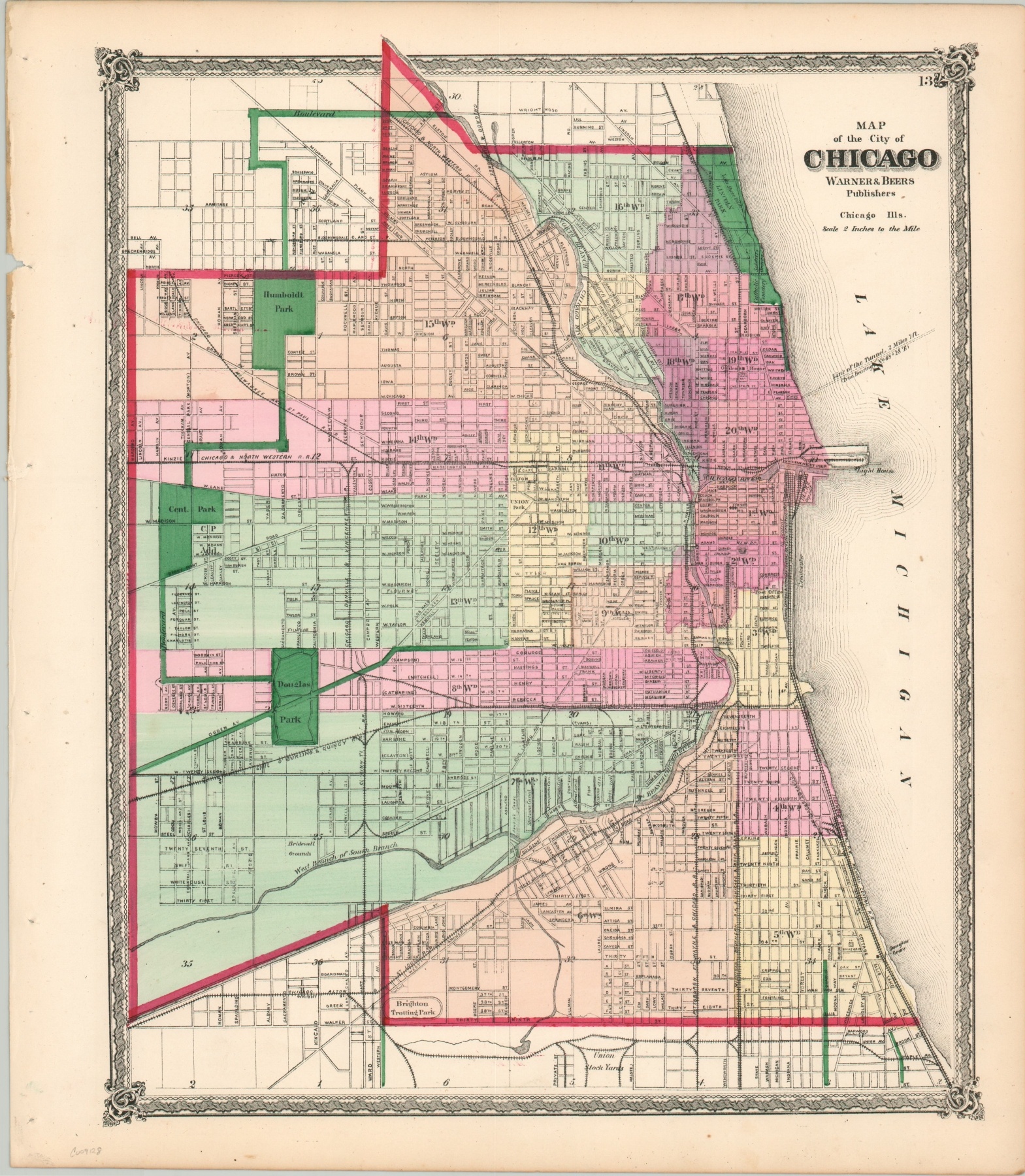
Hand colored map of Chicago showing the city three years after the fire.
1 in stock
Description
Though the rebuilding of Chicago from the Great Fire of 1871 was long underway by the time this map was published, the swath of (former) destruction can still be seen in a faint red tint across much of the central business district. Other colors, applied by hand via stencil shortly after the map was printed, distinguish city limits (red), the parks and boulevards (green), and wards (various).
Carefully engraved text labels streets and railroads, important buildings, and locations of interest. The Union Stockyards, opened less than a decade earlier, is shown just on the southern outskirts of the city. Other interesting examples include the tomb of Stephen Douglas (still incomplete), cemeteries on the Gold Coast, the ‘old’ University of Chicago, horse-drawn streetcar lines, and the Bridewell prison grounds.
The map was published in Chicago’s Lakeside Building by the firm of Warner & Beers in 1874.
Map Details
Publication Date: 1874
Author: Warner & Beers
Sheet Width (in): 15.6
Sheet Height (in): 18
Condition: A
Condition Description: Binding holes in the left martin and a few spots and light toning around the outer edges. One small spot in Lake Michigan and a bit of ink offsetting within the image. Very good overall.
$125.00
1 in stock