Map of the City and County of San Francisco
$295.00
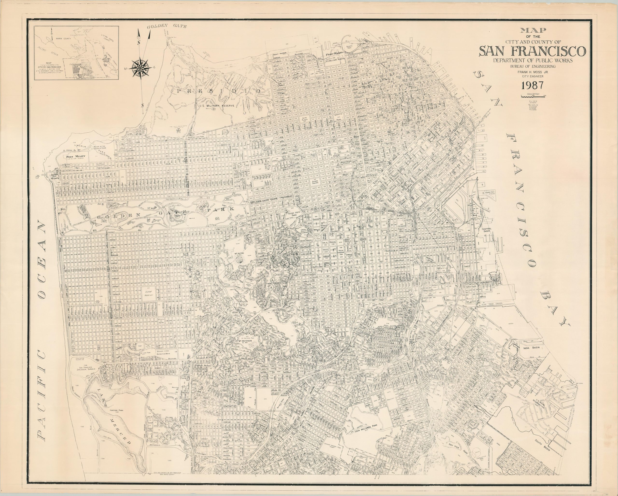
Gigantic map of San Francisco County published in the late 1980s.
1 in stock
Description
The 1980s were a fast-moving decade for the city of San Francisco, bracketed by the White Night riots of 1979 and the Loma Prieta Earthquake ten years later. It was ground zero for the AIDS pandemic, a focal point for political and social activism, home of the dominant 49ers, and one of the best underground music scenes in America.
This huge map provides a detailed overview of the city in 1987, near the end of Diane Feinstein’s tenure as mayor. Blocks are numbered amid labeled streets and neighborhoods. Dozens of various locations of interest are identified throughout the image; including the much-maligned Embarcadero Freeway, Golden Gate Park, Fisherman’s Wharf, Candlestick Park, Fort Mason, and more. An inset of the Bay Area in the upper left defines the city and county limits.
The map was drawn by R.J. Seib under the direction of City Engineer Frank H. Moss, Jr. Published locally by the San Francisco Department of Public Works in 1987.
Map Details
Publication Date: 1987
Author: Frank H. Moss, Jr
Sheet Width (in): 52.5
Sheet Height (in): 41.75
Condition: A-
Condition Description: Map printed on one large, single sheet that shows moderate wear along the outer edges, including small tears and spots of winkling. Faint toning from age visible within the image (most evident on the left side), but remains in very good condition overall.
$295.00
1 in stock