Map of the Chicago-Milwaukee & St. Paul Railway and Connections
$225.00
Late 19th century route map of the ‘Milwaukee Road.’
1 in stock
Description
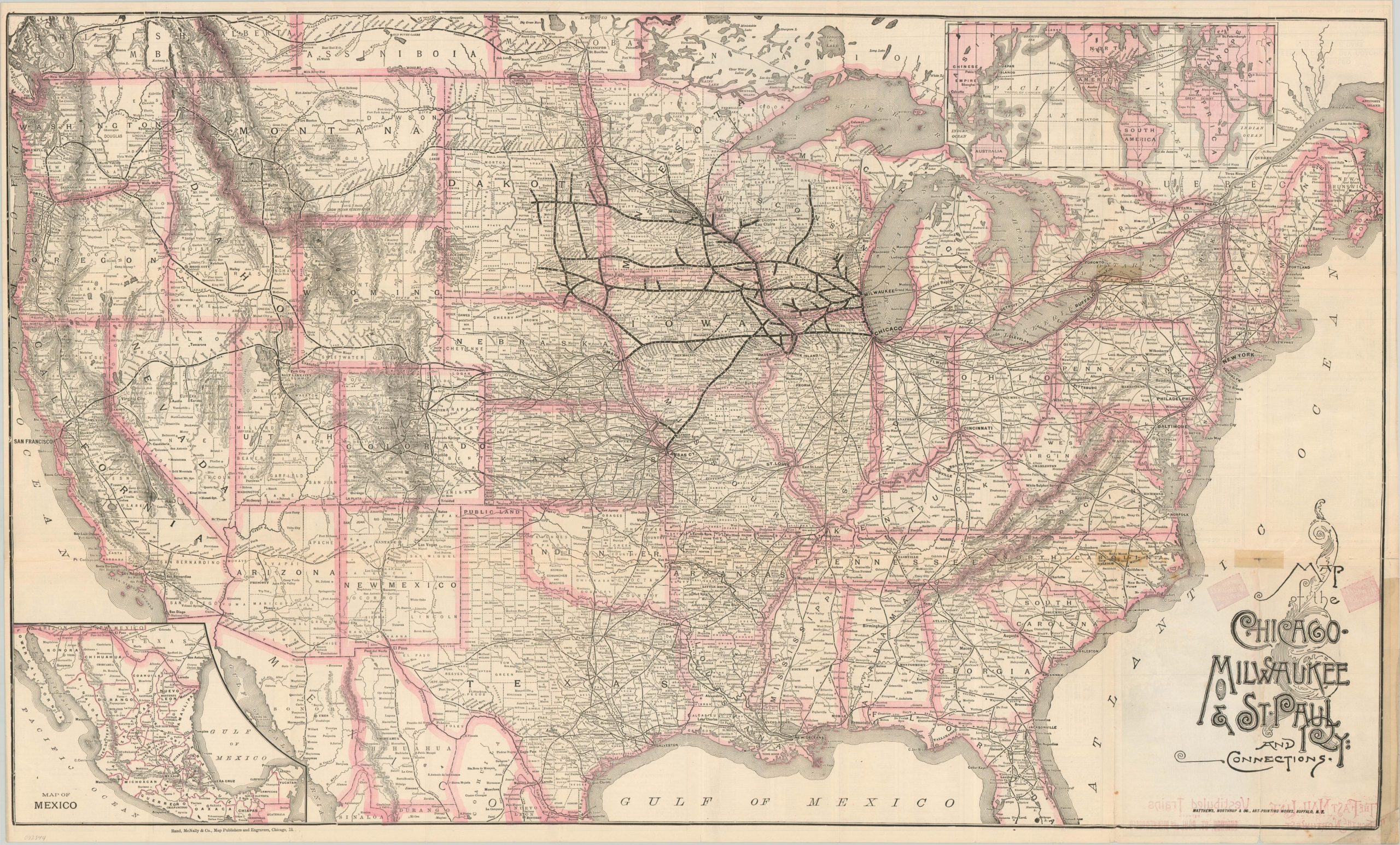
This detailed railroad map of the United States shows the robust network of iron rails that spread across the country in the late 19th century. In particular, the lines of the Chicago, Milwaukee and St. Paul Railway are emphasized throughout several states in the Midwest.
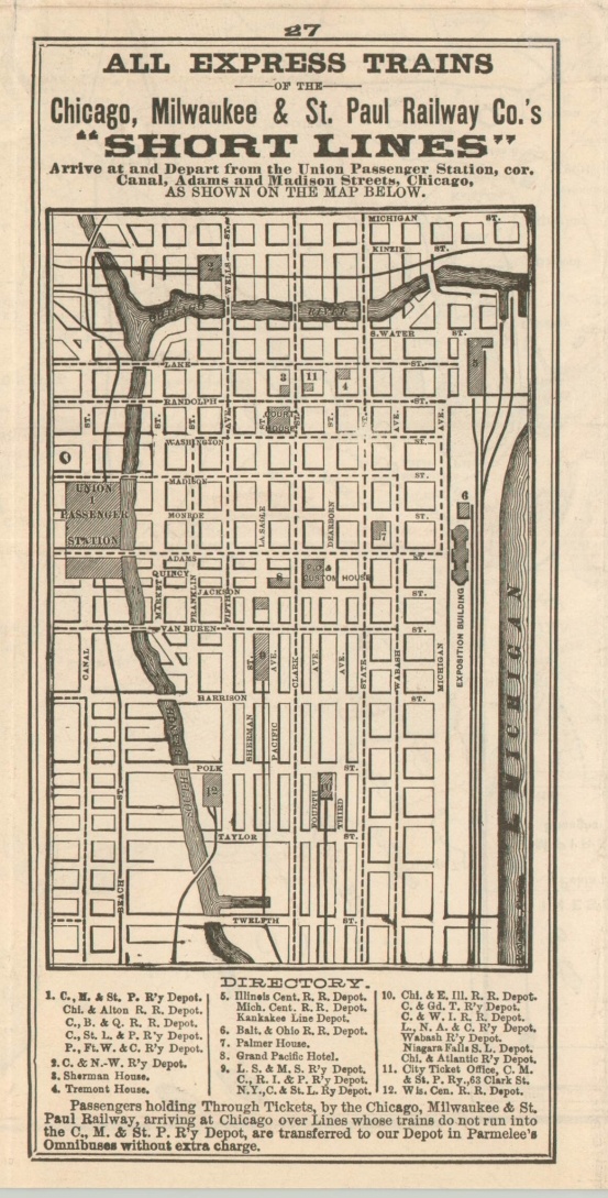
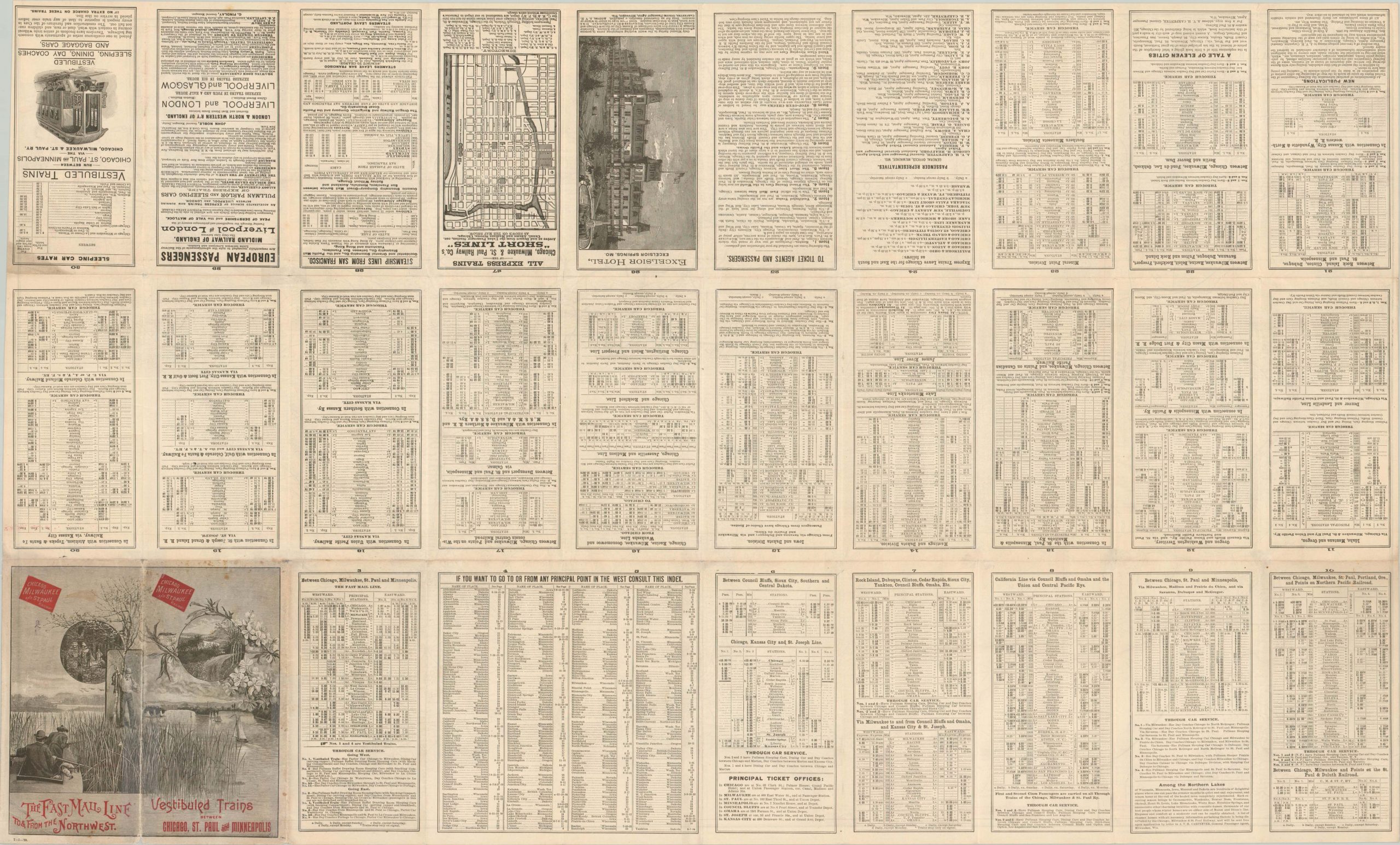
A small map of Mexico with connections in the southwest can be seen in the lower left. A second inset in the upper right shows how connections on either coast can take the intrepid traveler to nearly anywhere on the globe via rail and steamship lines. An extensive series of timetables can be found in the verso.
Arranged and published by Rand McNally in Chicago in 1888. Printing by Matthews, Northrup & Co.
Map Details
Publication Date: 1888
Author: Rand McNally
Sheet Width (in): 38.20
Sheet Height (in): 23.10
Condition: B
Condition Description: Originally folded into 30 panels, with moderate wear and creasing along originally issued fold lines. Old cellophane tape repairs in the lower right, and numerous spots of separation have been repaired and reinforced on the verso with archival tape. A few spots of minor paper loss at fold intersections and moderate discoloration in the lower right corner. Remains in good to very good condition overall.
$225.00
1 in stock