Map of the Chicago, Milwaukee, and St. Paul Railway and Connections
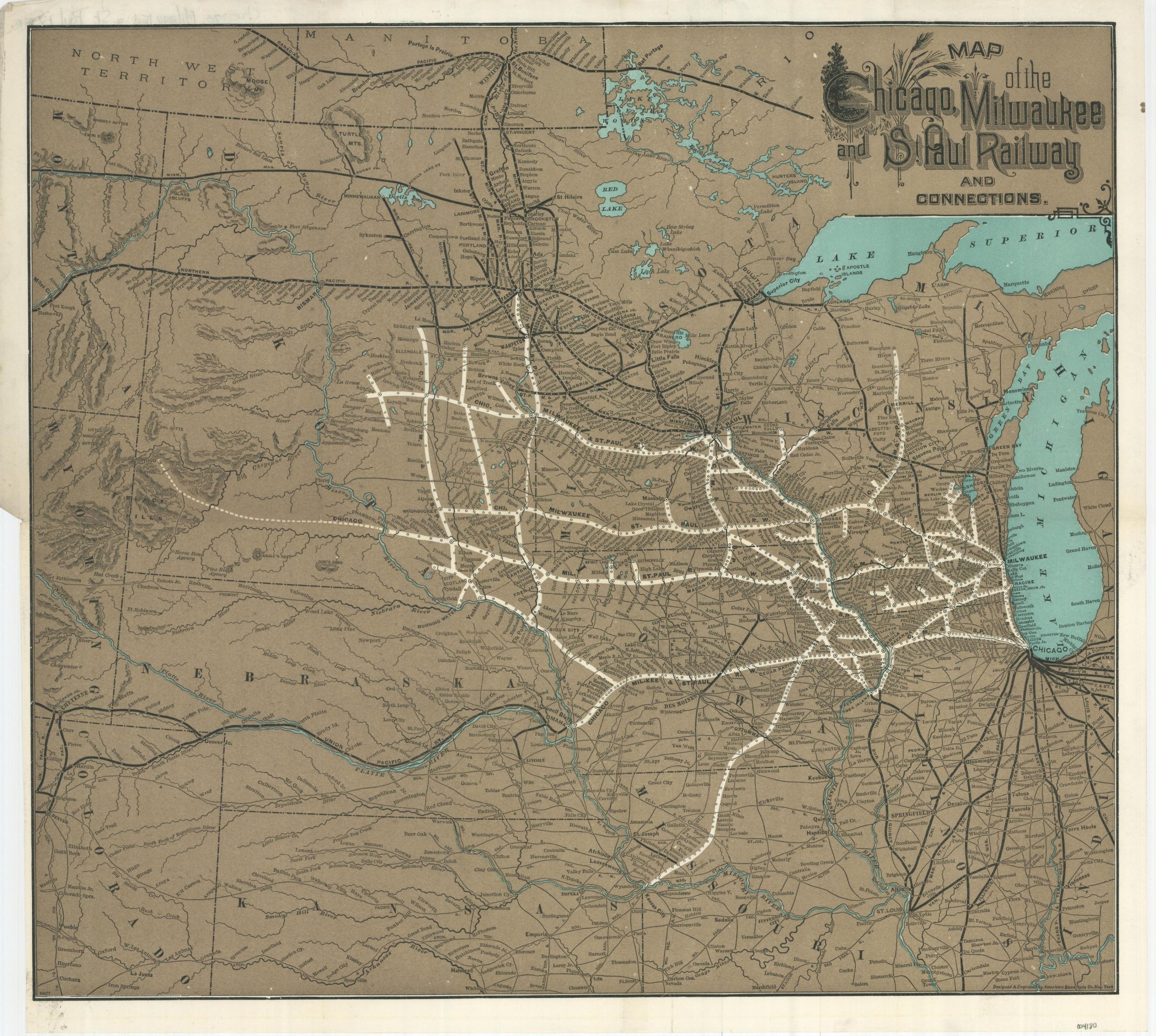
The network of the ‘Milwaukee Road’ in the mid-1880s.
Out of stock
Description
This attractive color lithographed map of the Upper Midwest and the Plains States highlights the system of the Chicago, Milwaukee, and St. Paul Railway. Stretching from Chicago in the east to Milwaukee, the Twin Cities, Fargo, Omaha, and Kansas City, the company operated a robust network of rails that accommodated freight and passenger traffic to destinations across the United States.
The proposed line connecting running from Chamberlain to Deadwood in South Dakota (not yet a state) reflects greater ambitions to connect to the Pacific Coast – an achievement that would be reached by 1909. Connecting routes to the ‘Milwaukee Road’ are shown with thick black lines, while other competitors are represented in a more diminutive fashion. Topography is depicted in hachure and an interesting mix of toponyms reflects frontier fortifications, Indian agencies, geographic features, and settlements of all sizes.
Designed and engraved by the American Bank Note Company in New York. Published around 1885. Blank on verso.
Map Details
Publication Date: c. 1885
Author: American Bank Note Company
Sheet Width (in): 18.25
Sheet Height (in): 16.75
Condition: A
Condition Description: Faint wear in the corners and creasing along originally issued fold lines. Very good to near fine.
Out of stock