Map of the Chicago Loop
Uncommon map of Chicago’s downtown during the Great Depression.
Out of stock
Description
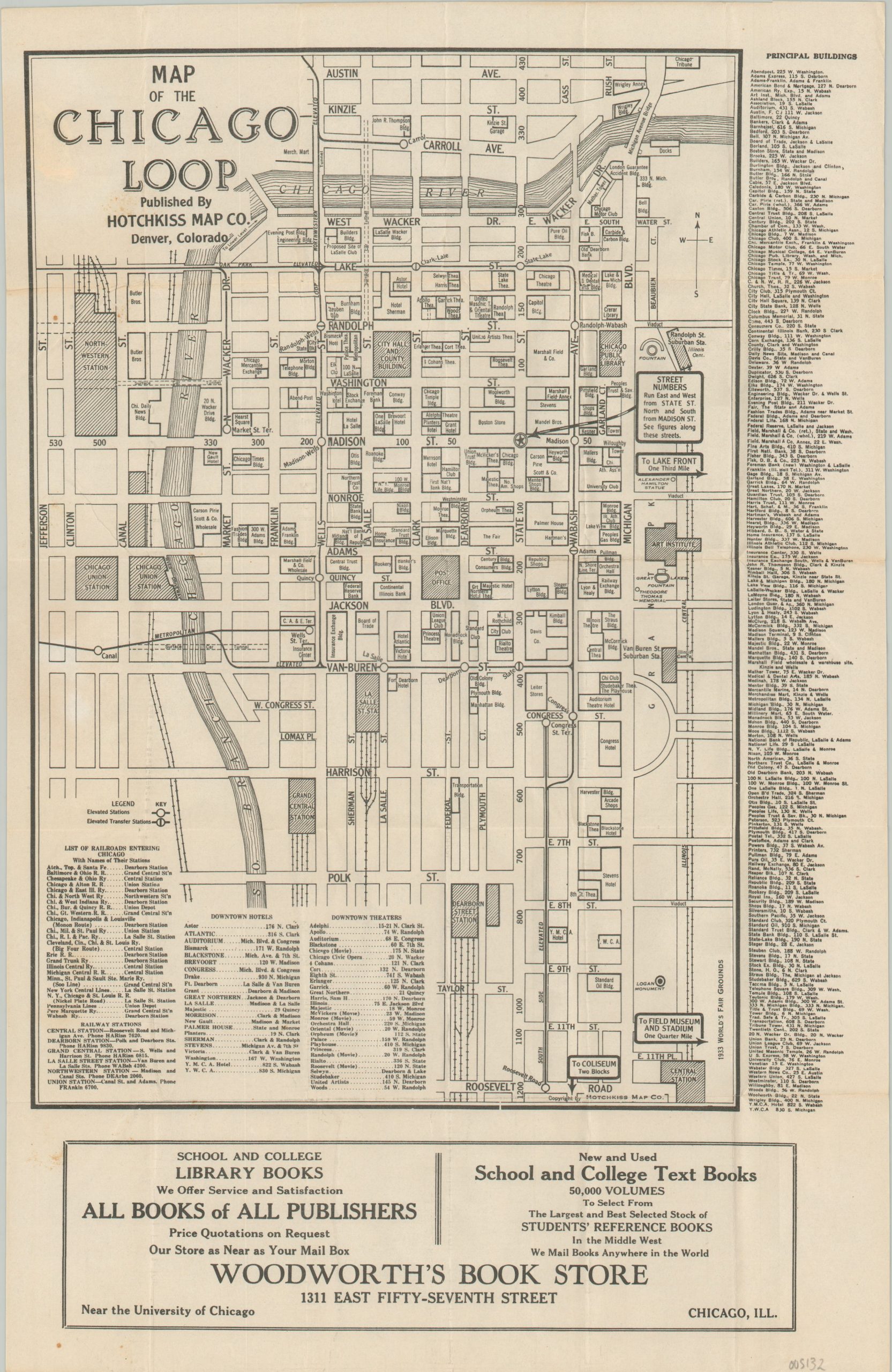
Dated using the absence of the ‘Old’ Post Office (open in 1932) and the presence of the Chicago Board of Trade (completed 1930), this map provides a detailed snapshot of the composition of the Chicago Loop in 1931. The Tribune Tower, recently completed in 1925, represents the upper limit of the image, which extends south as far as Roosevelt Road and west to Union Station.
Prominent public buildings and transportation depots are shaded, while a myriad of other buildings – hotels, restaurants, stores, theaters, and more are also labeled. The junction at State and Madison is highlighted with a star, indicating that intersection as the directional cut-off point for street names, and elevated stations are also shown with a special symbol.
The map was published in Denver by the Hotchkiss Map Company on behalf of Woodworth’s Book Store, a longtime Chicago institution whose successors still operate in northern Indiana. The firm was located on 57th Street, near the University of Chicago, and among textbook sales offered services such as developing Kodak film, the repair of fountain pens, and restringing tennis rackets!
Map Details
Publication Date: 1931
Author: Hotchkiss Map Company
Sheet Width (in): 10.75
Sheet Height (in): 16.5
Condition: A-
Condition Description: Scattered spotting visible in the upper left corner, where formerly adhered to covers (now lost). Creasing and light wear along originally issued fold lines. Very good overall.
Out of stock