Map of the Chicago and Grand Trunk and Grand Trunk Railway Line
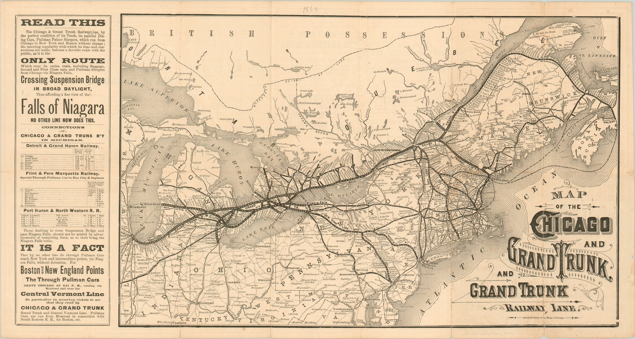
1884 Rand McNally map and timetable of the Grand Trunk Railway System.
Out of stock
Description
Stretching from Chicago to Portland, Maine and Quebec City on the St. Lawrence, the Grand Trunk Railway System was one of the foremost freight and passenger operators in Ontario, Quebec, and the northeastern United States in the late 19th century. The extensive network can be seen on this map, published in Chicago by Rand McNally for the 1884 travel season.
Accompanying advertisements on the left and the verso highlight many of the benefits of the Grand Trunk lines – including a daytime crossing of the suspension bridge at Niagara Falls and the comfortable Pullman rail cars. Due to financial difficulties, the entire Canadian portion of the Grand Trunk system was nationalized in 1919 and became a major portion of the new Canadian National Railway System.
Map Details
Publication Date: 1884
Author: Rand McNally
Sheet Width (in): 26.50
Sheet Height (in): 14.00
Condition: B
Condition Description: Originally folded into 17 panels. Several spots of moderate wear and breakage along the fold lines resulting a few small spots of image loss (most prominently near the title). The tears and breaks have been flattened and reinforced on the verso with archival tape. Scattered soiling and toning consistent with age.
Out of stock