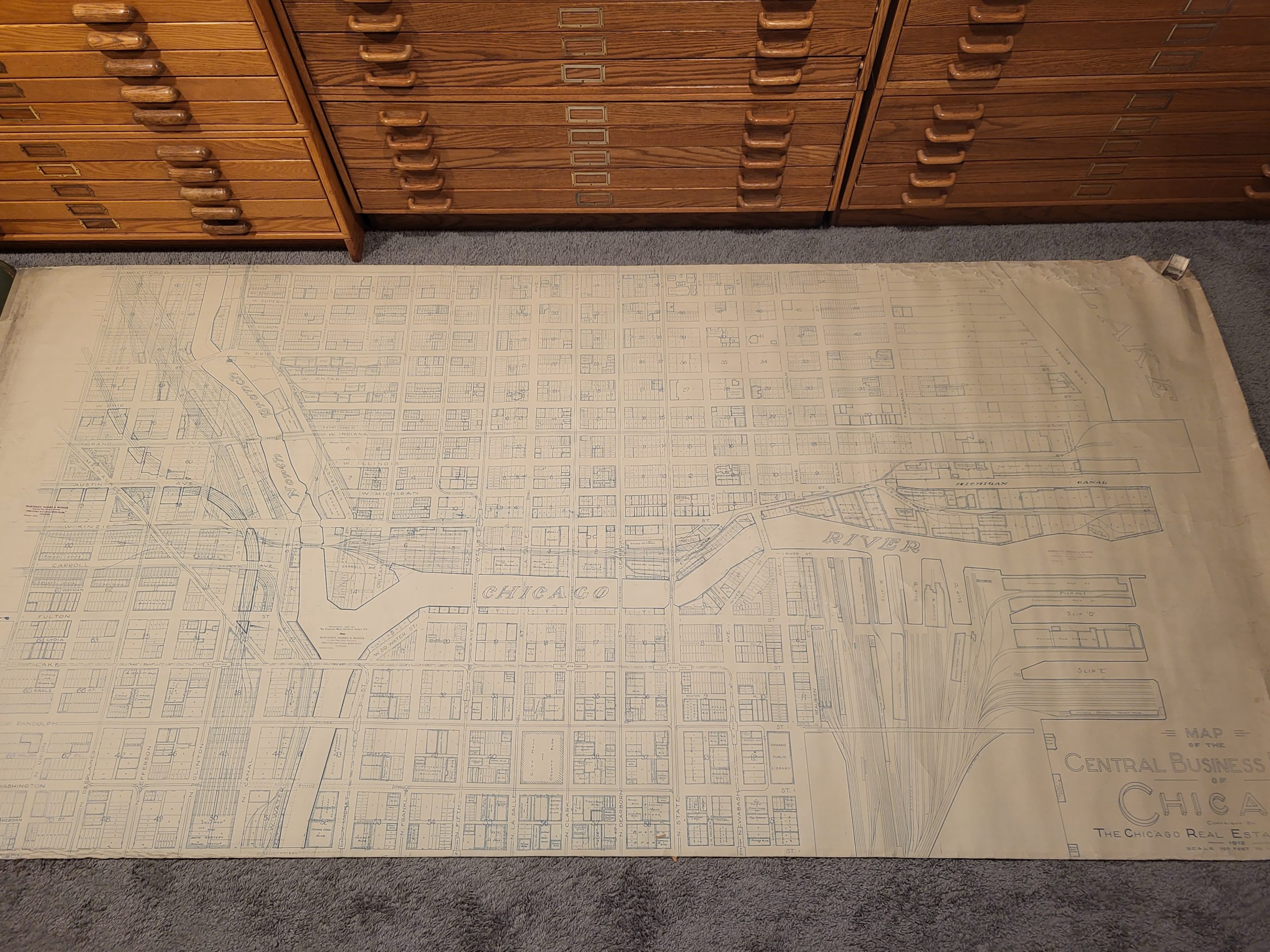
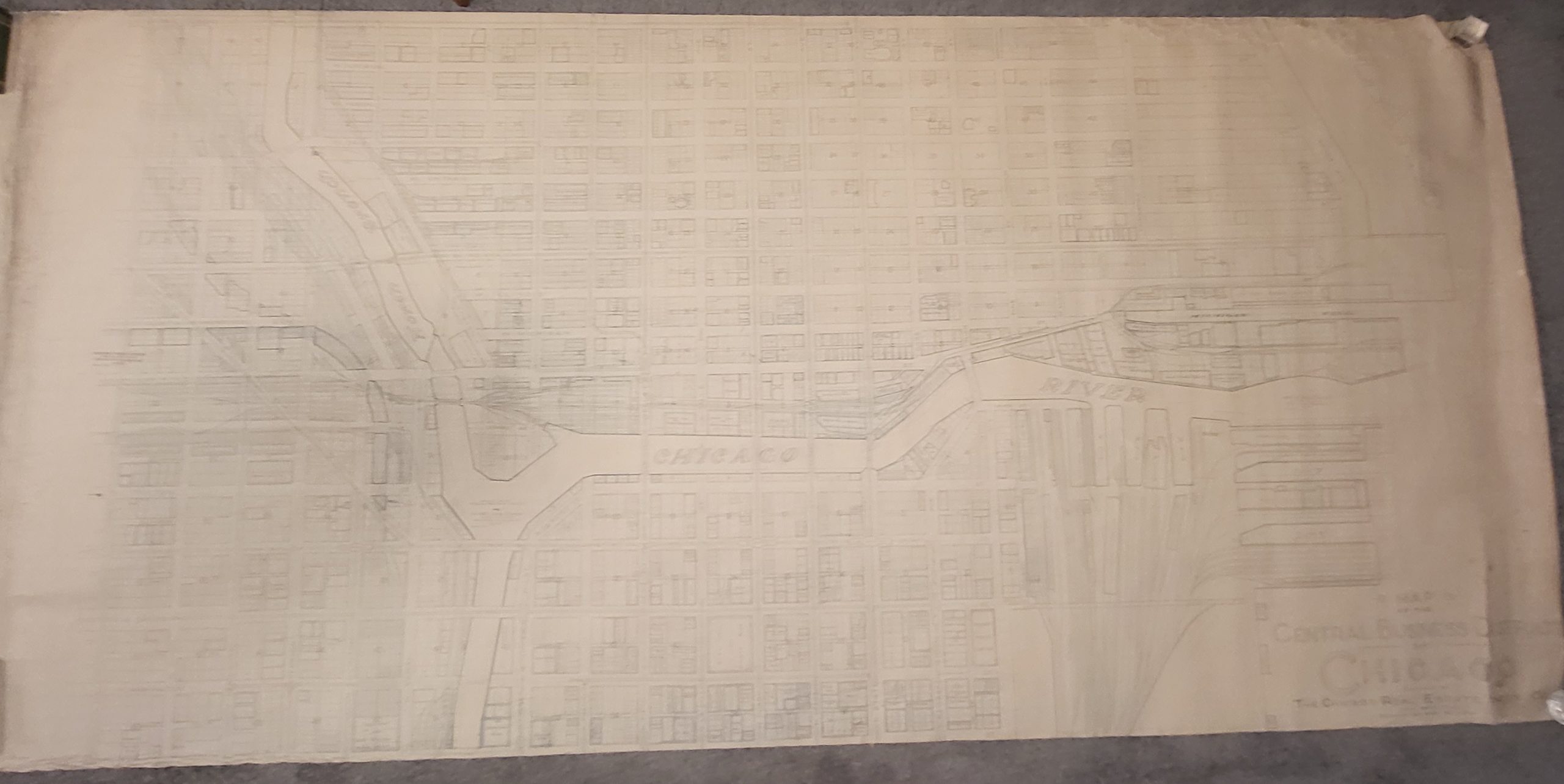
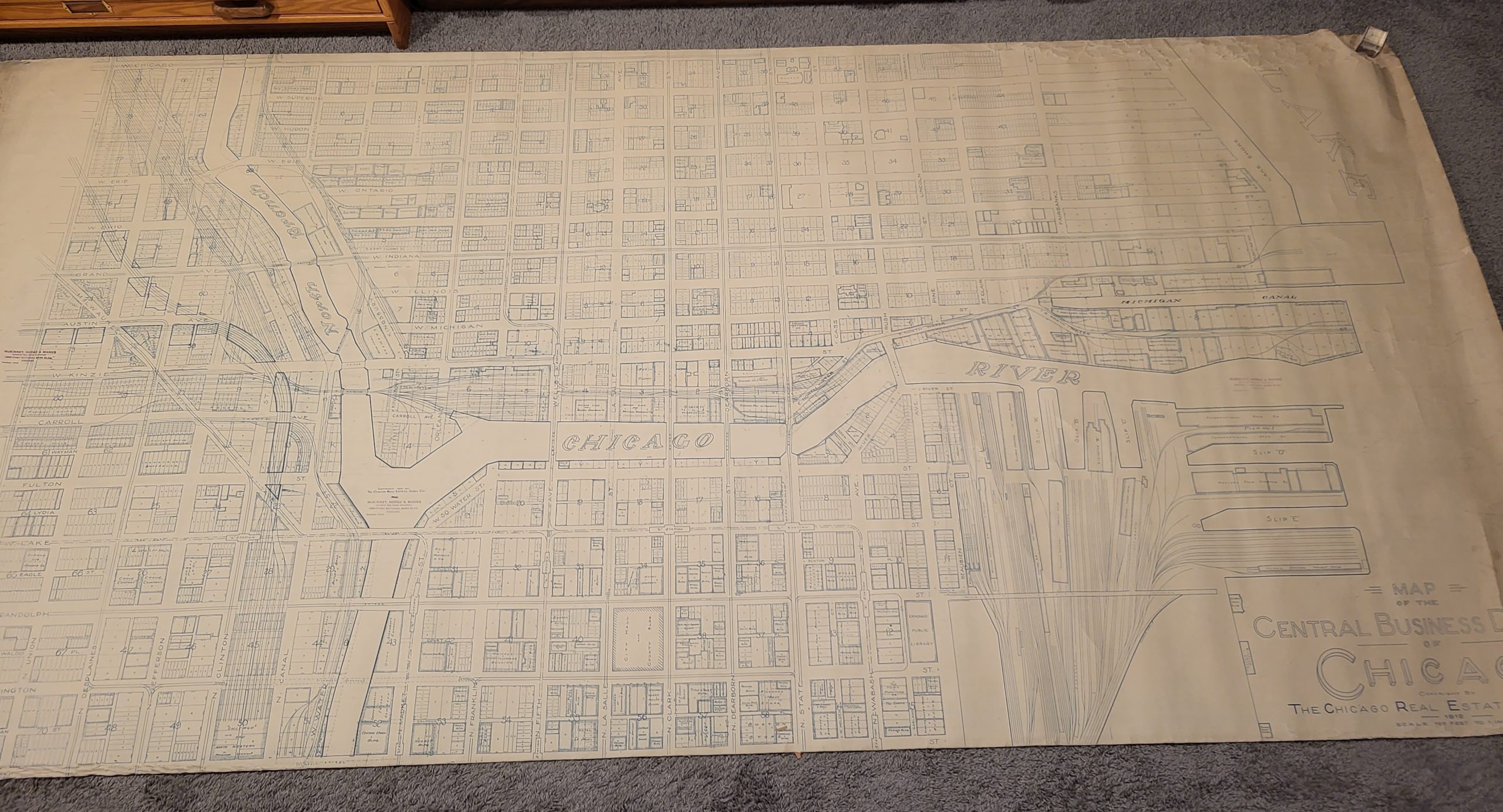
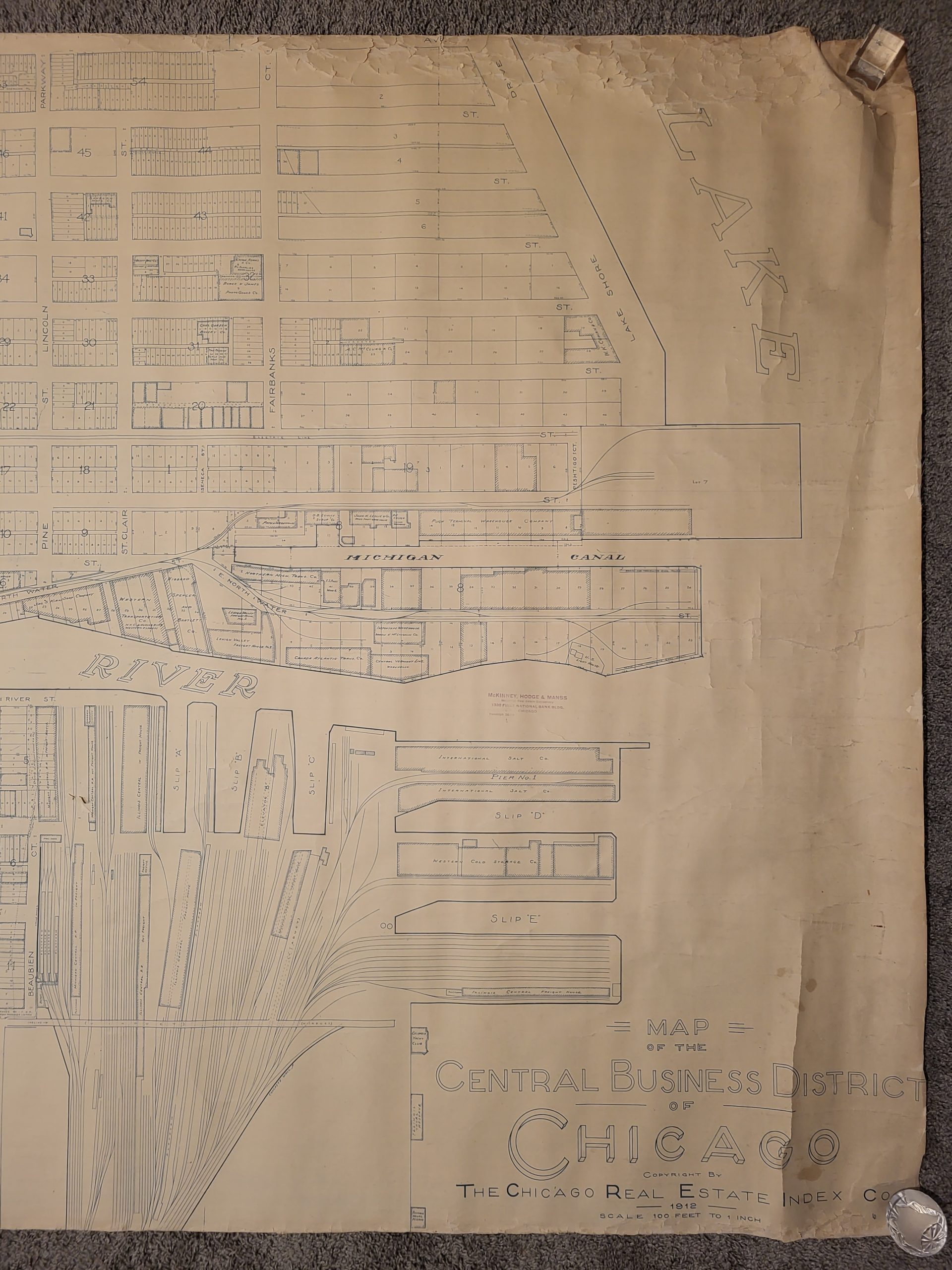
Map of the Central Business District of Chicago
Original price was: $4,000.00.$2,500.00Current price is: $2,500.00.
A 9.5′ long map of Chicago’s River North neighborhood!
1 in stock

Description
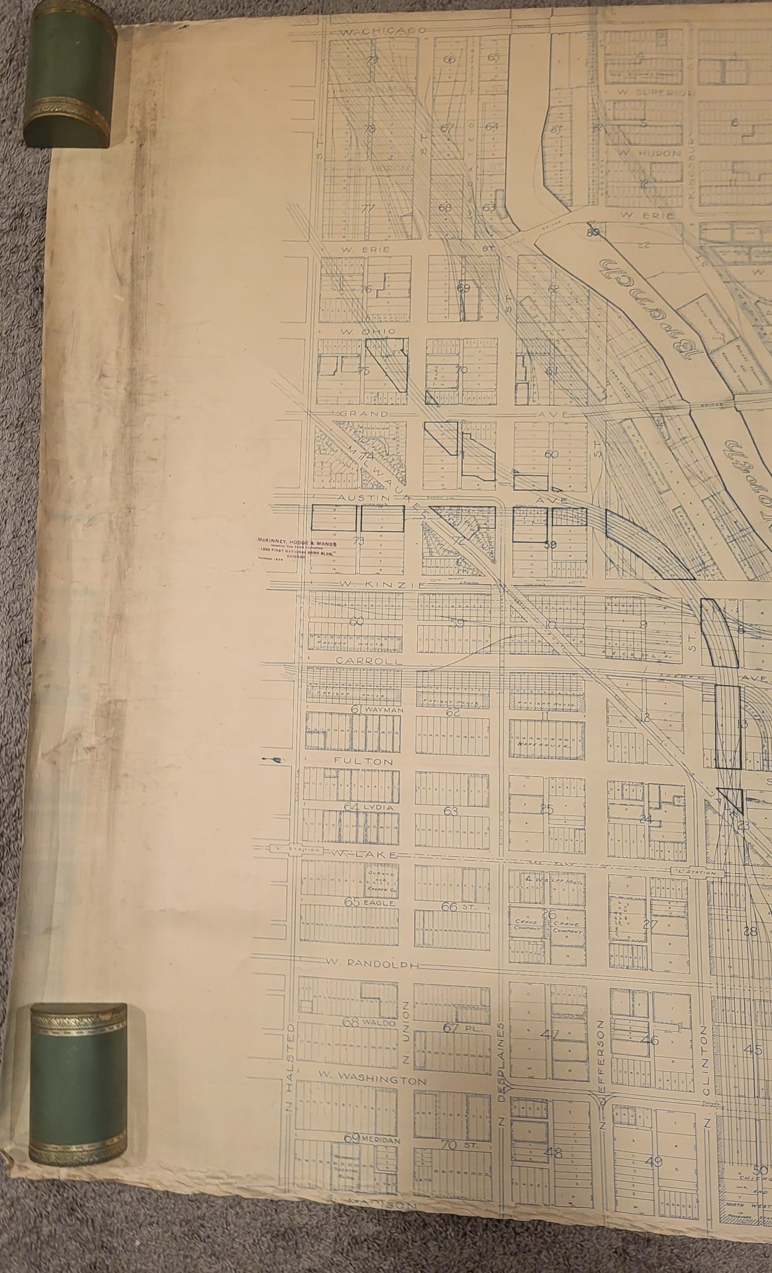
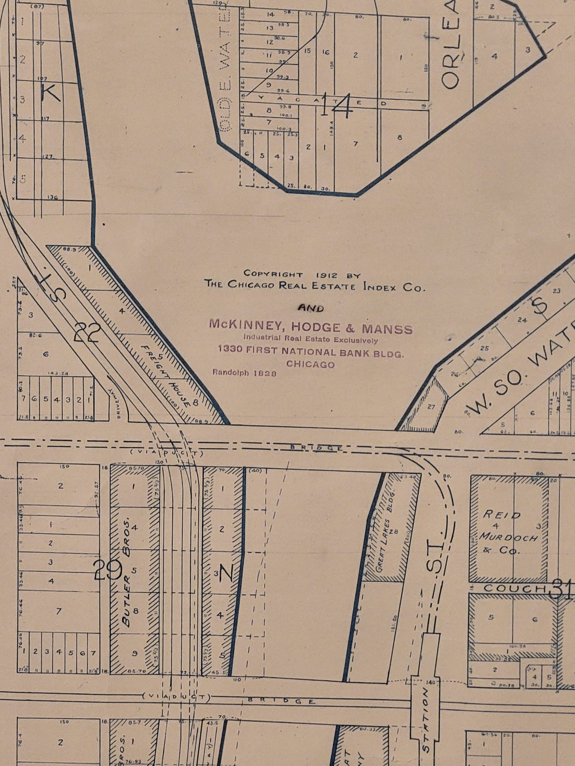
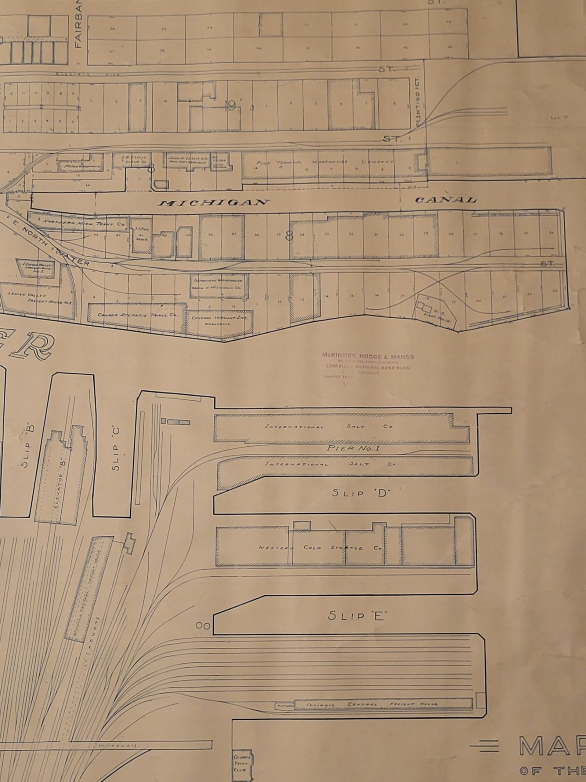
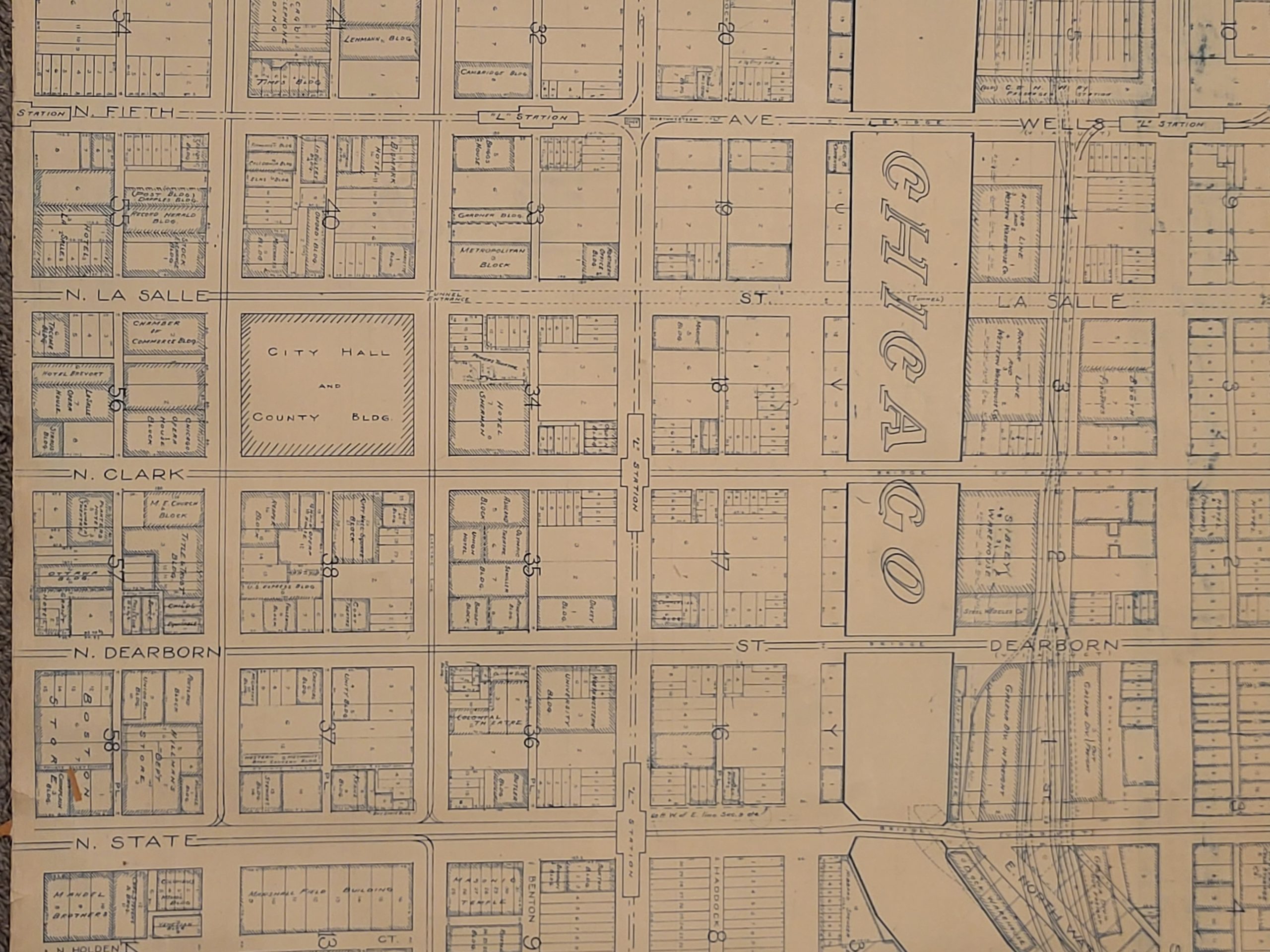
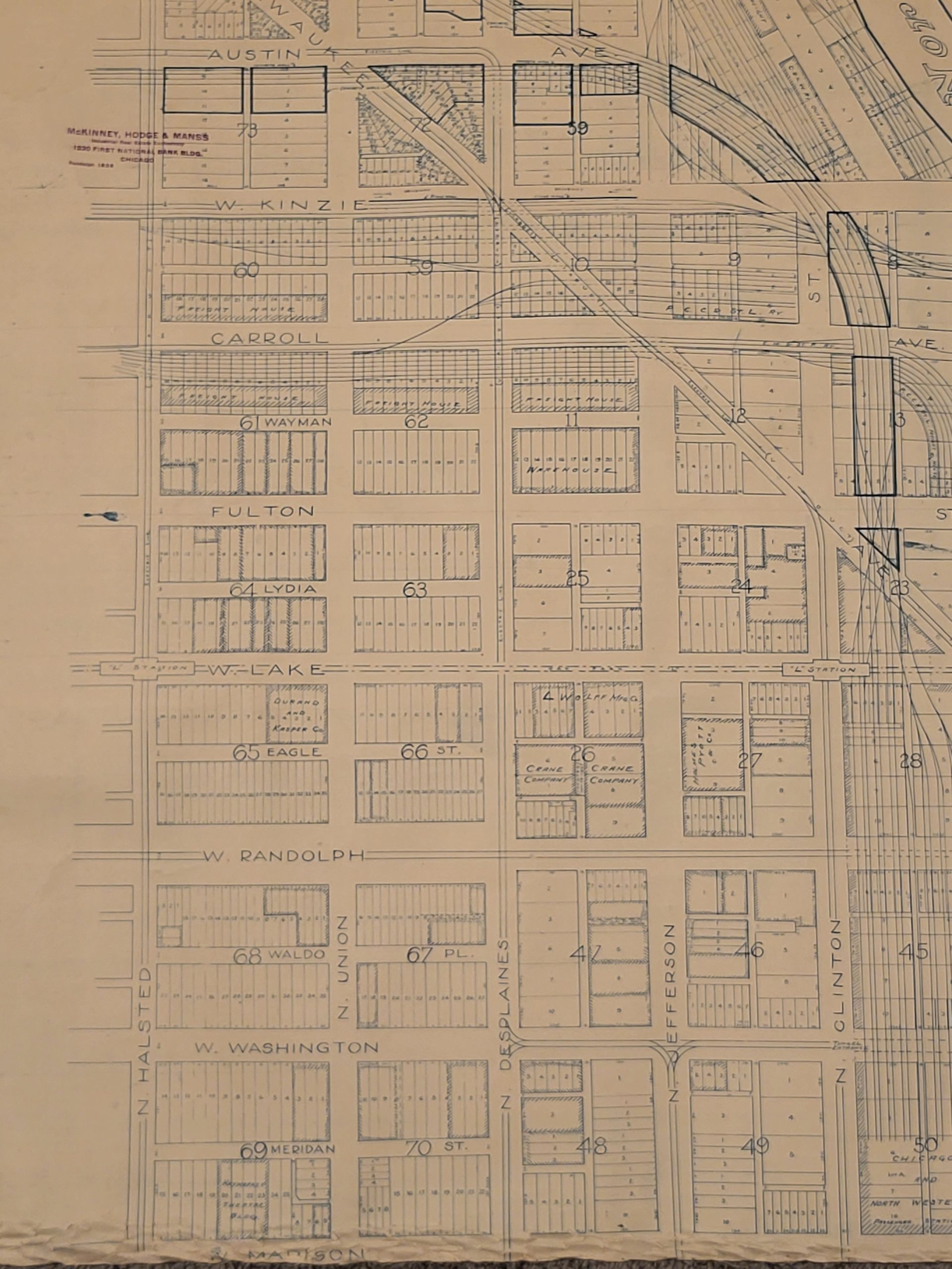
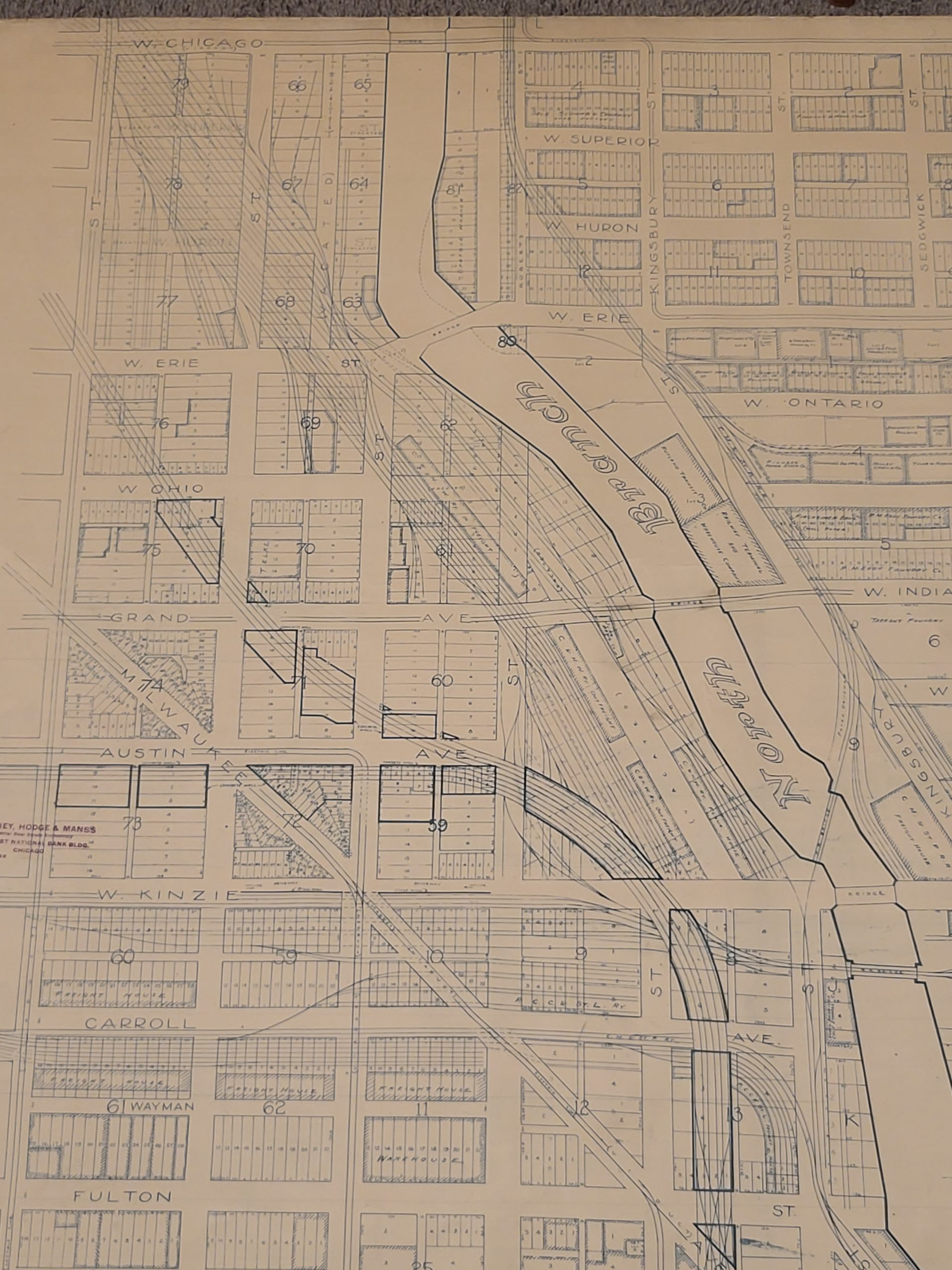
This massive map of downtown Chicago, issued at the incredible scale of 100 ft. to 1 inch, was published in 1912 by the Chicago Real Estate Index Company. According to a hastily modified rubberstamp in the center right, it was issued in conjunction with McKinney, Hodge, and Manns, a local industrial and business real estate firm.
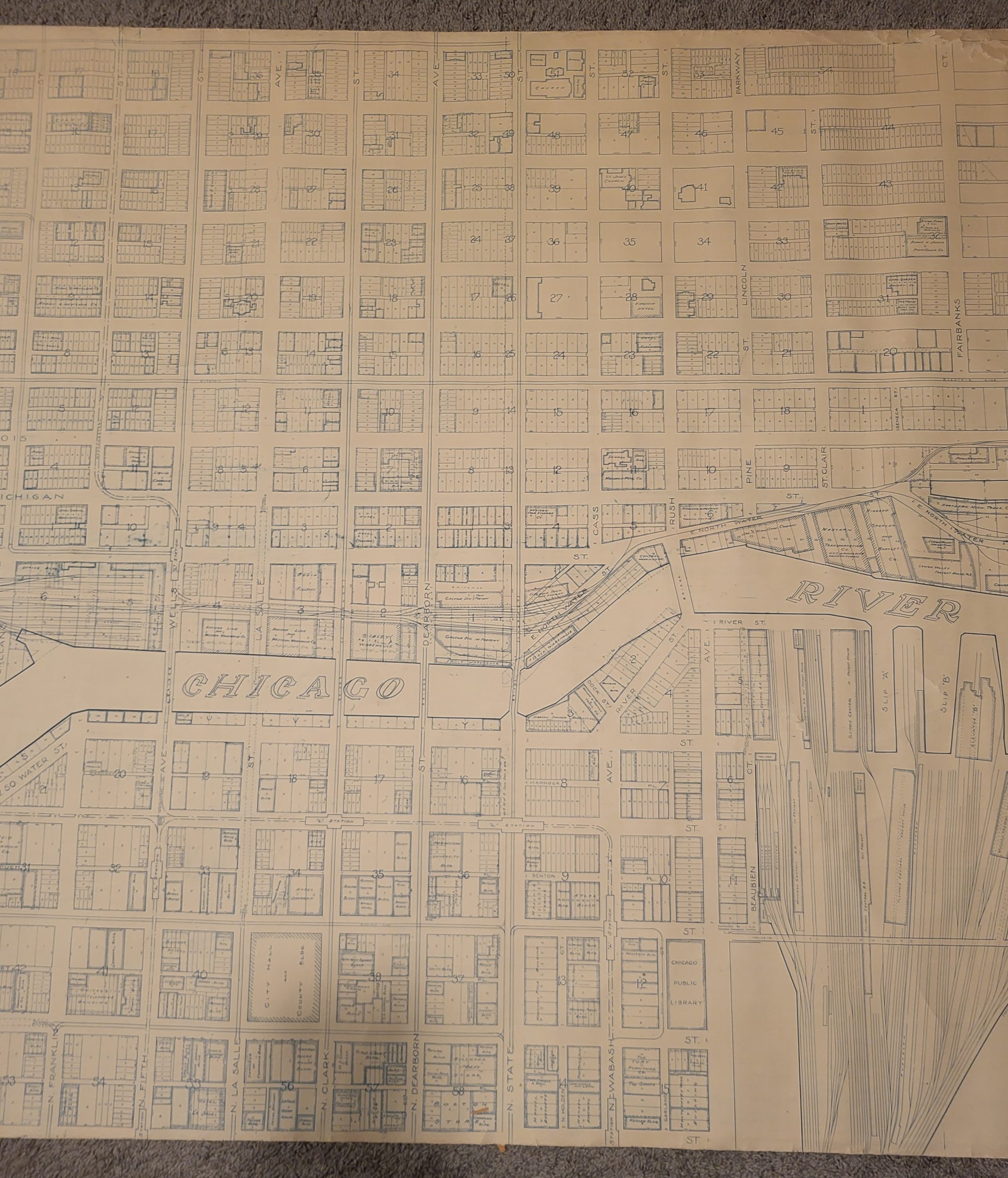
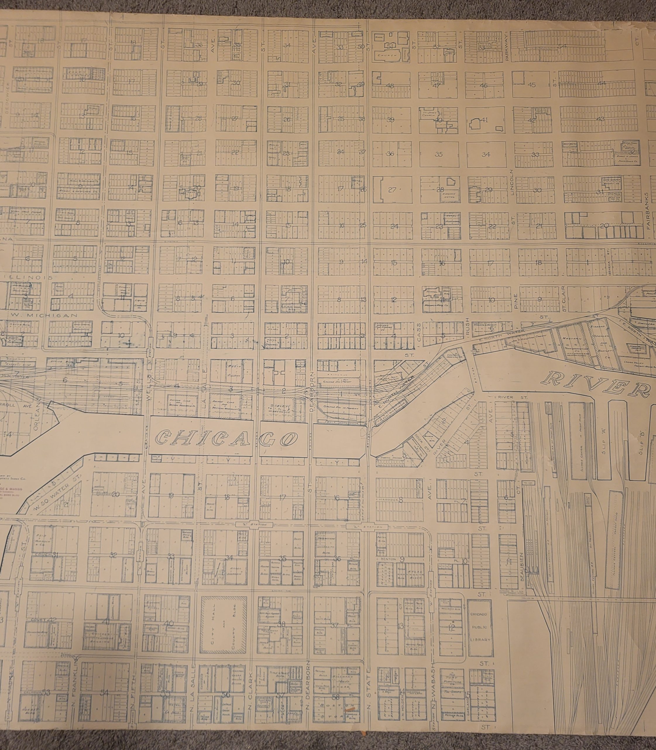
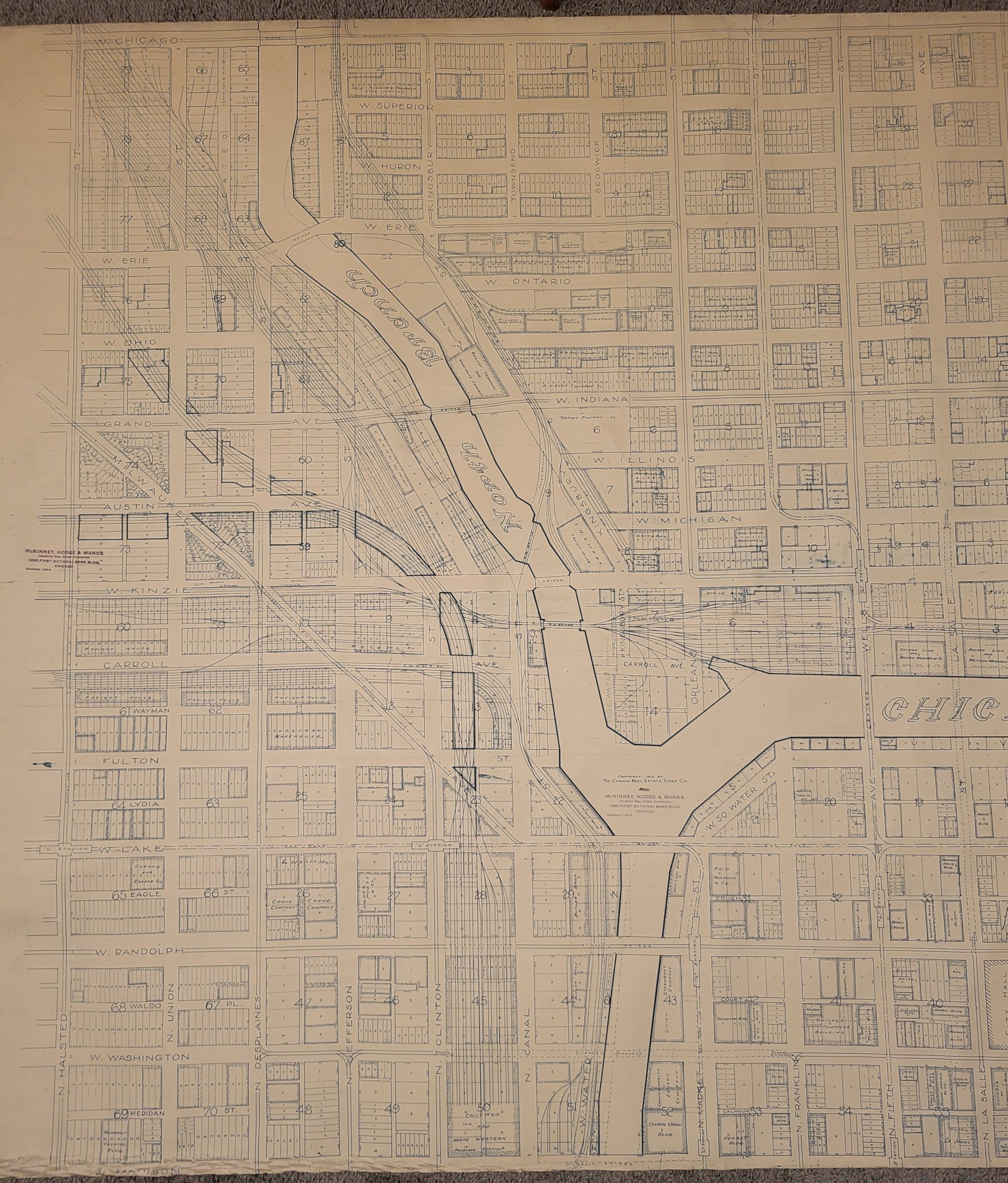
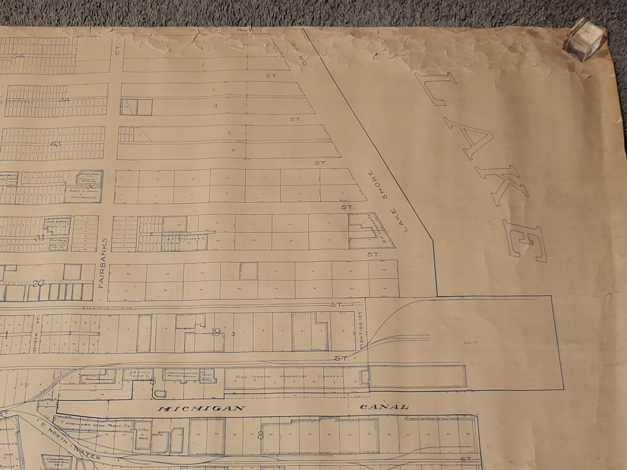
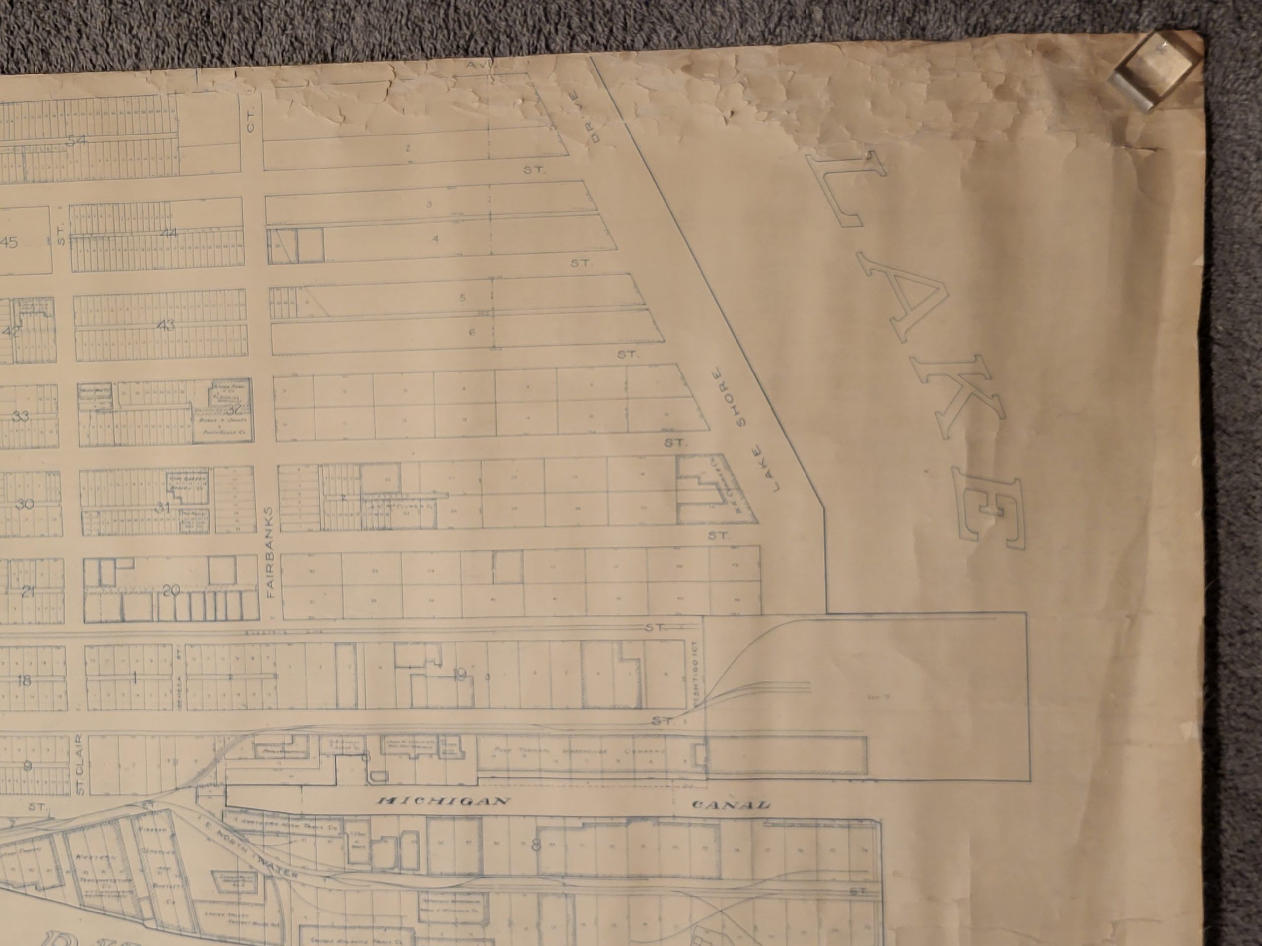
The image is bounded by Lake Michigan in the east, Madison St. in the south, Halsted St. in the east, and Chicago Ave. in the north, though a copy at the University of Southern Mississippi indicates a lower half may have extended the southern border all the way to 21st St. (Roosevelt Road). It provides a fantastically detailed overview of the economic and cultural heart of the Windy City in the early 1910s.
A phenomenal amount of real estate is dedicated to railroad interests, including the vast majority of what would eventually be Navy Pier. Besides the numerous tracks concentrated along Lake Michigan and the Chicago River, there are gigantic warehouses, freight elevators, repair facilities, transportation depots, coal sheds, and other supporting infrastructure. The routes of elevated railways (known colloquially as the ‘L’) and their respective stations are also shown, along with surface lines.
The footprints of dozens of individually labeled buildings are outlined, offering a brief glimpse into the structural composition of downtown before skyscrapers ruled the skyline. Churches, theaters, factories, stores, foundries, hotels, and residential districts are all situated within an easy walk of one another. Most of these buildings are now gone, but a few remain, like the Chicago Public Library (today’s Chicago Cultural Center) and the North American Cold Storage Company (now luxury condos).
The map is rare, with only one entry in OCLC noted at the University of Southern Mississippi. It is apparently the largest scale of three separate maps of Chicago published in 1912. See here for a reduced version, also scarce.
Sources: OCLC:1001346475; Open House Chicago; Chicago Historical Society; Encylopedia of Chicago; Chicagology;
Map Details
Publication Date: 1912
Author: Chicago Real Estate Index Company
Sheet Width (in): 116.5
Sheet Height (in): 53.5
Condition: B
Condition Description: Gigantic wall map mounted on linen. Upper right corner and lower left corner show moderate to heavy wear and wrinkling, including some minor paper chipping and image loss. Other creasing and tears from where the somewhat brittle paper was previously rolled, most evident in a large irregular closed tear on the center right. Soiling on the far left, confined to the margin, and some scattered spotting in the lower right, near the title block. About good condition overall.
Original price was: $4,000.00.$2,500.00Current price is: $2,500.00.
1 in stock