
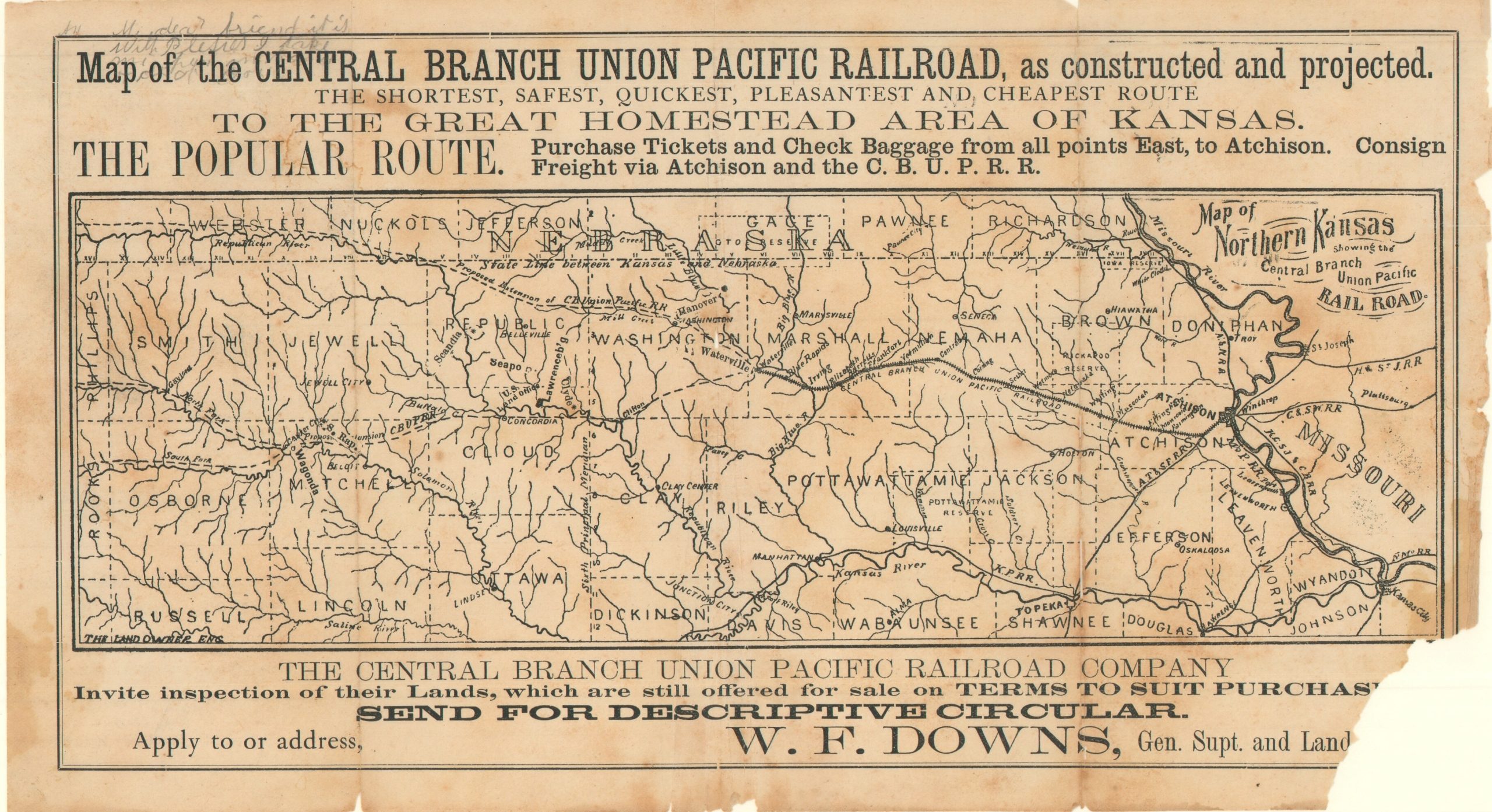
Map of the Central Branch Union Pacific Railroad, as constructed and projected.
$245.00
“The Shortest, Safest, Quickest, Pleasantest and Cheapest Route to the Great Homestead Area of Kansas”
1 in stock
Description
This scarce promotional map of northern Kansas, engraved by The Land Owner, was issued by the Central Branch Union Pacific Railroad Company around 1869 to advertise its route and encourage settlement in the state’s developing agricultural regions. The headline touts the railroad as “The Shortest, Safest, Quickest, Pleasantest and Cheapest Route” to the “Great Homestead Area of Kansas,” while directing passengers to purchase tickets and check baggage through the headquarters at Atchison, Kansas.
The somewhat rustic image emphasizes the company’s 100 miles of active track between Atchison and Waterville. Robust connections to eastern rail services are noted; however, western extensions are shown merely as “proposed”. Waterways are carefully detailed across the terrain – an important consideration for settlers entering a predominantly agricultural region. The lower portion of the sheet promotes the company’s available real estate, inviting prospective settlers to inspect properties offered for sale on terms intended to encourage purchase, with W. F. Downs, General Superintendent and Land Agent, listed as the contact for descriptive circulars.
The Central Branch Union Pacific Railroad Company was organized in 1867 as the successor to the Atchison and Pike’s Peak Railroad Company, chartered in 1859 to build westward from Atchison, Kansas, toward Colorado. Construction began in 1865, and by January 1868, the railroad reached its initial 100-mile land-grant terminus at Waterville, serving communities across northern Kansas and facilitating local commerce. However, federal transcontinental support was favored elsewhere; most notably to the Union Pacific Railway, Eastern Division (renamed the Kansas Pacific Railway in 1869, providing a helpful dating clue on the map), which was building west from Kansas City. Unable to secure additional land subsidies to realize its transcontinental ambitions, the company operated as a regional feeder line until coming under the control of Jay Gould and being leased to the Missouri Pacific Railroad in 1880.
Map Details
Publication Date: 1869
Author: The Land Owner
Sheet Width (in): 12.00
Sheet Height (in): 6.60
Condition: C
Condition Description: Black and white map printed on thin paper, creased along several vertical folds. One clean split, repaired on the verso with archival tape, and a large chip in the lower right corner. Spotting and foxing throughout. Fair condition only.
$245.00
1 in stock