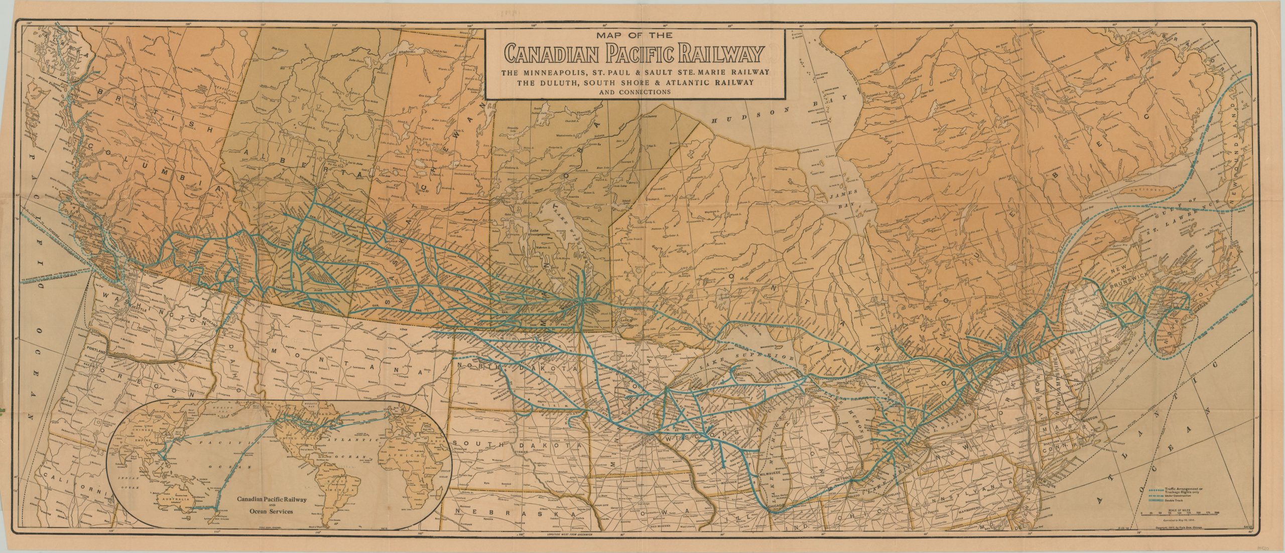
Map of the Canadian Pacific Railway
20th century pocket map of Canada’s first transcontinental railway.
Out of stock
Description
Connecting Halifax in Nova Scotia to Vancouver in British Columbia, the Canadian Pacific Railway was the country’s first railroad to operate from coast to coast. The idea had been around since the second half of the 19th century, when it was promoted as a way to unite the disparate British colonies of Canada, Nova Scotia, and New Brunswick. Confederation was achieved in 1867, with British Columbia joining the new dominion territory in 1871. Though it was a promised component of the confederation, construction would not begin on the railroad for another decade following.
This map shows the system forty-five years after building commenced, in 1916, and was published in Chicago by the Poole Brothers. The network of the Canadian Pacific and its connecting railways are shown in blue; with steamship routes, lines under construction, and trackage rights all indicated with hashed lines. Competitors lines, especially those of the Canadian National Railways, are a thin black and barely visible. An inset map in the lower left shows the global connections of the Canadian Pacific Railways and its steamship lines, which served Europe, Australia, and the Far East.
Just two years prior to publication, the worst peacetime maritime disaster in Canada’s history struck one ship, when the ocean liner Empress of Ireland sank in the Gulf of St. Lawrence. But passenger service had taken the backseat in 1916, when the CPR was dedicating its full resources to the British war effort during WWI.
Map Details
Publication Date: 1916
Author: Poole Brothers
Sheet Width (in): 45.25
Sheet Height (in): 19.25
Condition: B+
Condition Description: Originally issued folded into 30 panels and affixed to green paper covers. Covers intact, but worn and chipped around the outer edges. The map shows moderate wear along fold lines, and some creasing. Only one area of separation, in the center, repaired with archival tape on verso. Faintly toned and minor offsetting present, but overall the map remains in very good condition.
Out of stock

