Map of the Burlington Route The National Park Line and Connections
$85.00
“There is nothing so American as our National Parks…” – Franklin D. Roosevelt, Aug 5. 1934
1 in stock

Description
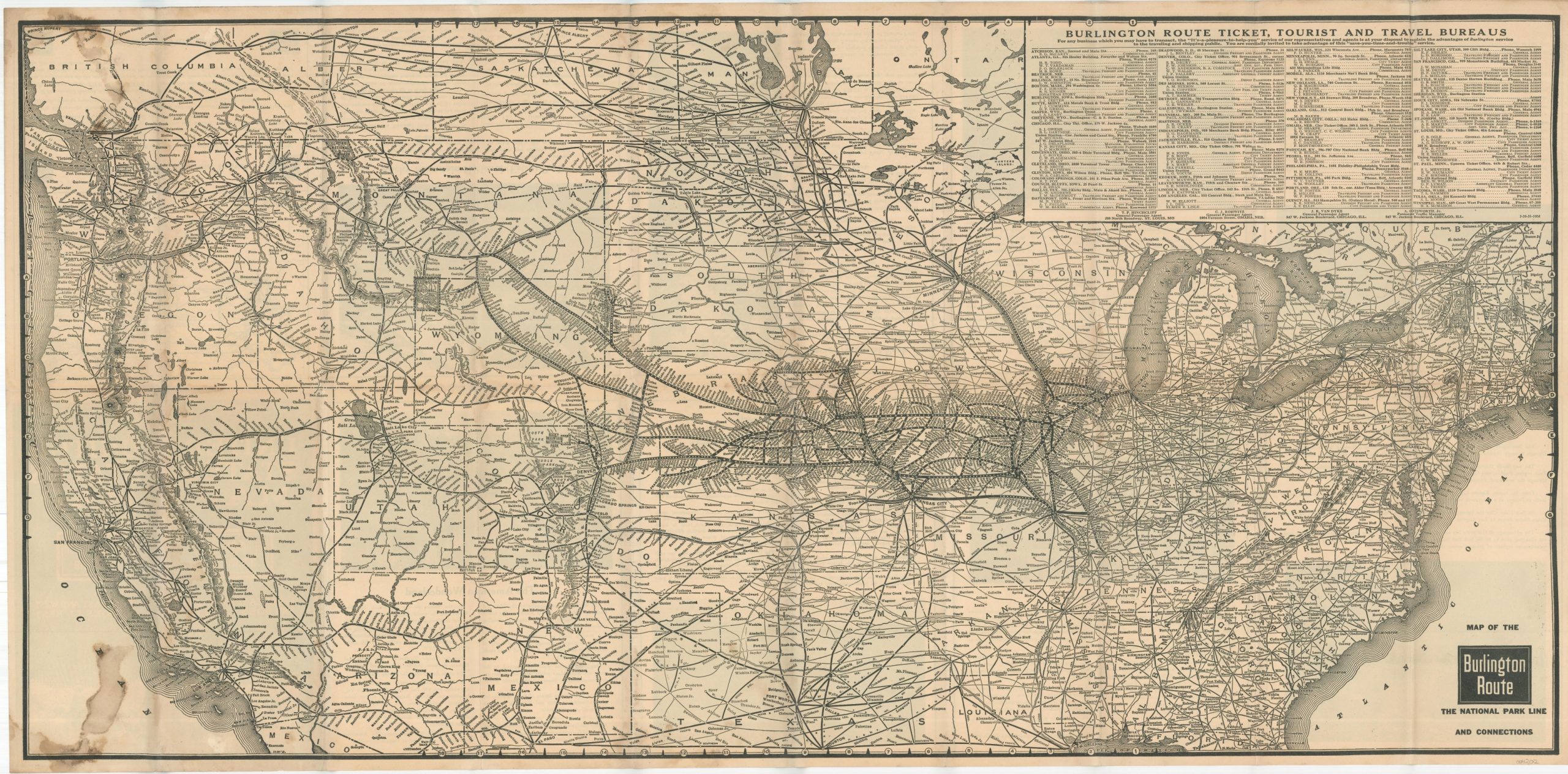
This detailed railroad map of the United States highlights the routes and connections of the Chicago, Burlington, and Quincy Railroad, nicknamed ‘The Burlington Route’ or ‘The Q.’ A distorted national outline greatly condenses East Coast states in favor of stretching out the West, allowing for a more legible presentation of the numerous stops along each line.
The company self-advertises as The National Park Line, and numerous such protected areas are labeled and outlined throughout the image. Text and photographs on the verso describe some of the various destinations, the majority of which were becoming increasingly popular as low-cost tourist attractions during the Great Depression. Examples include Rocky Mountain (Estes) National Park, Yellowstone, Glacier National Park, and Mt. Rainier.
“Via Denver – its western terminal – the Burlington and its connections serve Colorado, Utah, and California, thereby rounding out a system of transportation that serves THE ENTIRE WEST. With splendid through trains and through cars from Chicago, St. Louis, Omaha, Lincoln, Kansas City, St. Joseph, and Denver, THE BURLINGTON ROUTE best reaches the whole grand ensemble of the Rocky Mountain Vacationland all the way from Pike’s Peak to the Canadian Boundary and on out to Puget Sound…” [verso]
Map Details
Publication Date: 1931
Author: Chicago, Burlington & Quincy Railroad
Sheet Width (in): 37
Sheet Height (in): 18
Condition: B
Condition Description: A slightly toned, but strong, sheet shows discoloration and wear along originally issued fold lines. Stains on the front cover bleed through the image, visible in two spots in the upper and lower left corners. Remains in good condition overall.
$85.00
1 in stock