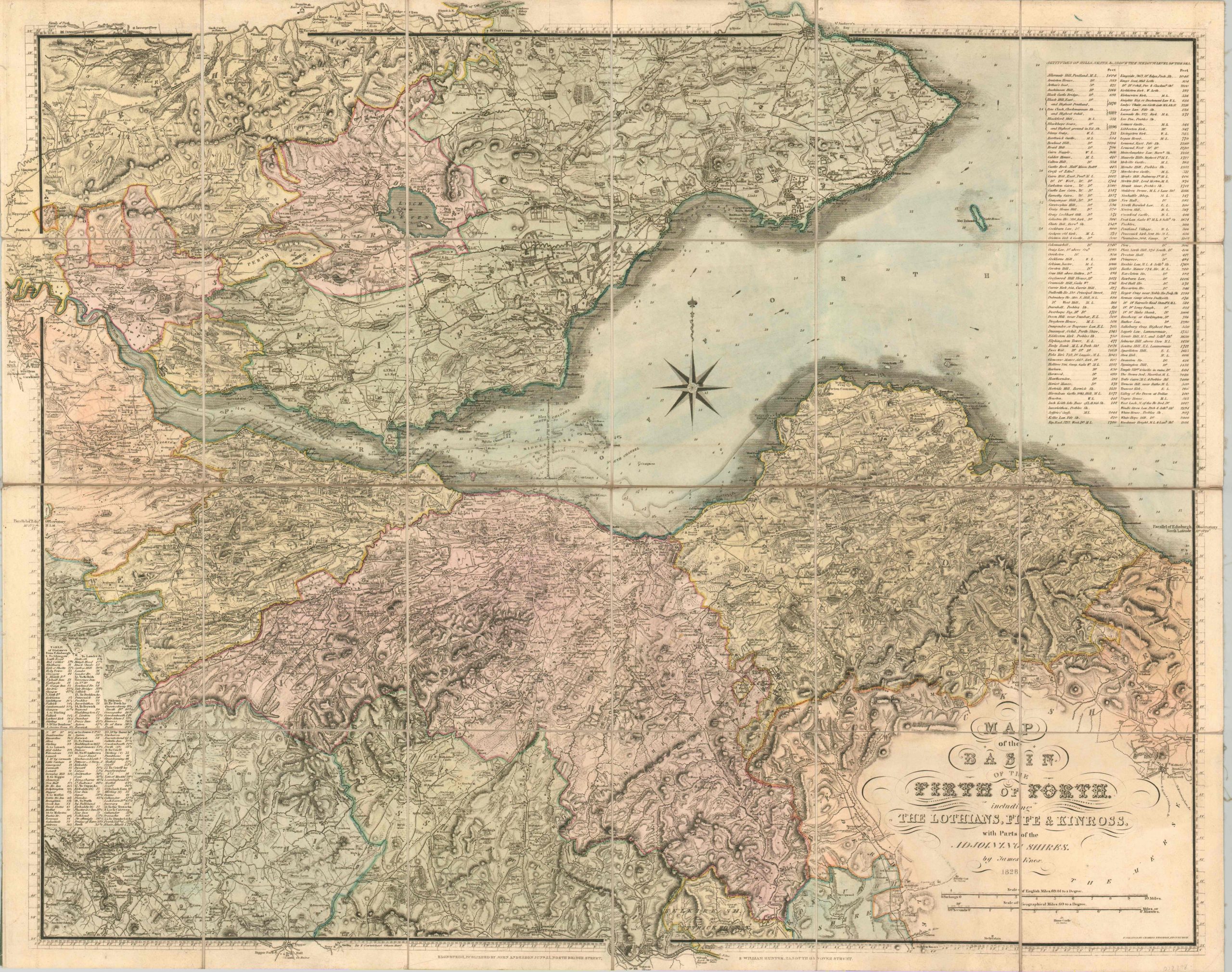
Map of the Basin of the Firth of Forth including the Lothians, Fife & Kinross, with parts of the Adjoining Shires
$350.00
Finely engraved case map of the Firth of Forth and immediate surroundings, including Edinburgh.
1 in stock
Description
This immaculately detailed map shows a large area around the spot where the River Forth meets the North Sea, off Scotland’s eastern coast (a firth is an estuary). The region is of tremendous economic importance, and includes the capital, Edinburgh, on the southern bank.
Issued at a scale of approximately 1 inch to 1 mile, the image presents a wealth of information on the local geography, settlement patterns, and transportation routes. Individual locations of interest like historic sites, castles, camps, and inns are also noted. Topography is shown in hachure, with the Pentland Hills evident south of the city.
A table in the upper right corner identifies the heights of some of the most prominent peaks. The lower left includes table of distances from Edinburgh to various places around Scotland.
The map was created by James Knox and engraved by Charles Thomson. Published in Edinburgh by John Anderson and William Hunter in 1828.
Map Details
Publication Date: 1828
Author: James Knox
Sheet Width (in): 32.00
Sheet Height (in): 25.40
Condition: A
Condition Description: Case map dissected into 24 sections and mounted on linen. A bit of faint scattered soiling within the image, but otherwise near fine. Very nice hand color. Old owner's bookplates on the verso. Includes the original case with publishers stamp.
$350.00
1 in stock


