
Map of the American Central Water Line and Other Principal Lines of Communication between the Western States and the Atlantic Seaboard
$200.00
Connecting a reunited America in the years following the Civil War.
1 in stock
Description
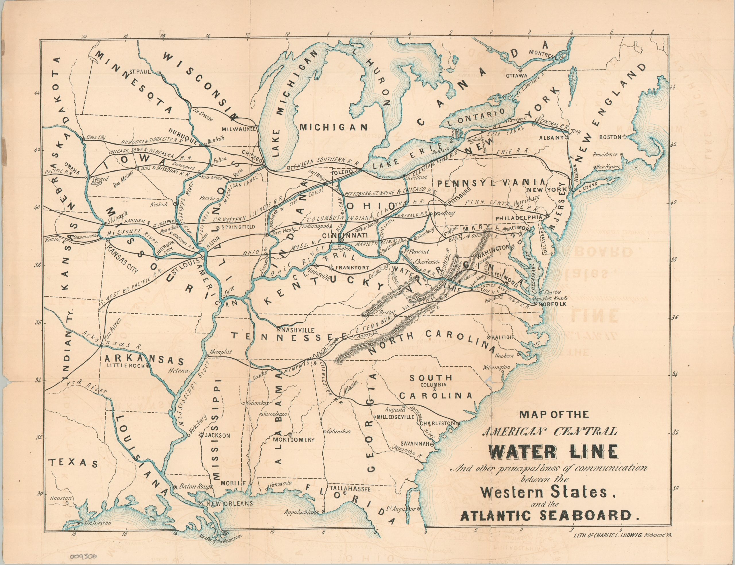
This uncommon map of the eastern United States was issued in 1869 to promote the proposed “American Central Water Line,” an ambitious transportation project championed by the James River & Kanawha Company. The scheme sought to connect the Ohio River and the commercial centers of the Midwest with the Atlantic seaboard through Virginia, using improvements to the Kanawha and James River systems to create a competitive alternative to established routes through the Great Lakes, Mississippi Valley, and Northeast. Lithographed by Charles Ludwig of Richmond, the map depicts the proposed water route alongside the principal railroads, canals, and navigable waterways connecting the Western states with the Atlantic.
The railroad network provides an especially interesting snapshot of American transportation development immediately after the Civil War. Many of the railroads shown were technically “paper only,” representing proposed routes that had yet to be constructed, while the map nevertheless reveals a striking disparity between North and South. The North is crisscrossed by numerous east-west routes connecting the developing cities of the Midwest with the Atlantic seaboard, whereas the South has comparatively few such connections. In the region south of the Ohio River, only the Memphis & Charleston and East Tennessee & Virginia railroads are prominently represented, underscoring the transportation gap that the American Central Water Line hoped to exploit.
The proposed route followed the Ohio and Kanawha Rivers before crossing Virginia to connect with the James River and, ultimately, the ports of Hampton Roads. Its promoters envisioned Virginia reclaiming a share of the rapidly expanding commerce between the American interior and the Atlantic. The project was never completed, and the subsequent dominance of the railroads ultimately rendered the proposed water route obsolete.
Map Details
Publication Date: 1869
Author: Charles L. Ludwig
Sheet Width (in): 15.50
Sheet Height (in): 12.10
Condition: B
Condition Description: Color printed map on a single-sided sheet, heavily worn along original folds. Formerly cleanly split into thirds, but reattached using archival tape on the verso. A small hole in the lower right, south of Wilmington, and some scattered offsetting from the black ink. About good condition overall.
$200.00
1 in stock