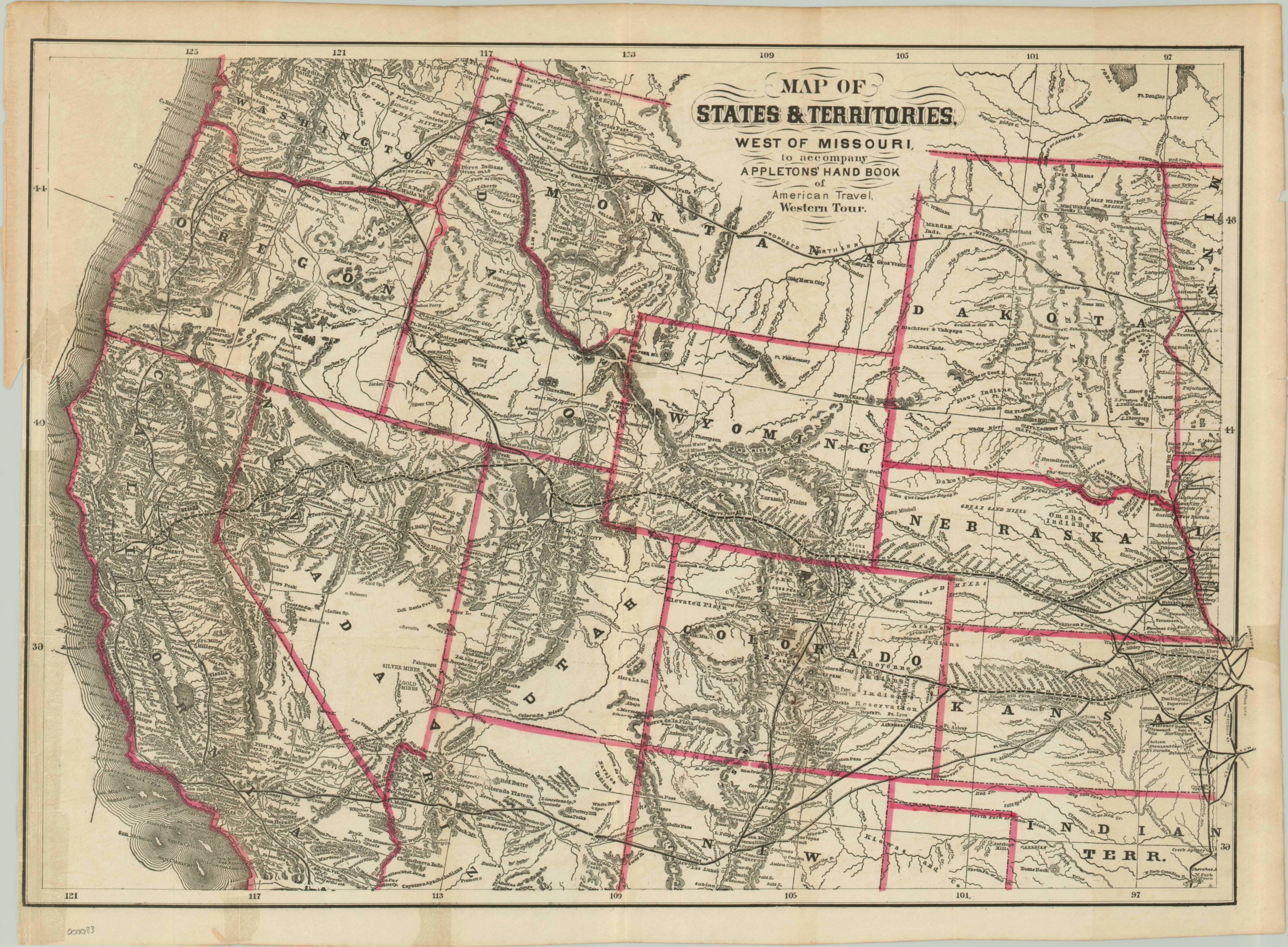
Map of States & Territories West of Missouri…
$250.00
Intriguing map of the western United States depicting the recently completed Transcontinental Railroad.
Description
Names like Dakota and Indian Territory allude to the Wild West, which is exactly the (approximate) time and place this lithographed map depicts. As stated in the title, it was created to accompany Appleton’s Hand Book of American Travel and therefore contains information of particular interest to settlers, real estate agents and entrepreneurs. The completion of the Transcontinental Railroad, linking San Francisco Bay to existing eastern routes at Council Bluffs, Iowa, opened up the American west to a new frontier of development and is depicted boldly bisecting the map. Station stops are crammed along each primary and arterial route alongside names of towns, forts, mines and mountain peaks. Proposed northern and southern routes can also be seen, but these would not be completed until the following decades.
Upon further examination, fascinating details about life on the frontier can be found. A Creek agency in the Indian Territory was home of the United States government official authorized to negotiate with native tribes. Ruins dotted throughout southern Arizona are likely remnants of Spanish pueblos. The Emigrant Route to Oregon can be seen meandering through Wyoming and Idaho. Mentions of gold are frequent – even twenty years after the Gold Rush, the lure of rich prospects still drew many hopefuls west.
Map Details
Publication Date: 1872
Author: D. Appleton & Co.
Sheet Width (in): 23.5
Sheet Height (in): 17.25
Condition: B+
Condition Description: The map is in good condition, published on thin paper with several tears into the image that have been repaired on verso. Narrow left margin
$250.00

