Map of Stanford University and Vicinity
$95.00
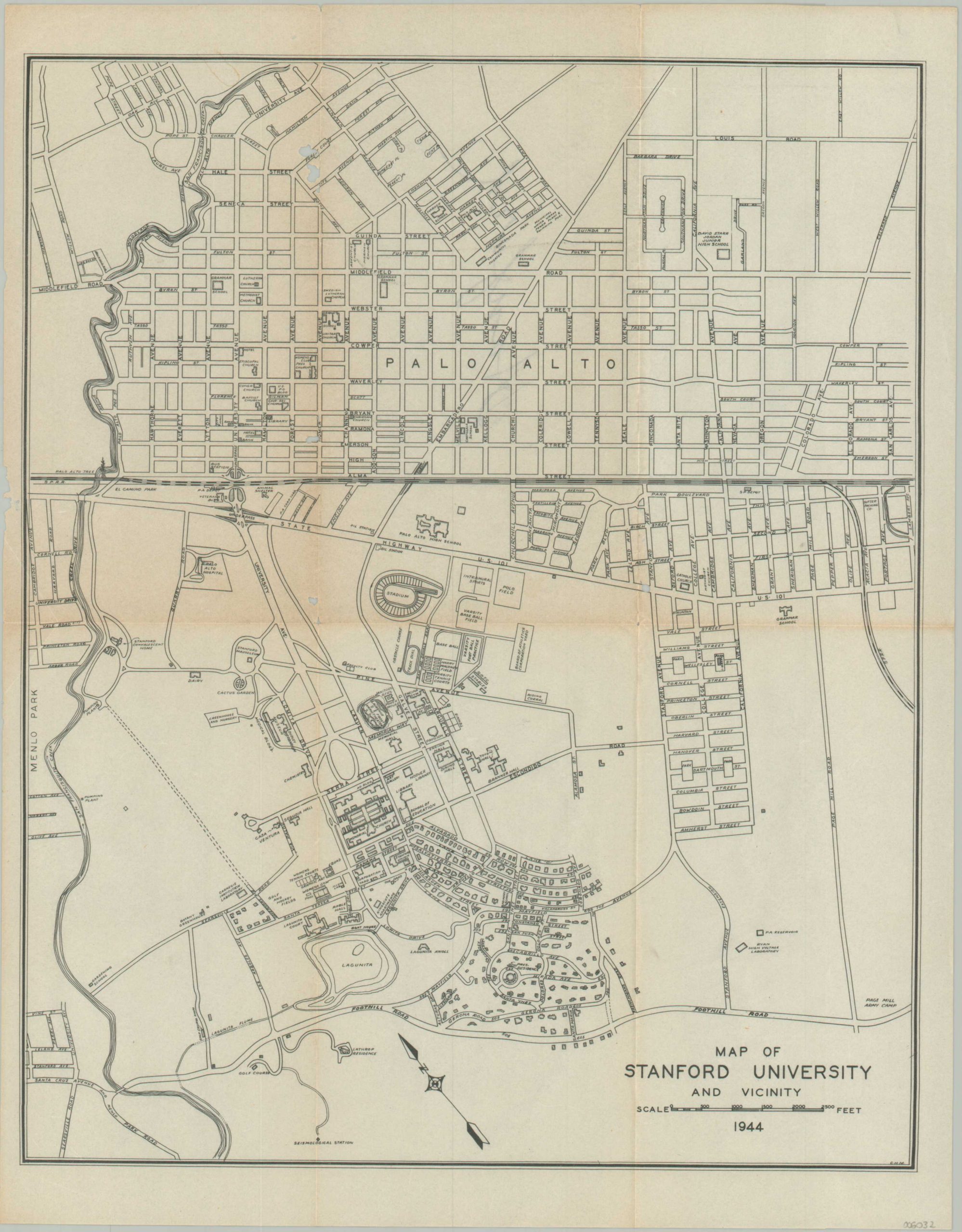
WWII-era plan to the campus of Stanford University.
1 in stock
Description
This overview of the campus of Leland Stanford Junior University (its official name) is dated 1944 and is signed C.H.M. in the lower right corner. It provides a detailed wartime snapshot of the campus plan, originally designed as a collaborative effort between Frederick Law Olmsted and Boston firm Shepley, Rutan, and Coolidge. Streets, important facilities, and a variety of other locations of interest (churches, public buildings, etc.) are labeled within the image.
Source: Stanford University
Map Details
Publication Date: 1944
Author: Stanford University
Sheet Width (in): 10.9
Sheet Height (in): 13.9
Condition: B+
Condition Description: Printed on thin paper that shows creasing and moderate wear along old fold lines. Several small holes, the largest about the size of a pencil eraser, also visible along fold lines. About good condition overall. Blank on verso
$95.00
1 in stock