
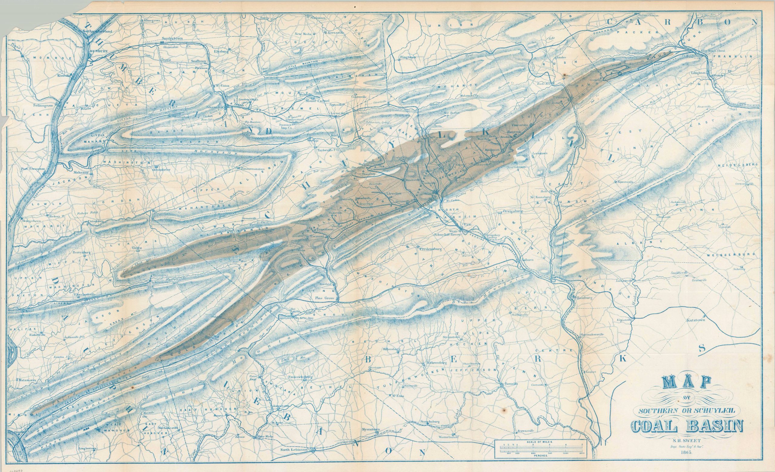
Map of Southern or Schuylkill Coal Basin
$200.00
Pennsylvania’s rich coal deposits as the Civil War raged.
1 in stock
Description
This detailed geological survey provides a comprehensive view of the Southern Anthracite Field, primarily covering Schuylkill County with adjacent portions of Northumberland, Dauphin, and Berks. Prepared by S.H. Sweet, the former Deputy State Engineer and Surveyor of New York, the map was a central component of a 1865 Special Report to the New York Senate regarding the transportation of Pennsylvania coal to northern markets.
The image utilizes an attractive blue and brown aesthetic to highlight the range of the massive coal basin, while finely engraved hachures provide an almost tactile overview of the rugged Appalachian terrain. Numerous collieries and burgeoning boom towns are labeled throughout, with Pottsville situated near the center of the sheet. A dense network of canals and railroads is also identified, illustrating the robust infrastructure designed to facilitate the delivery of these vital coal reserves.
Map Details
Publication Date: 1865
Author: S.H. Sweet
Sheet Width (in): 29.00
Sheet Height (in): 17.60
Condition: B
Condition Description: Single-sided map, creased along old folds. Large chip in the upper left corner and some scattered surface spotting and toning along folds. About good condition overall.
$200.00
1 in stock