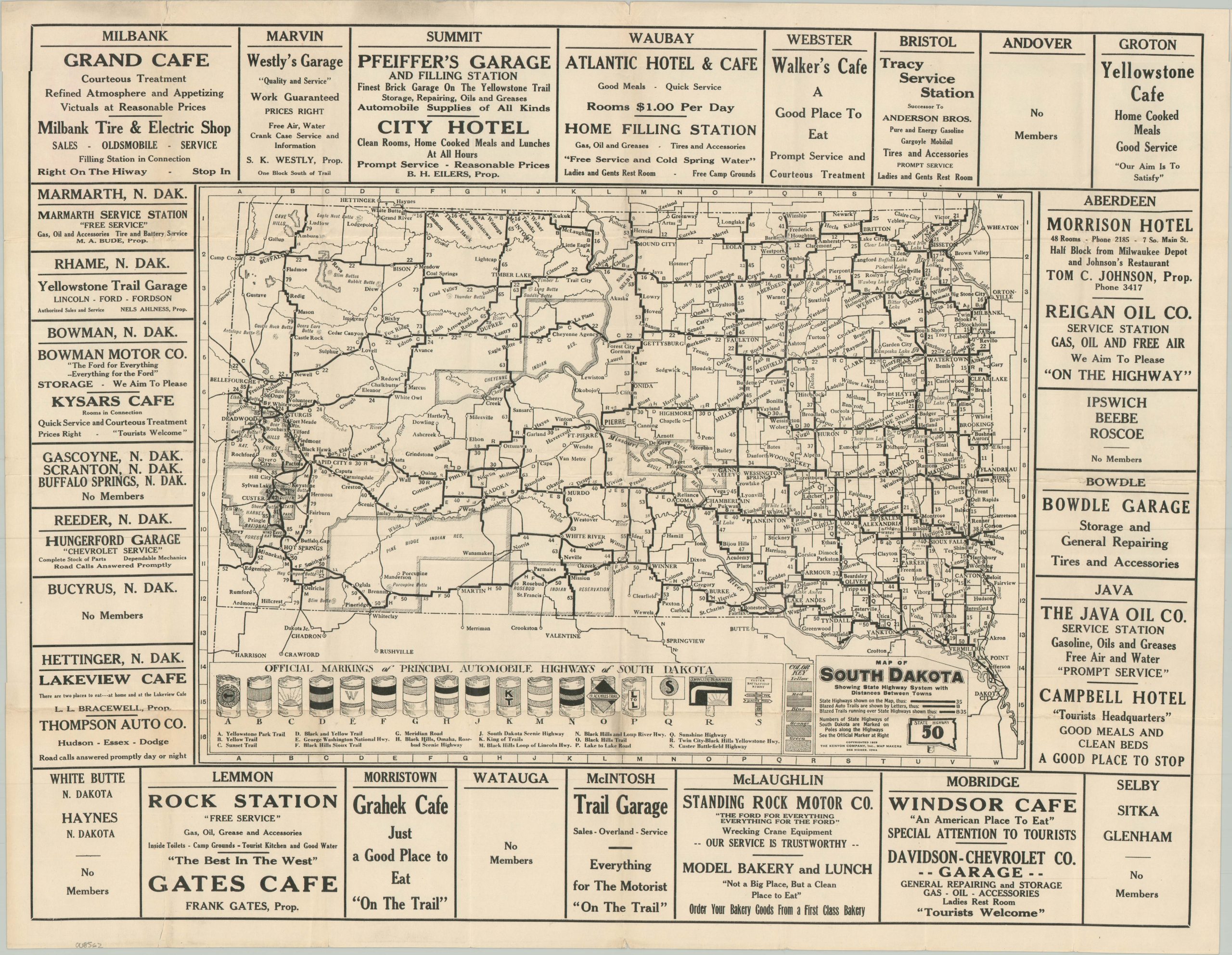
Map of South Dakota Showing State Highway System with Distance Between Towns
$125.00
1 in stock
Description
This interesting mid-1920s road map of South Dakota presents the statewide road network at a formative transitional period. A mix of state highways and ‘Blazed Auto Trails’, often sharing the same routes, are shown with thick black lines and labeled alphanumerically. The box in the lower left explains the various signs used to mark each highway – one can imagine that certain utility poles would have gotten quite crowded! Distances between points are provided, adding further to the already busy image.
The year after issue, the introduction of the U.S. Numbered Highway System attempted to resolve much of this naming confusion. Copyrighted in 1925 by the Kenyon Company, Inc. of Des Moines, Iowa. Advertisements along the outer border promote participating sponsors, though several towns are marked as ‘No Members’ – opportunity for future business subscribers?
Map Details
Publication Date: 1925
Author: The Kenyon Company
Sheet Width (in): 23.25
Sheet Height (in): 18.40
Condition: A-
Condition Description: Single-sided sheet extracted from red paper covers, sadly lost. Minor wear and moderate creasing along folds, with a few small marginal tears. Very good condition overall.
$125.00
1 in stock