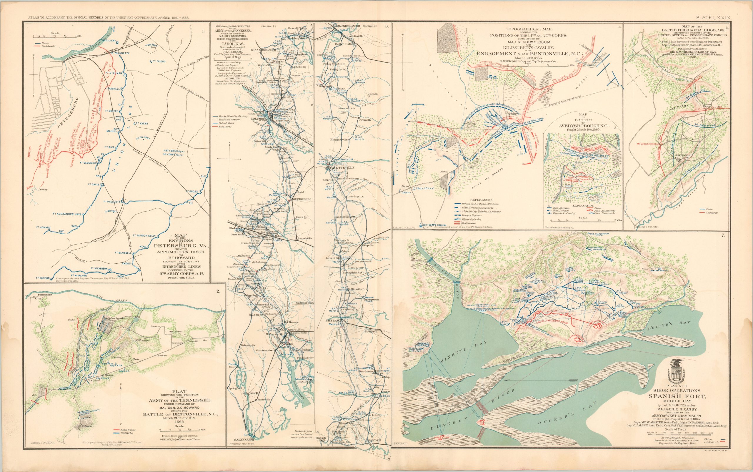
Map of the Environs of Petersburg, Va.; Plat Showing the Position of the Army of the Tennessee during the Battle of Bentonville; Siege Operations at Spanish Fort, Mobile Bay; Map of the Battle-Field of Pea Ridge, Ark.
$75.00
Plate Number LXXIX from the War of the Rebellion Atlas – the closing days of the bloodiest conflict in American history.
1 in stock
Description
This double-page lithographed sheet was originally published in 1895 by the United States War Department as part of the Atlas to Accompany the Official Records of the Union and Confederate Armies. The massive two-volume work, known also as the War of the Rebellion Atlas, consists of 178 plates and over 1,000 graphic elements; mostly maps, but also panoramas, technical drawings, and full-color illustrations. Collectively, the contents offer a comprehensive resource that visualizes the vast majority of engagements, large and small, of the American Civil War. A fully scanned copy is available online in the digital collections of Baylor University Library.
Map Details
Publication Date: 1895
Author: United States War Department
Sheet Width (in): 29
Sheet Height (in): 18
Condition: B-
Condition Description: Moderate damp staining along the bottom of the sheet. Toning along centerfold and in the margins, consistent with age. Scattered offsetting from the printed color. Between fair and good condition overall.
$75.00
1 in stock